Home » Off the Beaten Track
Category Archives: Off the Beaten Track
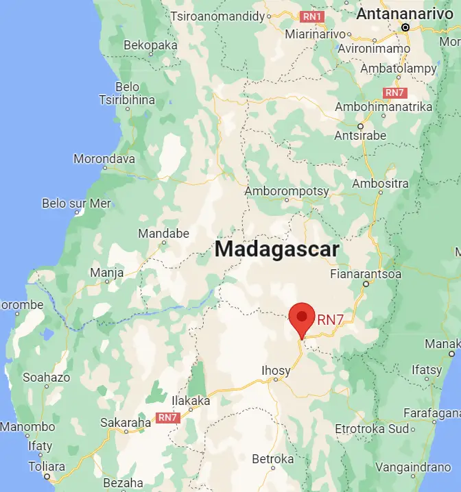
Mora Mora on the RN7 Madagascar – A Road Trip
Route Nationale Sept – the RN7 Madagascar – is one of the primary roads in the magical island that lies off the southeast coast of Africa. The road stretches from Madagascar’s capital city Antananarivo (also known by its more pronounceable name, Tana) to Toliara in the southwest of the country.
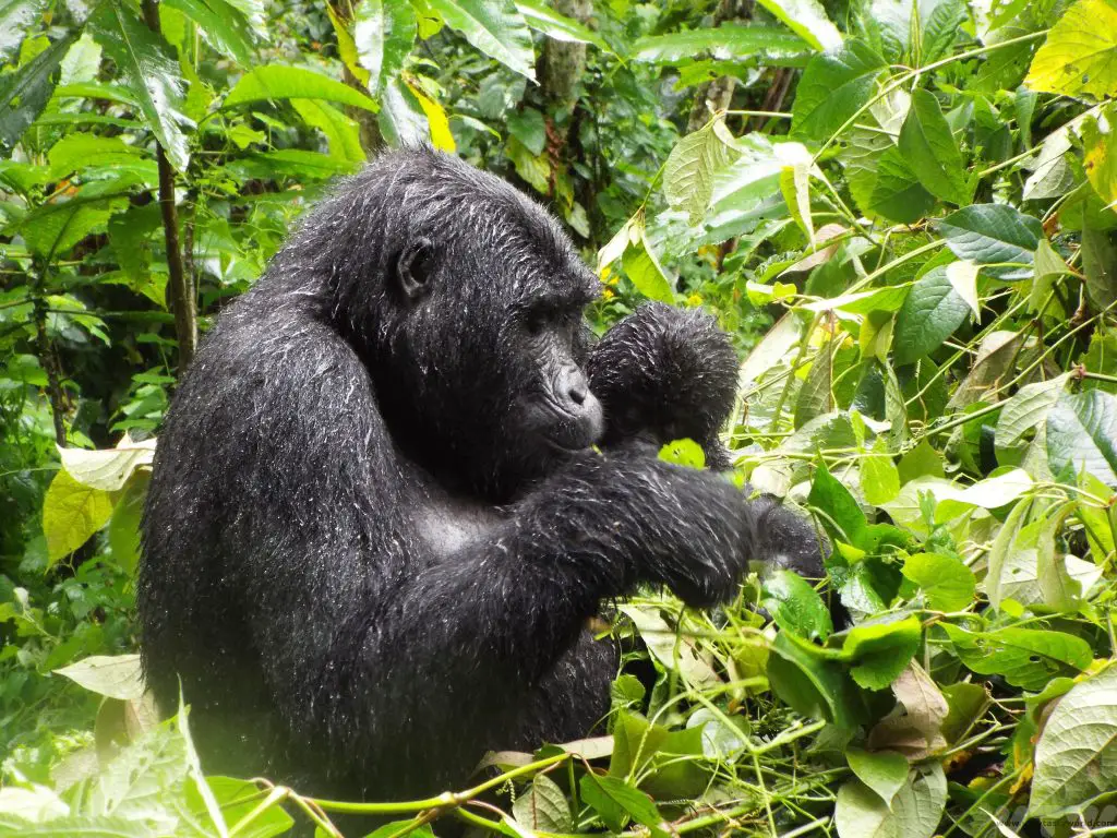
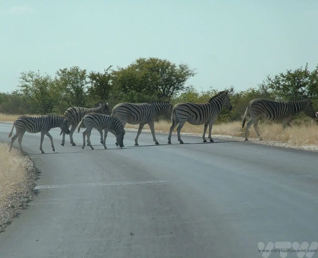
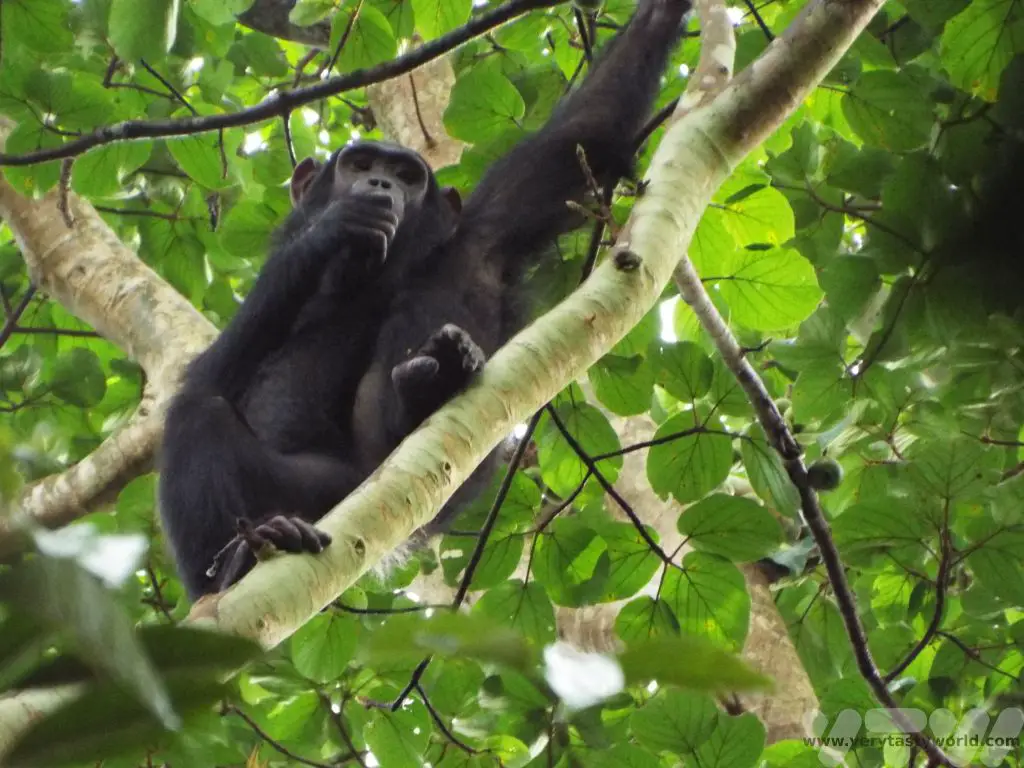
Madagascar is a very special place. The island separated from the mainland African continent 150 million years ago and, as a result, much of the wildlife evolved in a very different way. For example, the primates found in Madagascar are lemurs, not apes and monkeys. You won’t see any of the Big Five animals here but a lot of the flora and fauna is unique to the island and is absolutely fascinating.
The great thing about RN7 is that it covers a long distance – nearly 1000km – and winds its way through a variety of beautiful and diverse landscapes. There are several national parks located within a few kilometres of the road and these offer plenty of wildlife viewing as well as opportunities to explore the local culture.
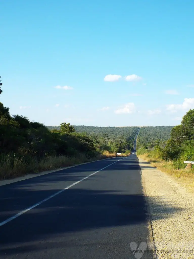
We travelled Madagascar’s RN7 from Toliara to Tana, having caught a flight with Air Madagascar to Toliara after our arrival in Madagascar, but it’s perfectly possible to do this trip in reverse. This journey took seven days to complete but can easily be adapted to spend more or less time at particular locations depending on your interests. We recommend a ‘mora mora’ approach to the trip. ‘Mora mora’ means ‘slowly, slowly’ in Malagasy – take time to travel and time to explore – it’s a very rewarding journey.
The travel times quoted here are the driving times and do not include the stops taken to enjoy activities along the way.
Toliara
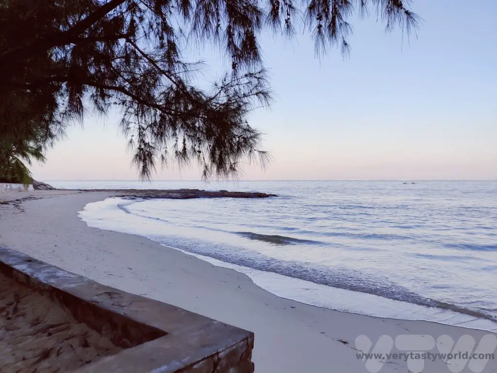
Toliara is the major city in the Southwest of Madagascar. Located on the coast, Ifaty beach is perfect if you are after some seaside time.
Toliara to Isalo
240 km (~4 hours)
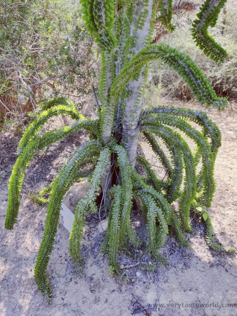
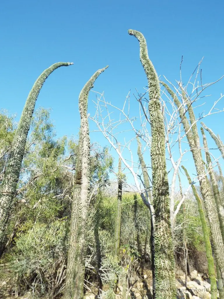
We started our long journey at Toliara and enjoyed our first stop at the Antsokay Arboretum. This arboretum contains over 900 plant species, largely categorised as spiny forest, due to the hot and dry climate of the region. These plants are characterised by their ability to survive harsh conditions.
Following the short botanical trail we saw numerous different types of plant.
These included a number of species of fascinating elongated octopus trees which have small leaves and spikes. Some of them can be relied upon as a compass – they grow facing south to try to get moisture from any fog in the region.
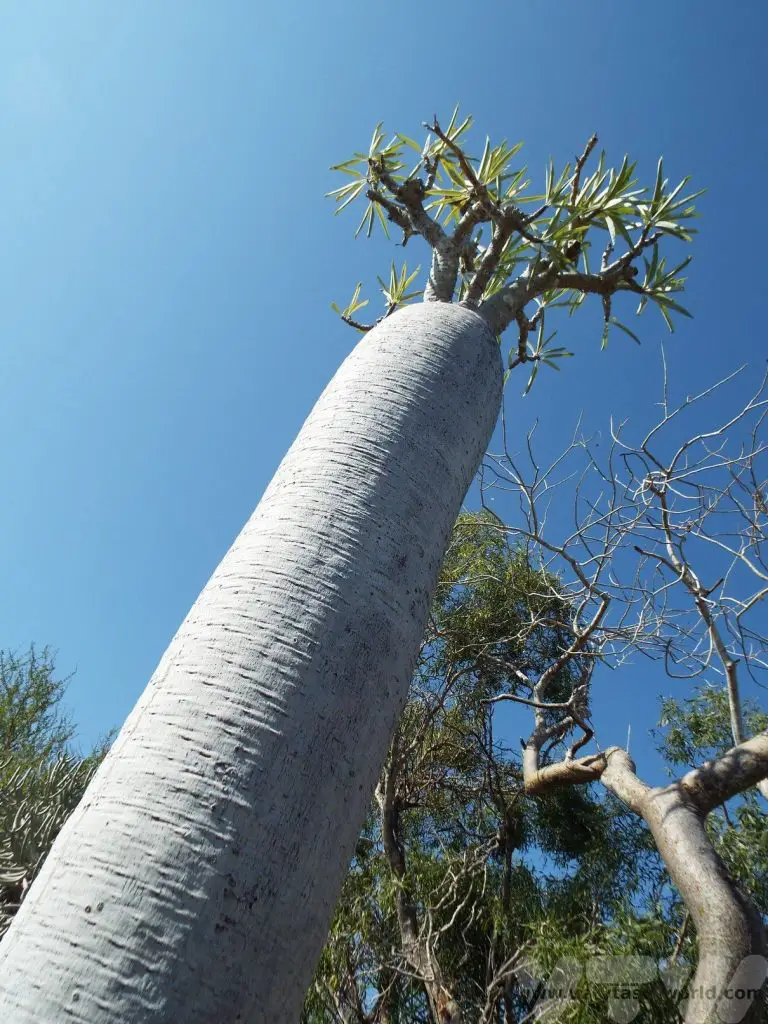
One of the best known species of tree in the region is the baobab, characterised by its huge trunk. This baobab was a teenager – only around 100 years old.

Some trees look like baobab but are fake. This one is known as an elephant’s foot.
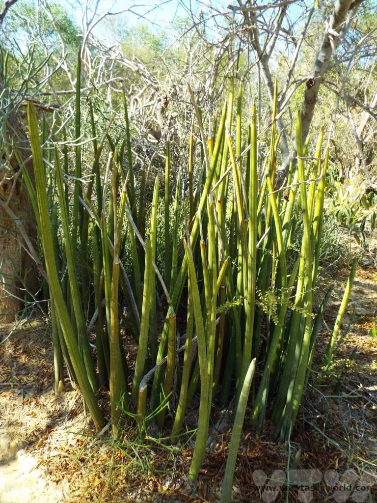
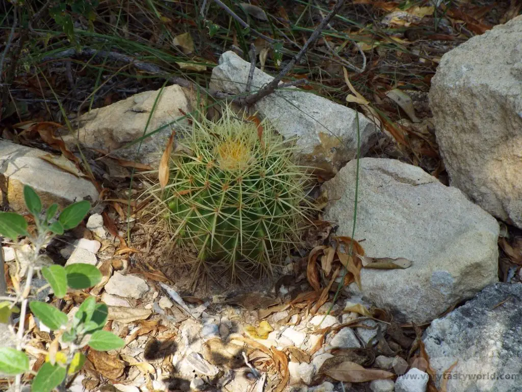
Malagasy people have an amusing approach to their mothers-in-law. The plant on the left, with its sharp points is colloquially known as mother-in-law’s tongue. And this cactus is called a mother-in-law’s cushion.
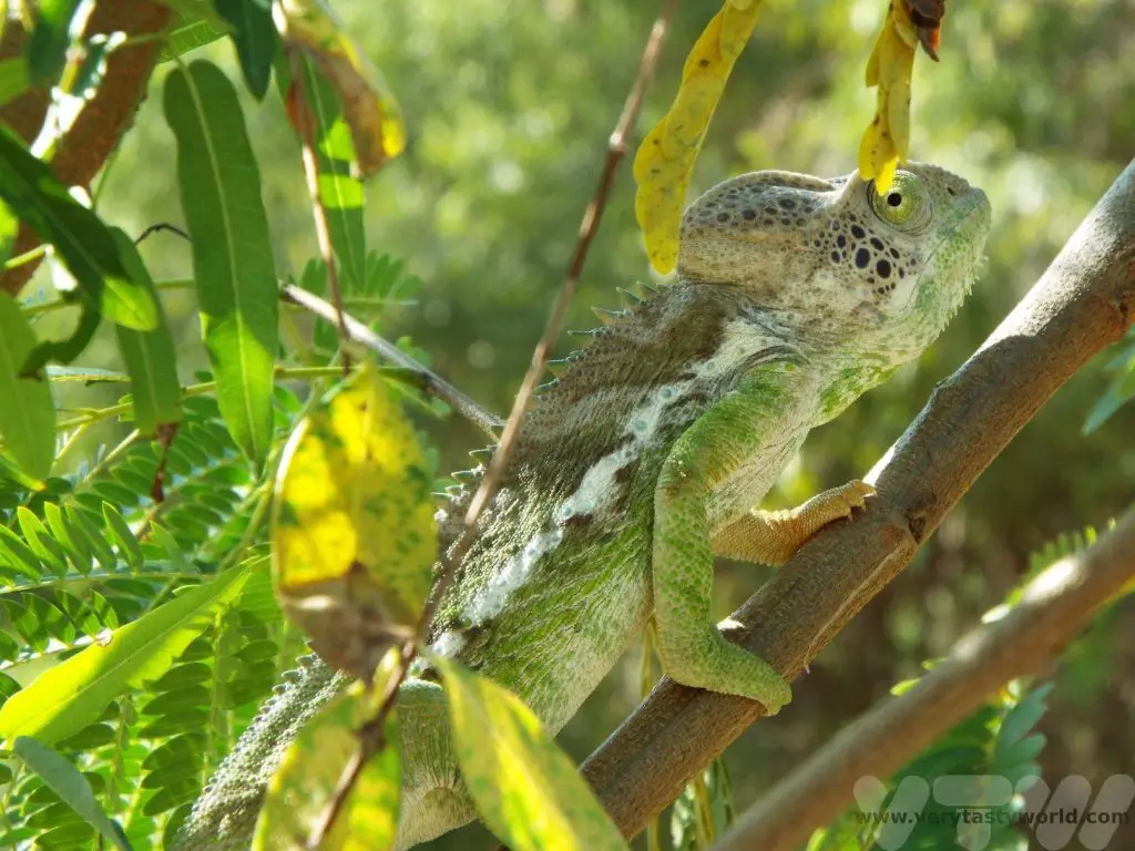
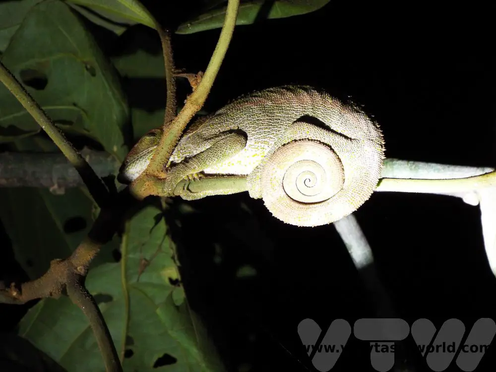
And we met our first chameleon. This was a male. He can change colour within a minute.
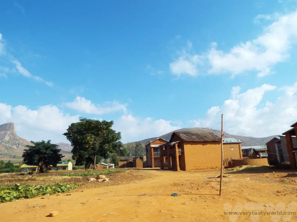
Then it was back on the RN7 for a couple more hours. Our next stop was Zombitse-Vohibasia National Park which is located around 150 km from Toliara. This is a dry deciduous forest – a transition area between the dry forests and more humid regions of Madagascar.
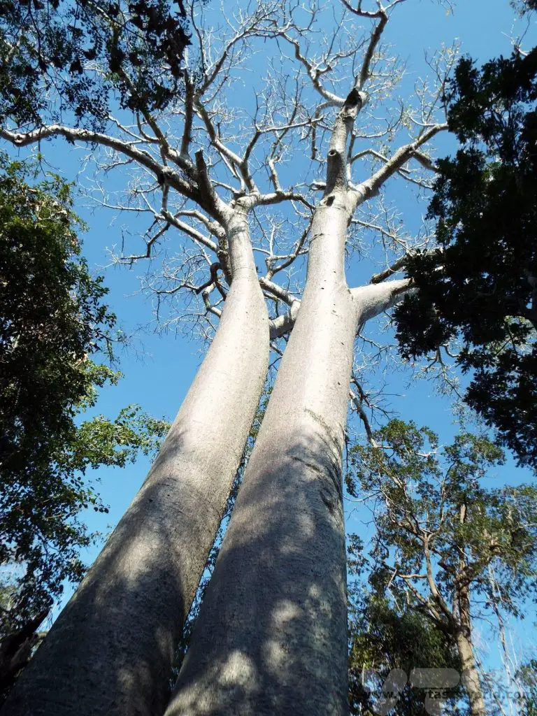
We particularly enjoyed viewing the baobab trees in this park. These remarkable trees predate human beings and can live for up to 5000 years. Their ability to store water in the bulbous trunk means that they can survive dry seasons as well as forest fires. They can grow up to 30m high and the biggest can be 50m in circumference. They have branches that look like roots. There is a legend that the baobab told god that it was the most beautiful of all the trees. Its arrogance angered the deity so much that he picked it up, flipped it over and planted it back in the earth upside down.
At Zombitse-Vohibasia there is a twin female tree which was 800 years old and a male that was 900 years old. Their roots are relatively shallow but can extend up to 50m horizontally underground in order to provide support for the tree.

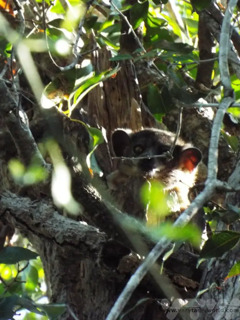
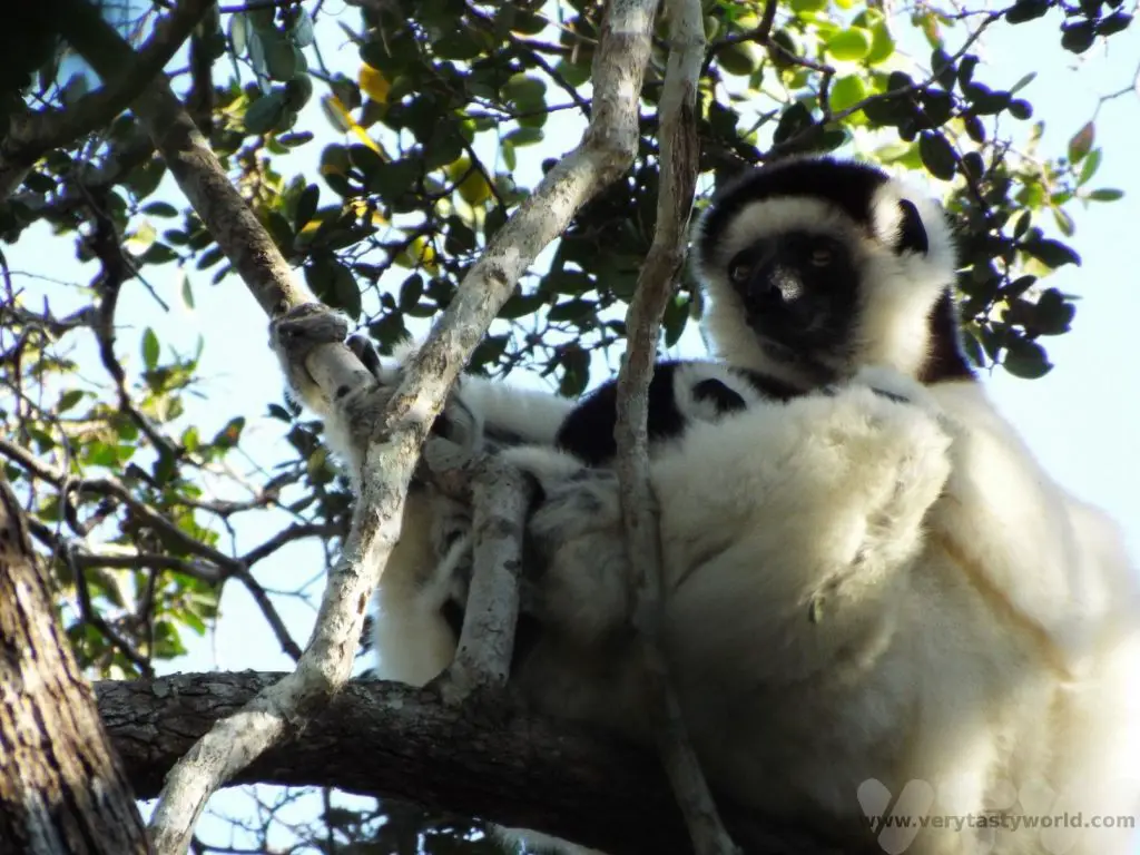
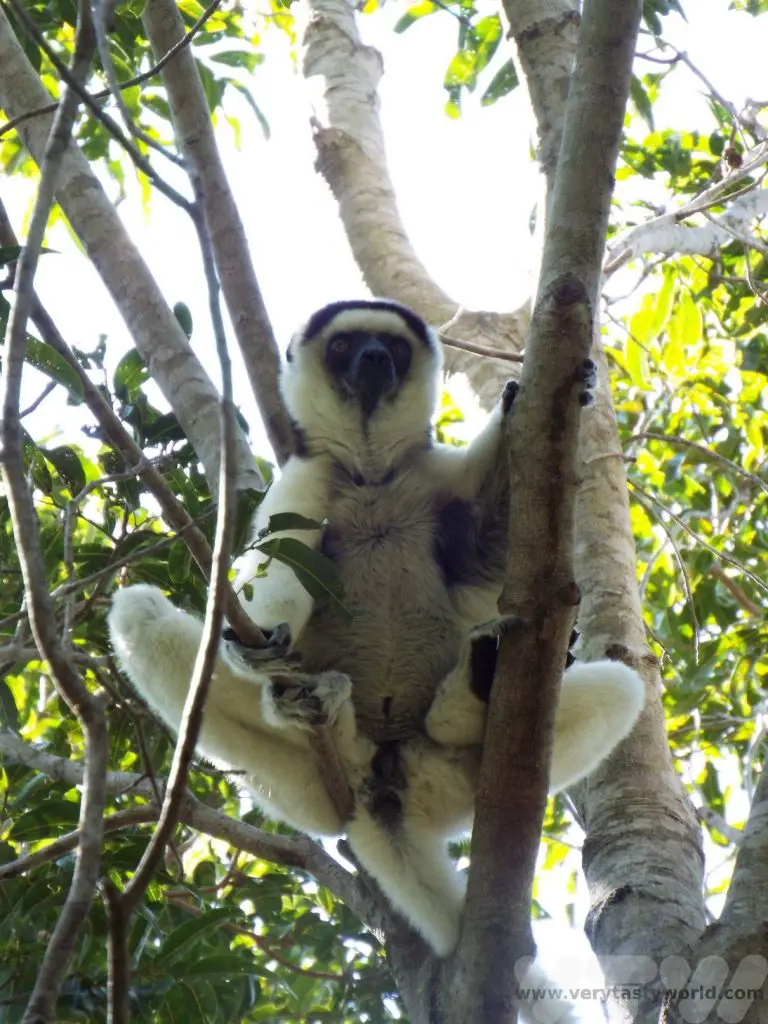
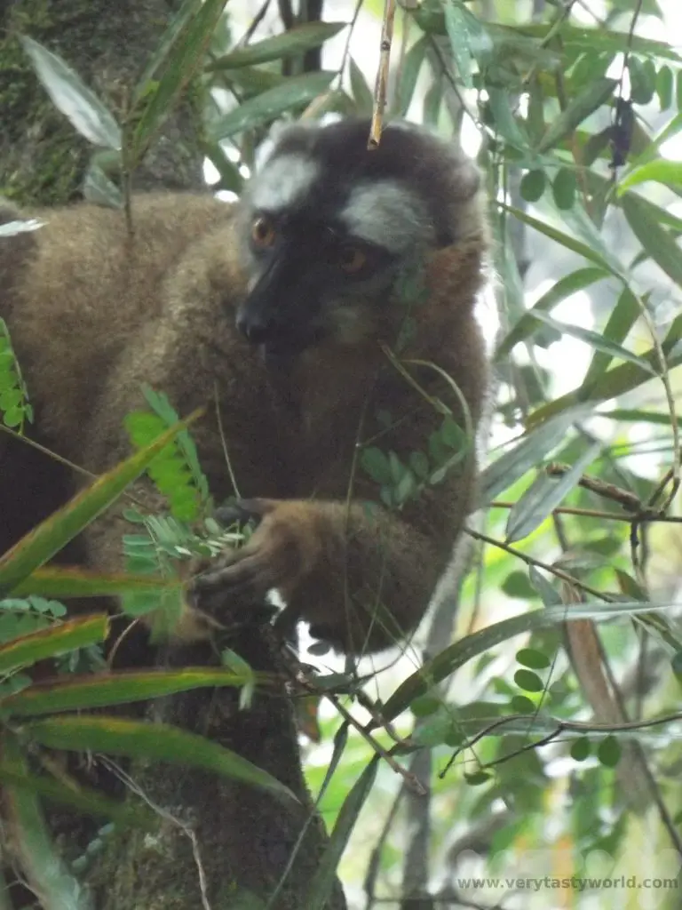
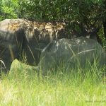
We also met our first lemurs. A nocturnal brown lemur who glared at us because he should have been asleep and a white sifaka.
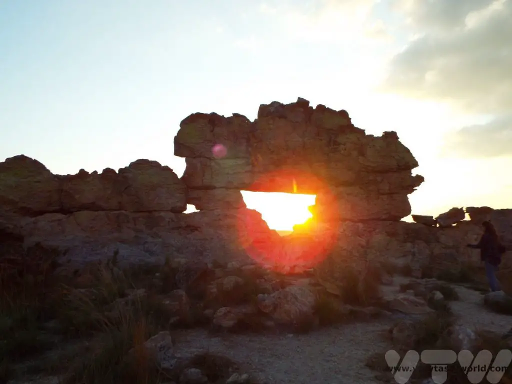
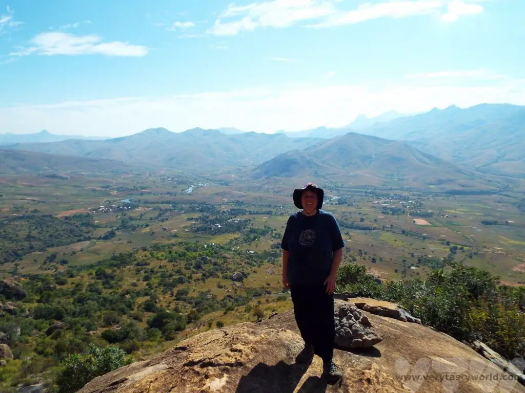
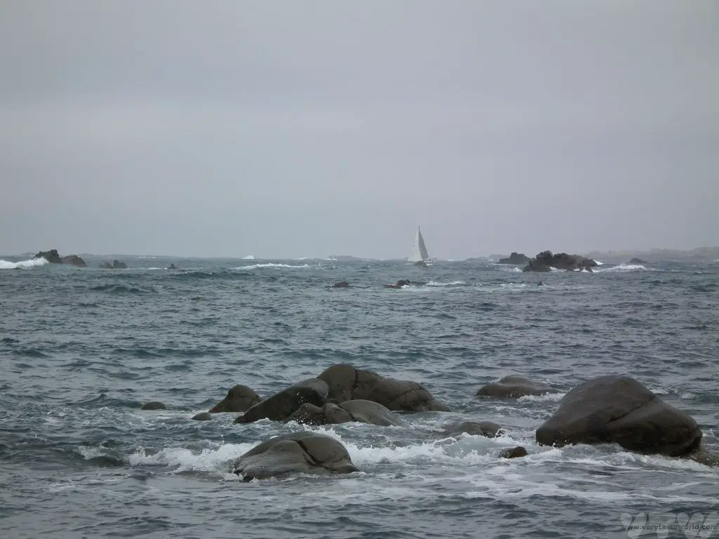
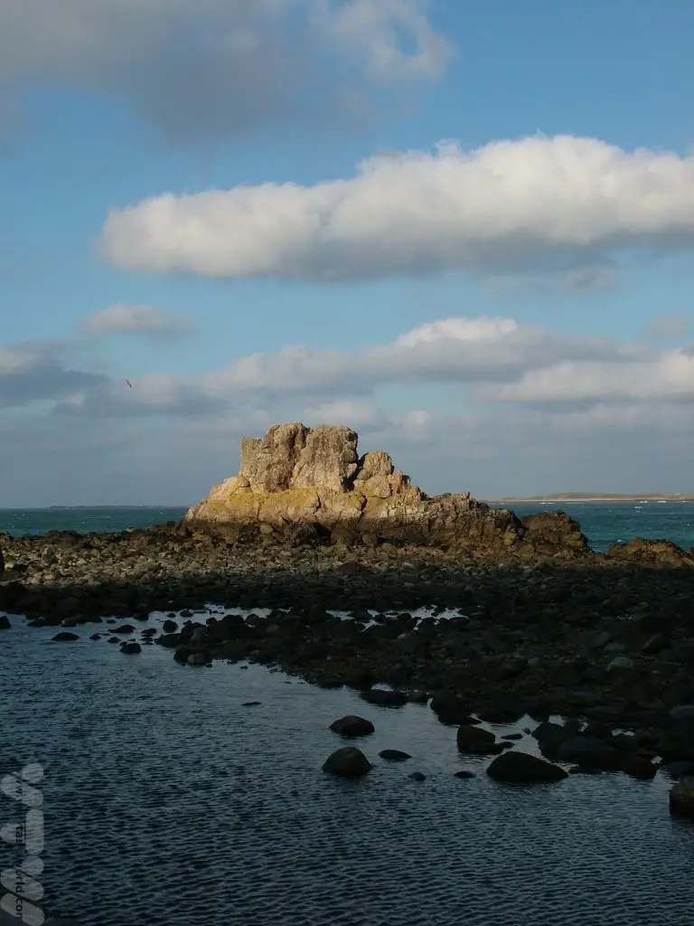
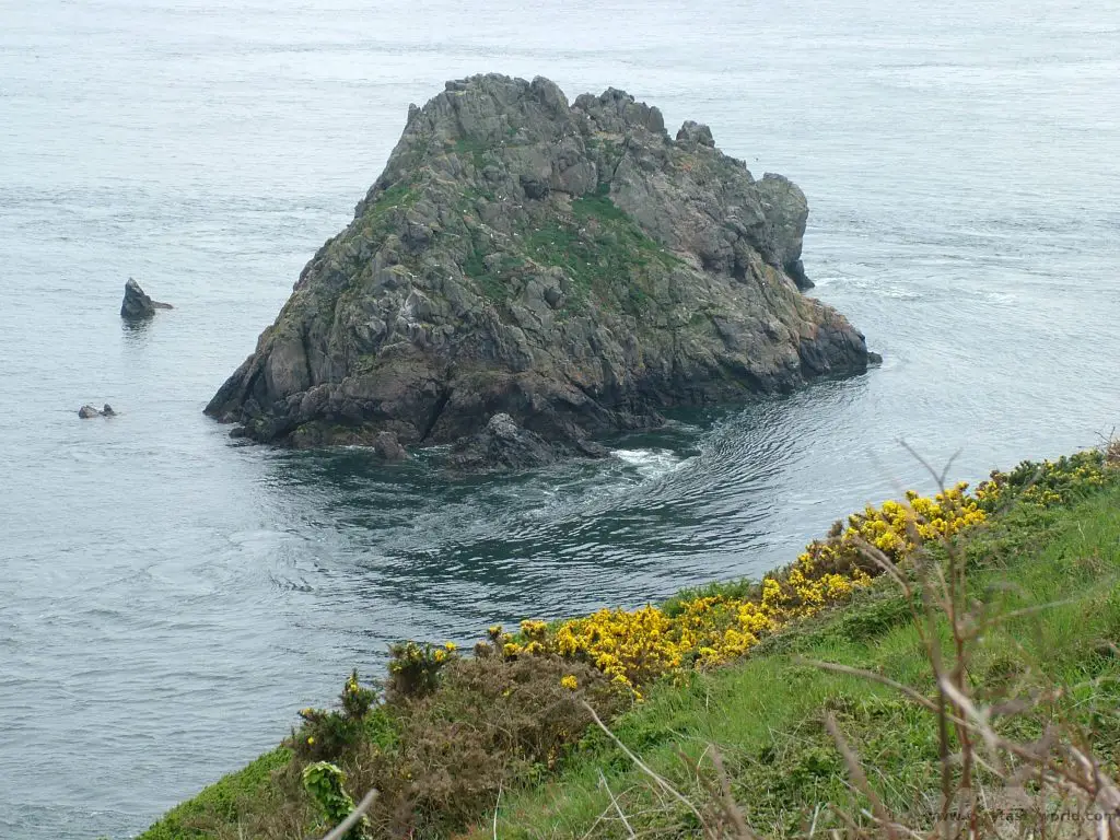
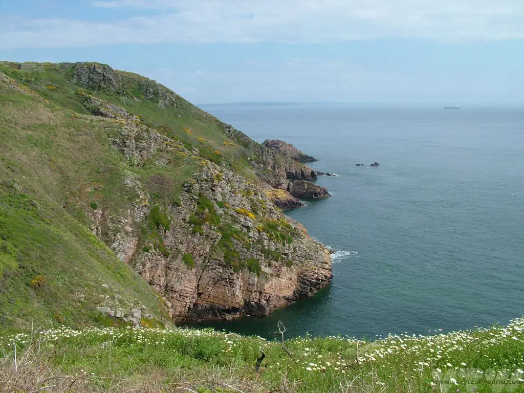
Travelling further along the RN7 as we approached Isalo the scenery changed from flat, extensive plains to a more rocky landscape. No visit to the area would be complete without visiting the Isalo window at sunset and our timing was just perfect. The window is a rock formation with a convenient hole that faces west, perfect for viewing the beautiful sunset. The window is just off RN7 and very easy to reach from the road.
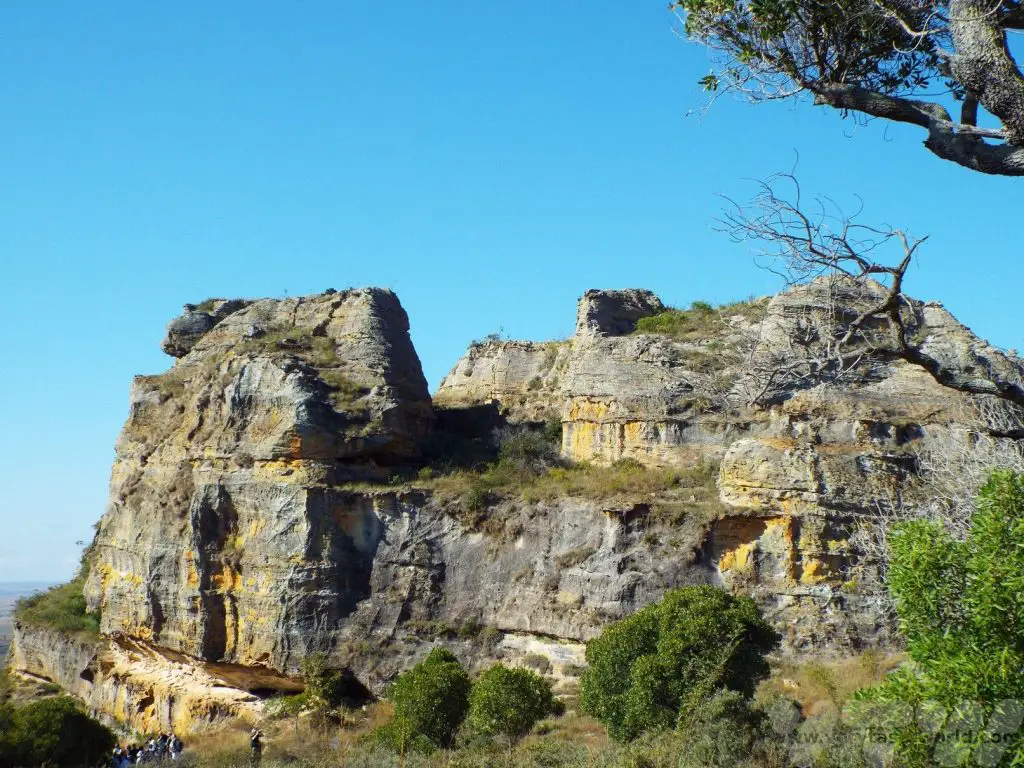
Isalo National Park
We spent the following day exploring Isalo national park. There are plenty of trails in the area, ranging from short hikes to a seven day trek. We chose the 14km trail. We met with our park ranger and drove to the start point.
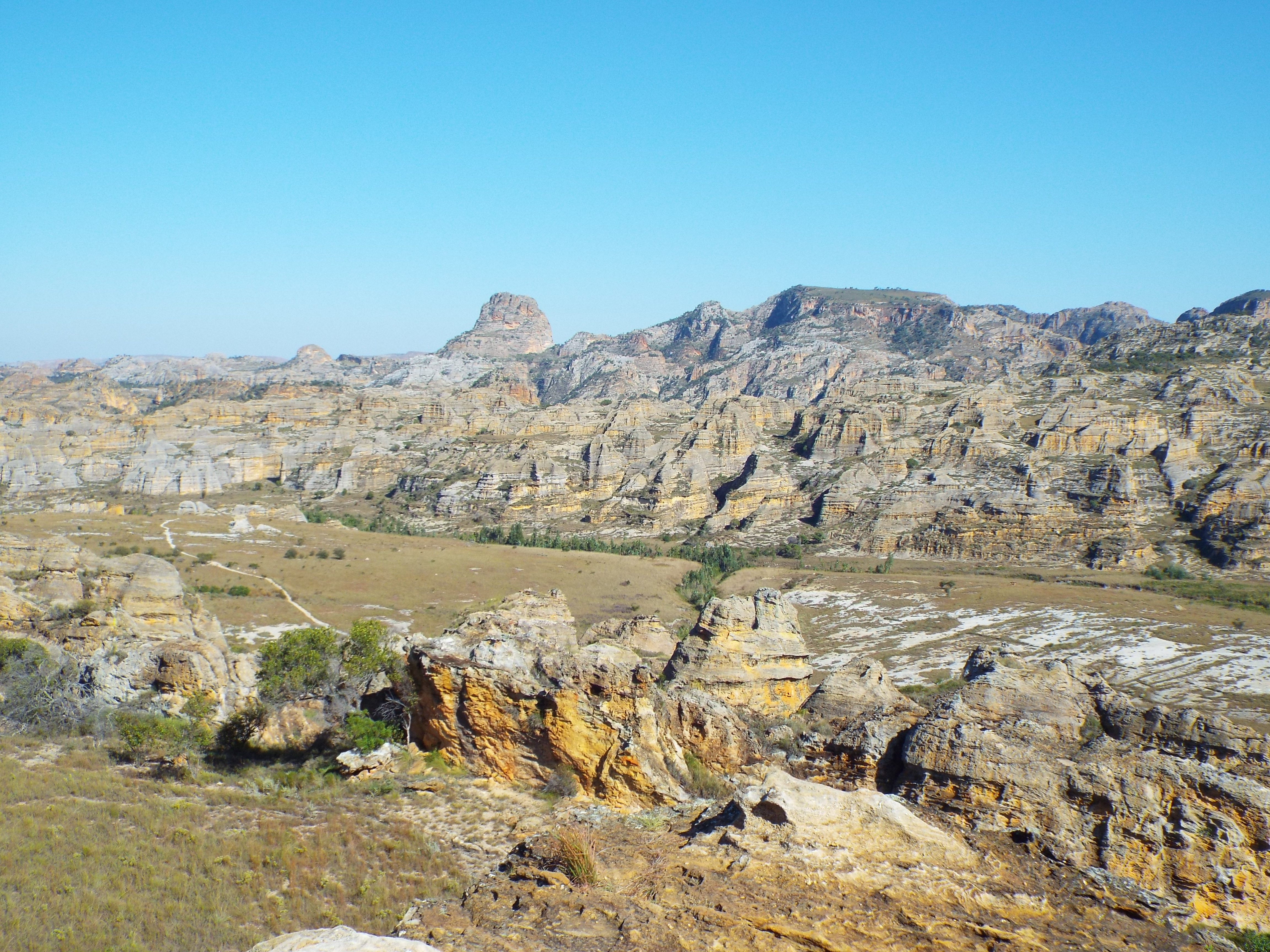
The walk involved climbing up steps to view some dramatic ridges.
We saw tapia trees which had survived a catastrophic forest fire in the area. The views from the ridge were magnificent.
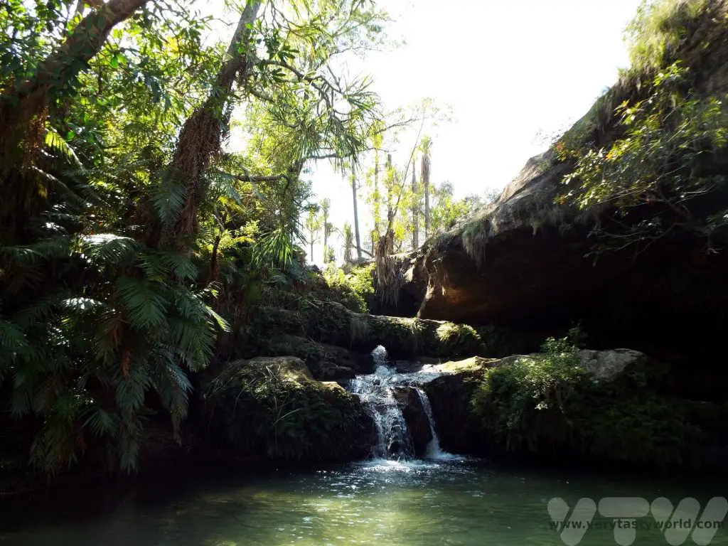
A walk along the relatively flat ridge led to a small waterfall with a pool where it was possible to enjoy a quick swim.
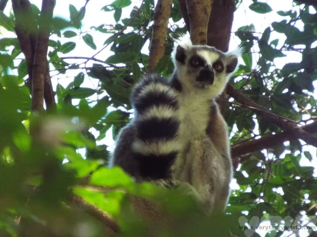
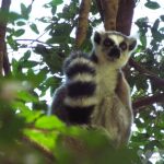
After a very pleasant dip in the pool, we walked along another flat section before climbing down the ridges. At the bottom, by the river, we discovered some white sifaka lemurs and ring-tailed lemurs.
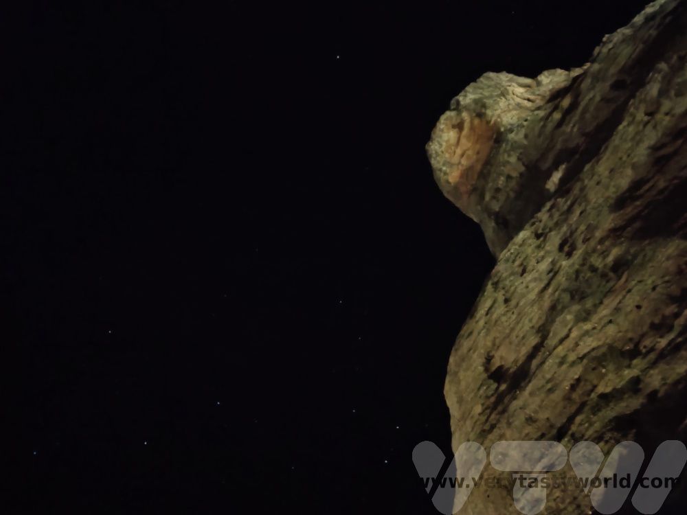
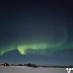
One of the most wonderful things about Madagascar is the night sky. Don’t forget to look up at night. It is possible to see the most brilliant views of the Milky Way. If you’re from the northern hemisphere, the stars are very different. The photo below was taken with a cheap phone camera. We would never have been able to capture these stars in the light-polluted skies at home.
Isalo to Andringitra
210km (~2 hours on RN7 then ~1 hour for 20km on a very bumpy dirt road)
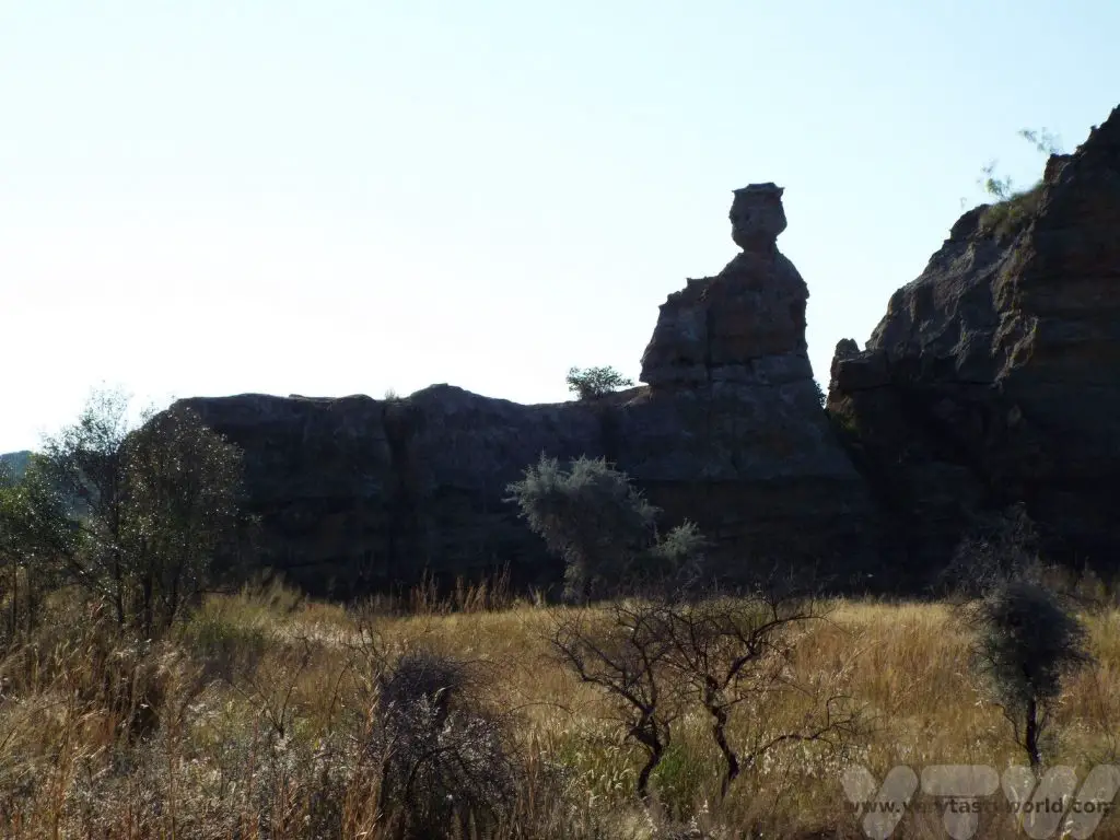
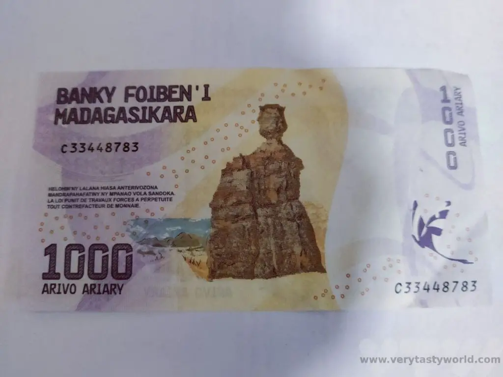
Another day on the road, we departed Isalo early in the morning. The RN7 has a landmark by the side of the road, a rock called the Lady Queen of Isalo. It is so distinctive that it appears on the 1000 Ariary banknote.
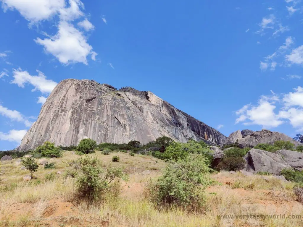
Andringitra
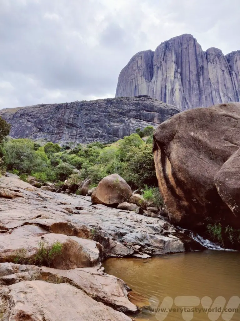
A little out of the way but definitely worth enjoying/enduring a ‘Madagascar massage’ along the extremely bumpy, rumbly dirt track, this area of outstanding beauty is a climbers’ paradise. Many professionals come to the area to climb the dramatic granite rock faces.
There are a couple of walks available for the less intrepid and we enjoyed both of these. A hike to the base of the ‘chameleon rock’ affords amazing views of the surrounding area when you reach the summit.
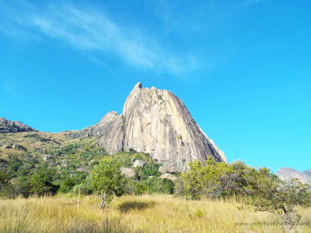
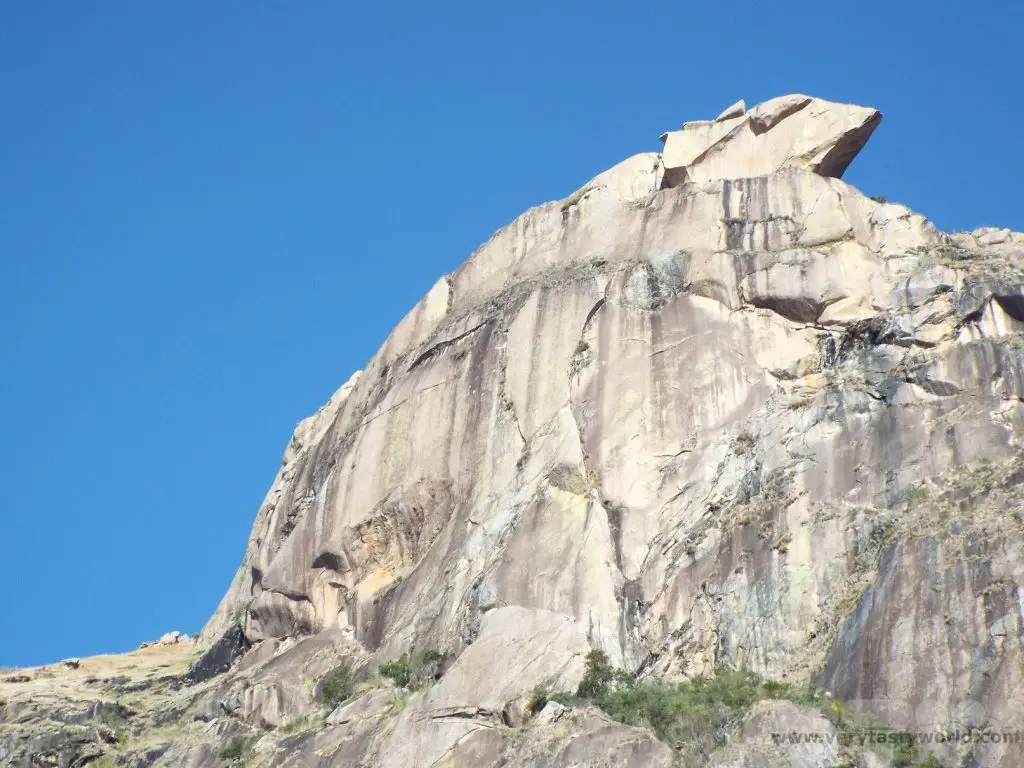
It’s about a 600m ascent and the view from the top of the ridge is spectacular.
And there’s also a lovely easy stroll through the fields and paddy fields to a natural swimming pool…
… and then through the forest, where you can see ring-tailed lemurs, and on to the local village. It was interesting to learn about the crops grown in the area and how the plants of the forest were used for medicinal and other practical purposes.
Andringitra to Ranomafana
350km (~5-6 hours)
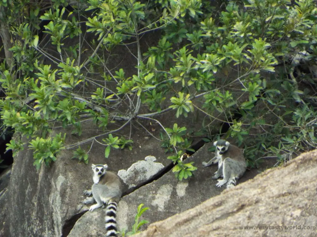
This was another long drive day but we had a few stops on the way. The Anja Community Reserve, south of the district capital city of Ambalavao, is a community-run forest where local people were able to guide us and we could spot some of the local ring-tailed lemurs.
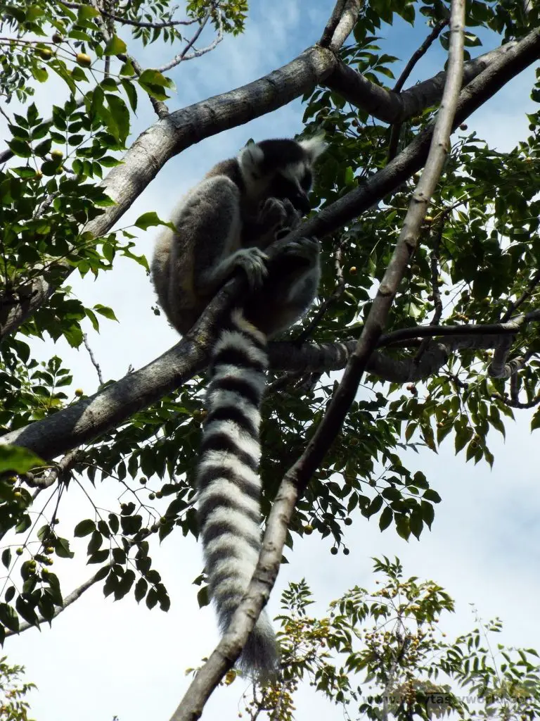
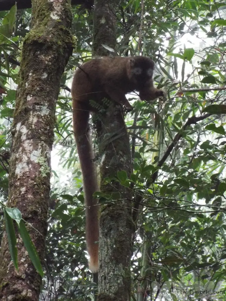
This would be the last place we would see the ring-tailed lemurs. Different species of lemur tend to live in specific parts of Madagascar. The ring-tailed lemurs have 14 black stripes and 14 white on their tails. They are fascinating to watch – lively and agile as they leap through the trees.
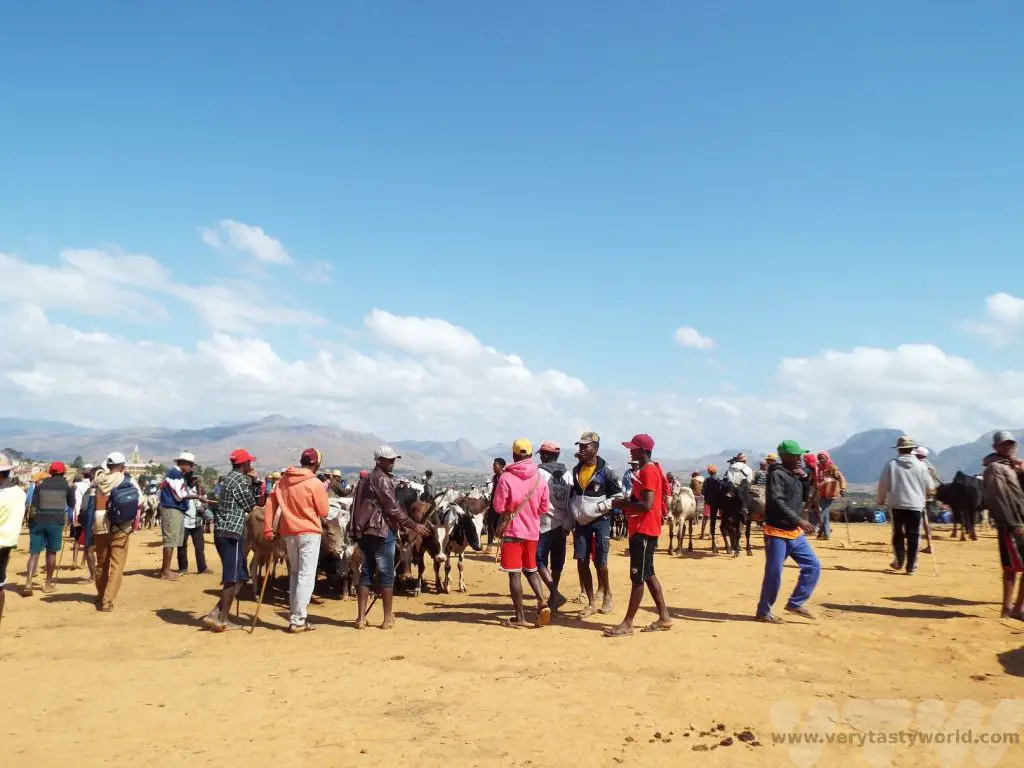
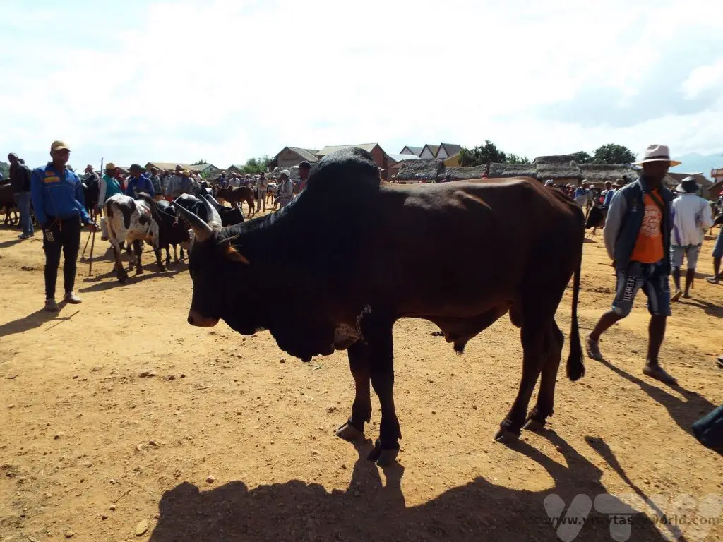
After a short drive to Ambalavao, the major city in the area, we arrived on zebu market day. Zebu are the livestock of the Bara tribe. They are cattle which have a distinctive hump, related to the species farmed by the Maasai in Kenya and Tanzania. Zebu is a common meat eaten in Madagascar and the hump is considered to be a delicacy. People travel from miles around to buy zebu at the market. The bull in the picture on the right (below) was worth about 2.5million Arairy (about $500 US).
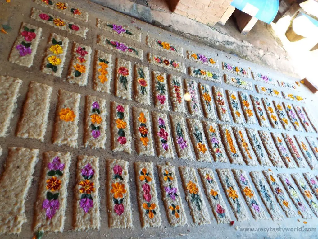
We also visited a paper-making facility of the Antemoro people. It’s very pretty flower-embedded paper.
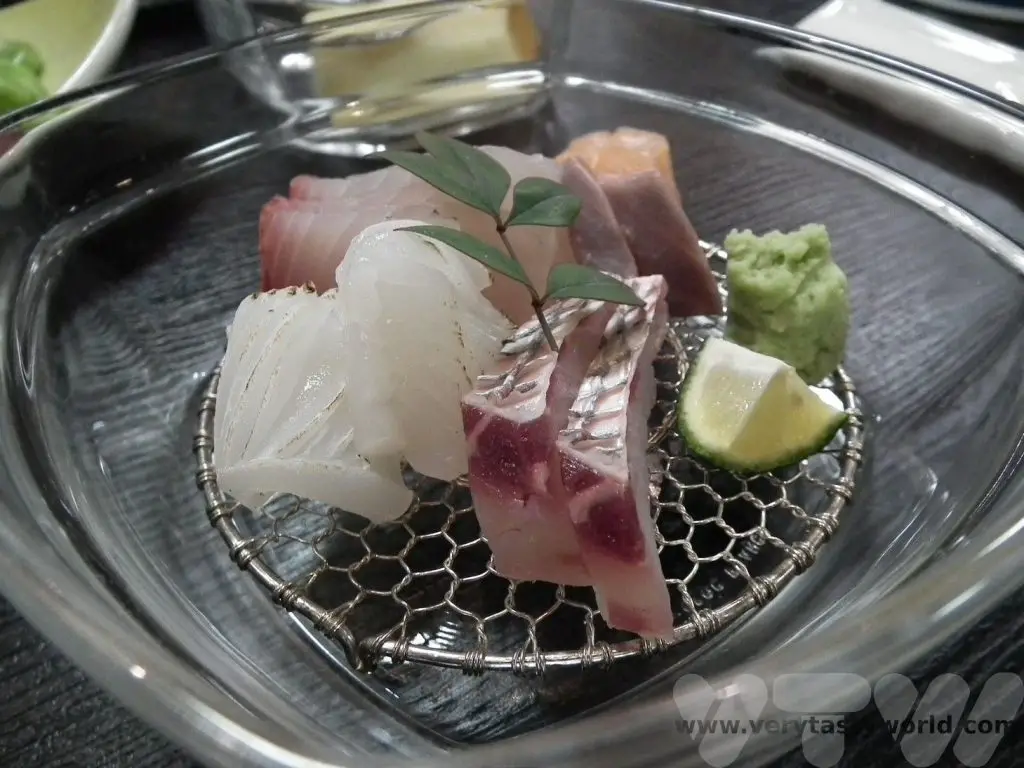
Ranomafana National Park
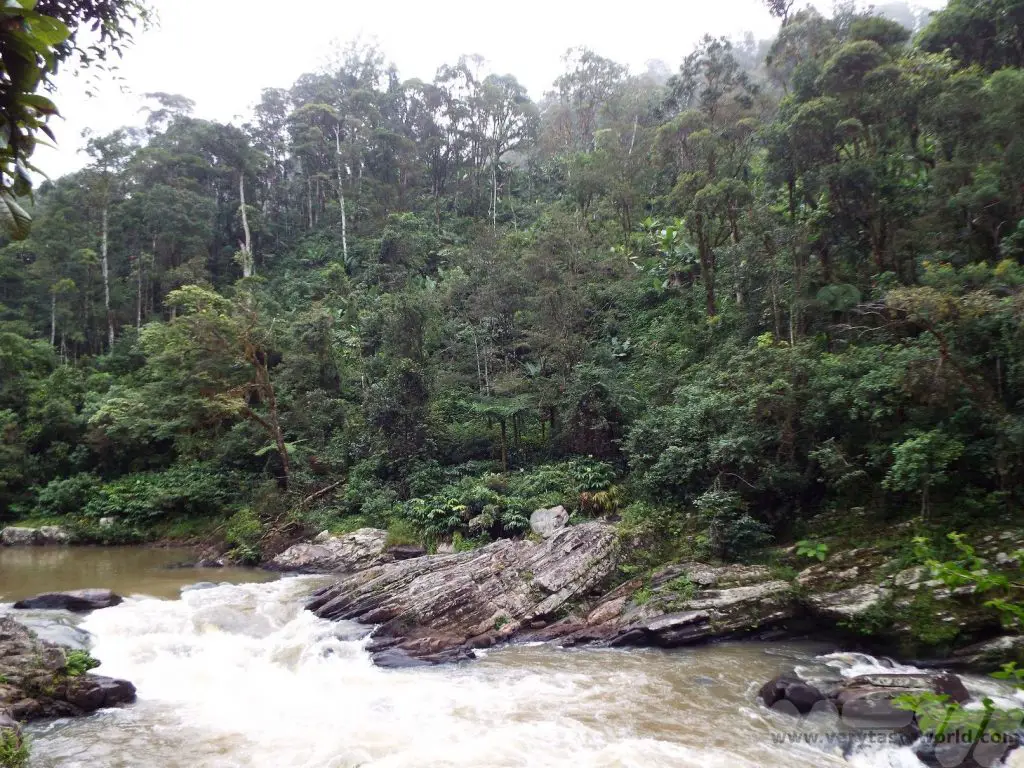
The deciduous rainforest of Ranomafana marked another transition in geography.
It was dark when we arrived at Ranomafana but we had a night walk planned. Walking along the road (you are no longer allowed to walk inside the rainforest because it is really dark and people have fallen over tree roots in the past) it is possible to spot many different creatures, including chameleons (which don’t change colour at night), frogs and, if you are lucky, the shy nocturnal mouse lemur, the smallest of all the lemurs. (We didn’t get lucky here but we did later in our trip.) The chameleons were fascinating.
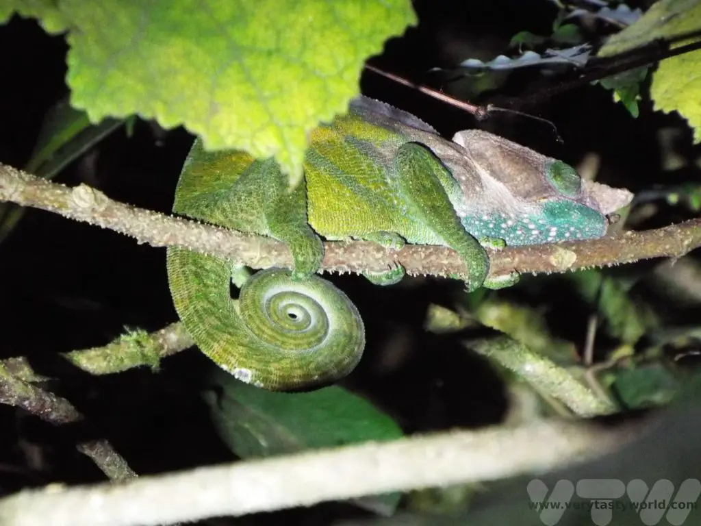
The blue-legged chameleon was particularly colourful.
The following day we visited the rainforest. The Ranomafana forest is huge, covering more than 41,600 hectares (161 square miles). It was established as a national park in 1991 and has a research centre. Scientists travel from all over the world to discover and learn about its flora and fauna.
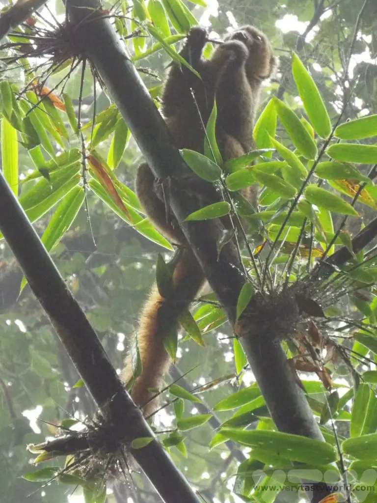
It has seven diurnal species of lemur and four nocturnal. With our excellent guide, Chantal, aided by expert spotters, we were able to see four species of lemur, including the critically endangered greater bamboo lemur.
We also saw the golden bamboo lemur.
Red-fronted brown lemurs have incredibly expressive faces.
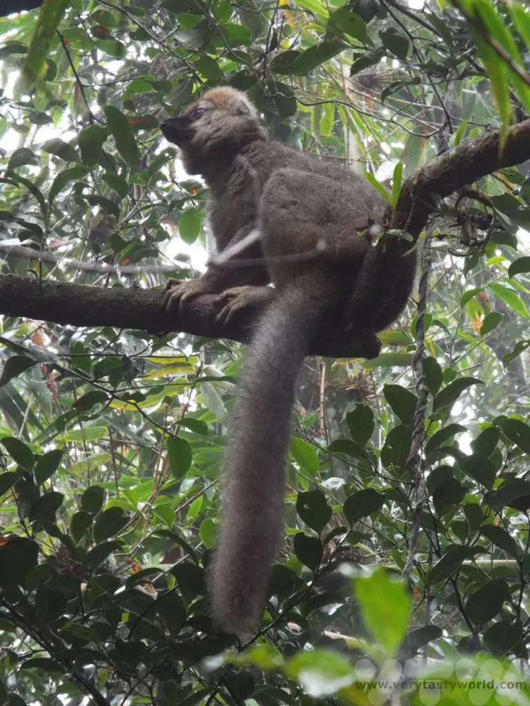
The red bellied lemurs were wonderful to watch, leaping through the trees.
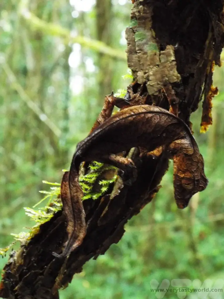
Another creature that totally befuddled us was the brilliantly named satanic leaf-tailed gecko. Our spotter told us there was a gecko on a tree – could we see it? The answer, despite looking really carefully, was an emphatic “no, but there is a dead leaf.” We had to move around the tree to get a picture that actually looked like a gecko.
In the afternoon we visited a local vanilla plantation. Vanilla is not indigenous to Madagascar but originated in Mexico. However it is widely acknowledged by many chefs that Madagascan vanilla is amongst the best in the world. A huge amount of work goes into producing this sought after spice. The plants are hand-pollinated because the bee that pollinates vanilla in Mexico doesn’t exist in Madagascar. The temperature and humidity are important factors in growing the plant.
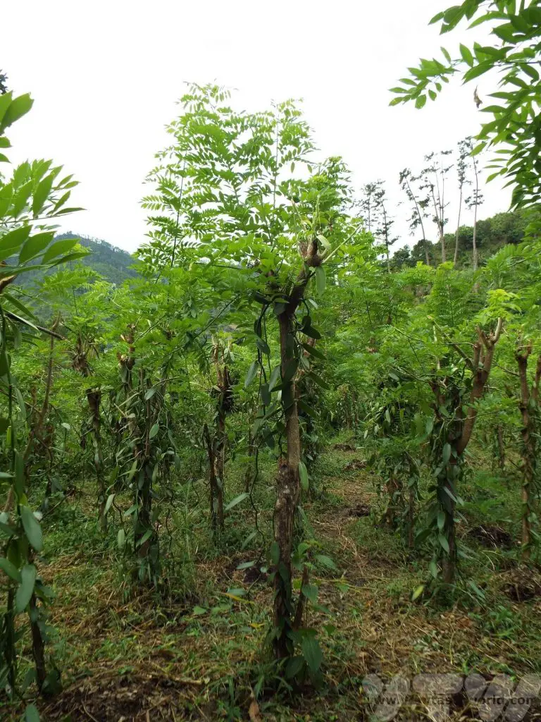
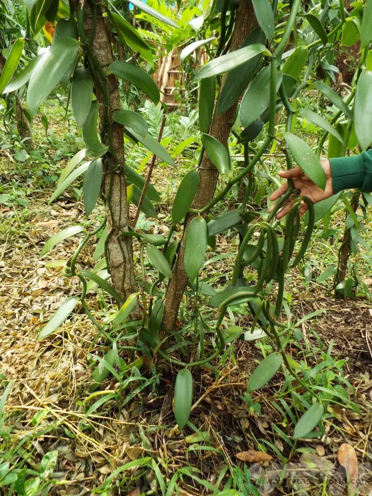
There are strict regulations on the production and harvesting of vanilla. Plants are marked so that each plant is assigned to its farmer and pods can only be harvested at a particular time of year. The Government monitors production. The pods are harvested then blanched in hot water for three minutes. They are then sun-dried over 10 days – the heat and humidity levels need to be just right.
We couldn’t visit and not buy some vanilla pods – and other spices such as cinnamon, wild pepper and wild ginger – to bring home as foodie souvenirs. We were advised to keep them in an airtight glass jar, although the pods apparently can also be frozen.
Ranomafana – Antsirabe
250km (~6-7 hours on bumpy road)
Another long drive day of driving with a couple of cultural stops.
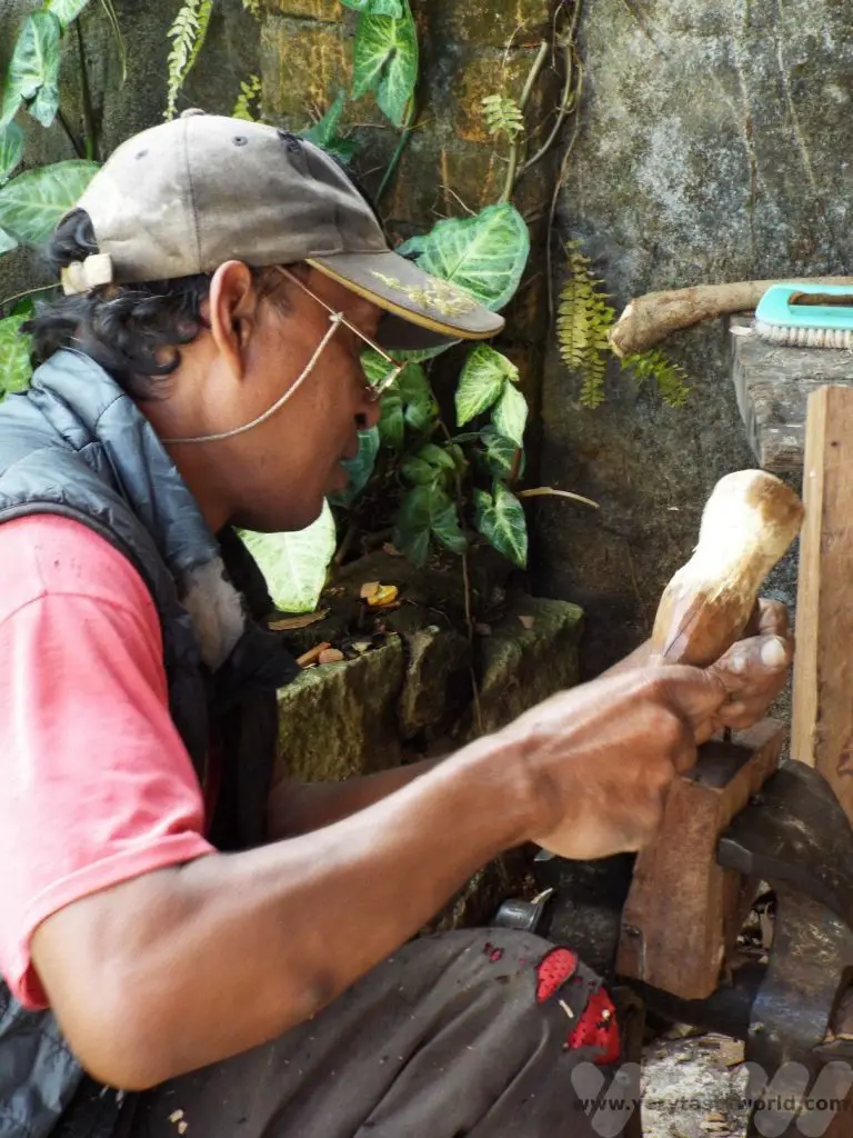
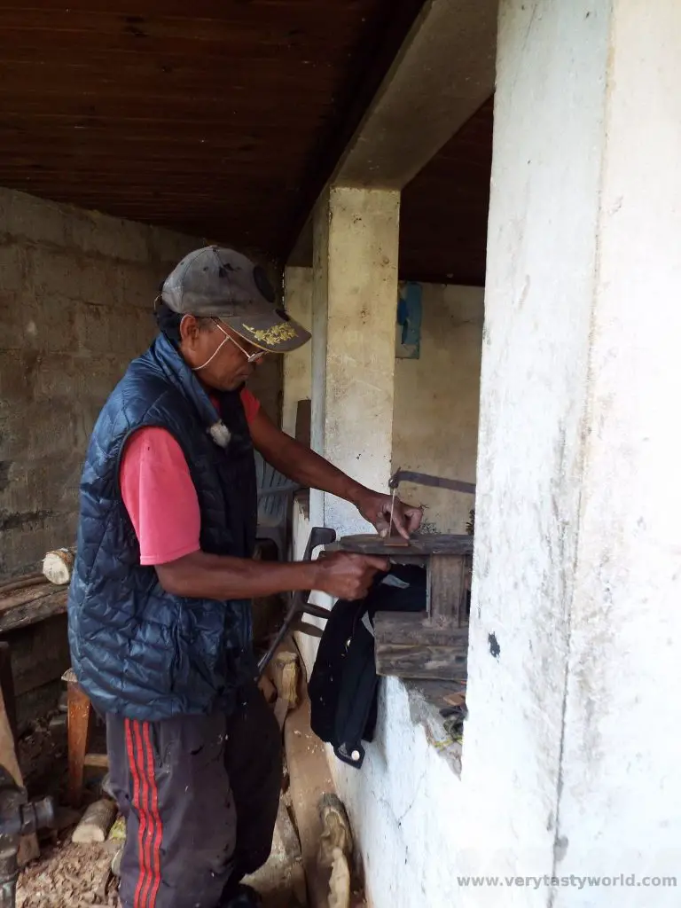
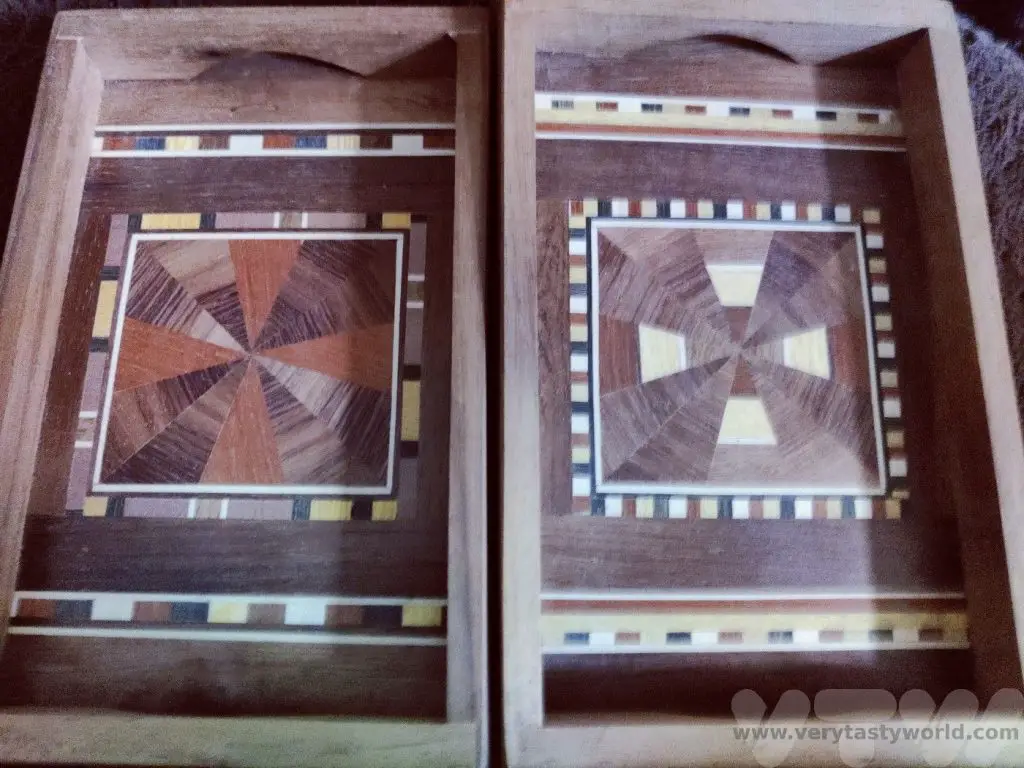
We passed through the Betsileo region which is known for the wood carvings of the Zafimaniry people, acknowledged as a UNESCO Intangible Cultural Heritage.
The Zafimaniry community have a woodcraft heritage. Foresters and craftworkers have a highly skilled knowledge of the local wood and how to craft it. We visited a workshop where we could meet craftsmen who not only carved intricate and beautiful pieces from mahogany and rosewood, we also saw them make their own tools. Even to the extent of making the blade for a hand-pulled bandsaw.
The quality of the products is exceptional. There is a large shop and, while we sometimes get a bit annoyed by visiting a small workshop followed by a big shop, we couldn’t resist buying a number of these top-quality pieces.
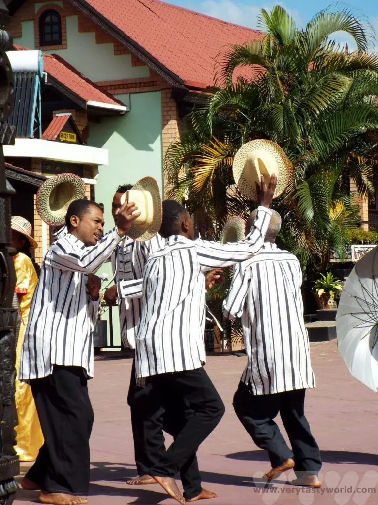
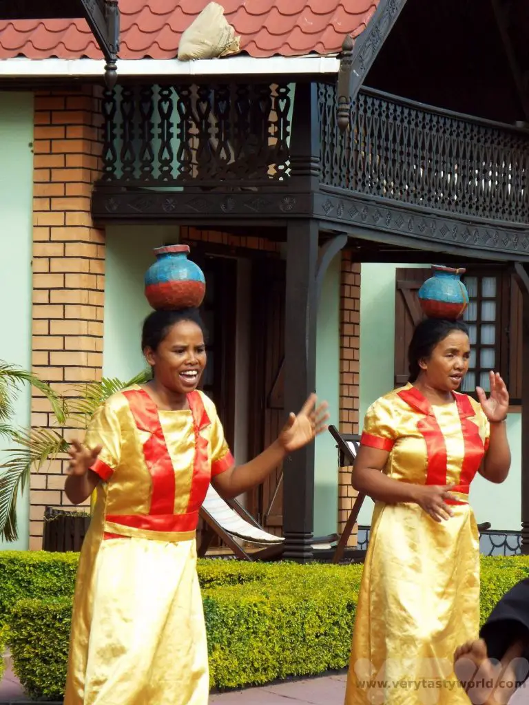
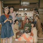
We also enjoyed a Malagasy lunch with traditional dance and music.
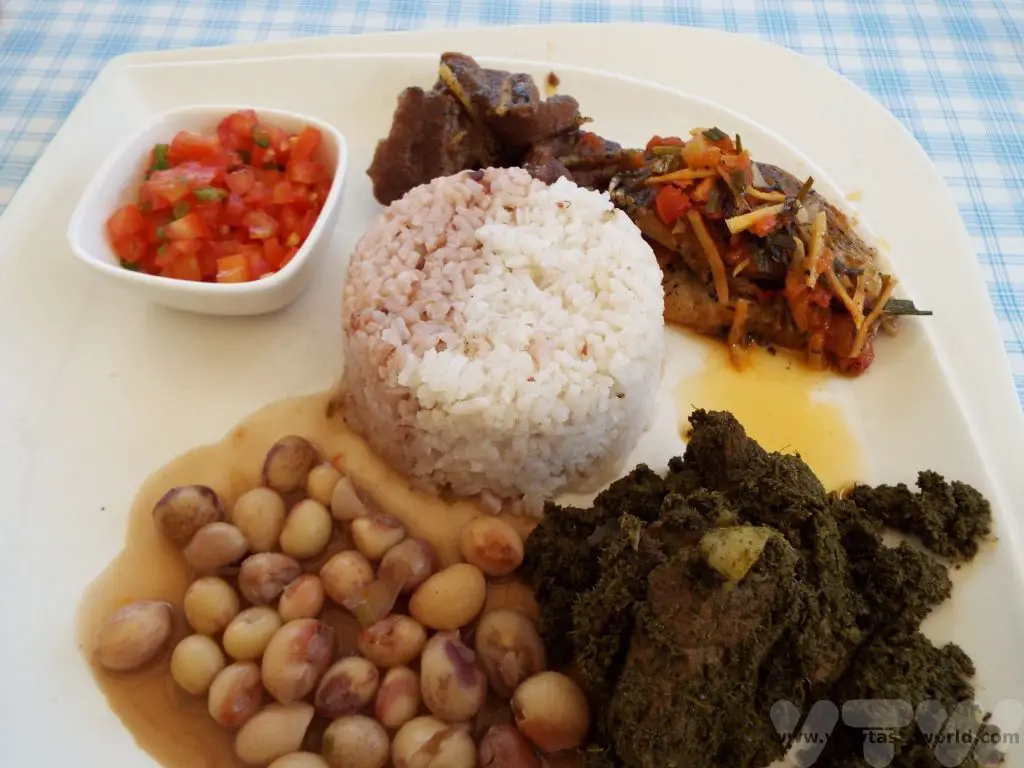
Rice is a staple in Madagascar. We saw paddy fields all over the country. The Betsileo are farmers and are one of the wealthiest tribes in the country due to their impressive cultivation techniques.
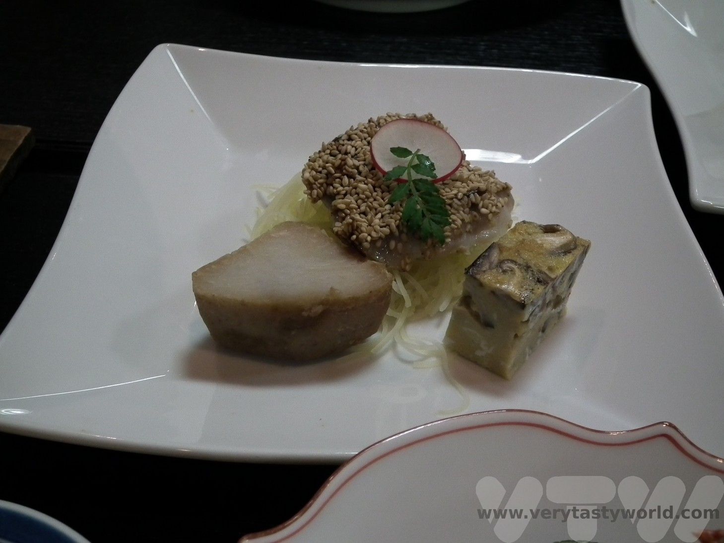
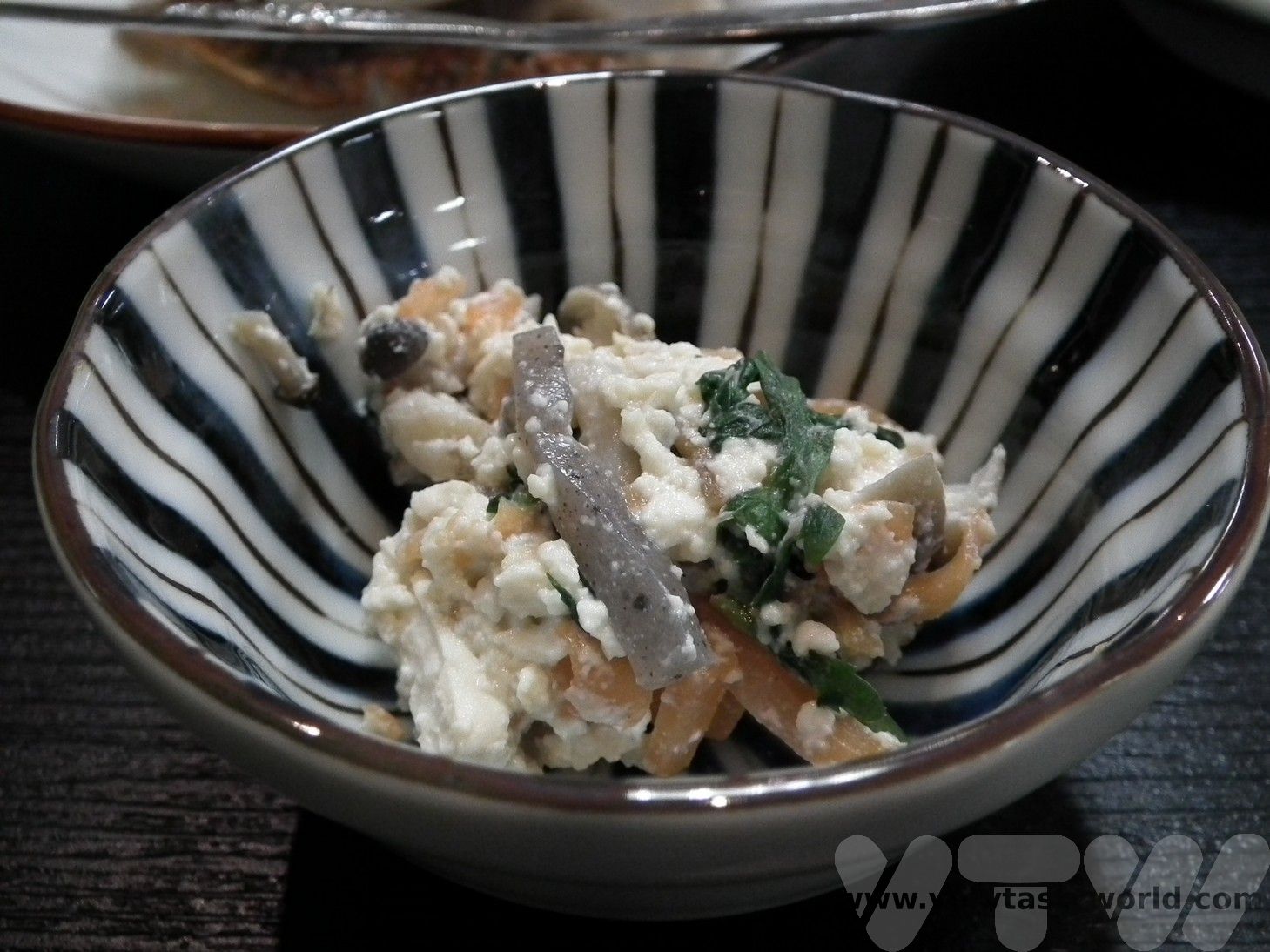
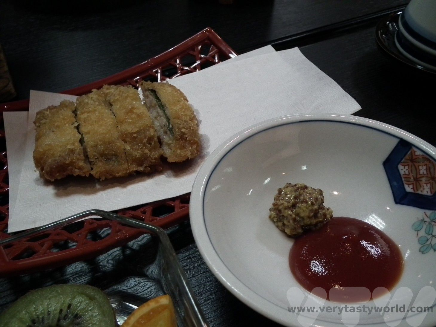
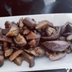
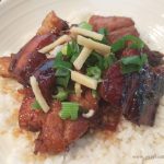
We enjoyed red and white rice with zebu steak, tilapia fish with chilli and ginger spices, beans and belly pork cooked with cassava leaves.
Antsirabe – Antanananviro
150km (4-5 hours drive)
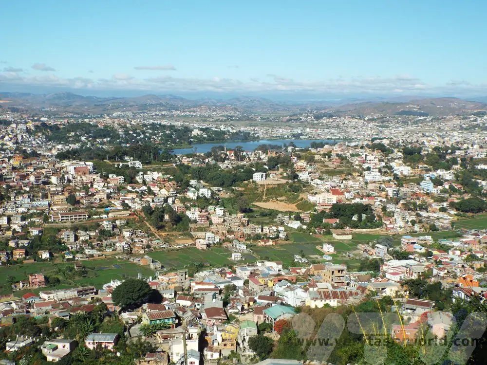
Antsirabe is the third largest city in Madagascar and is an important commercial centre. It’s also home to the brewery which makes the national brew Three Horses Beer or THB as it is affectionately known. It’s a light, refreshing pilsner and we enjoyed it many times during our trip.
We had a long drive ahead so only had a short time to explore Antsirabe. We visited a famous precious stones facility and learned about the minerals that can be found in Madagascar. It is famous for its sapphires. We bought a lovely piece of crystalline, a stone that can only be found in this country.
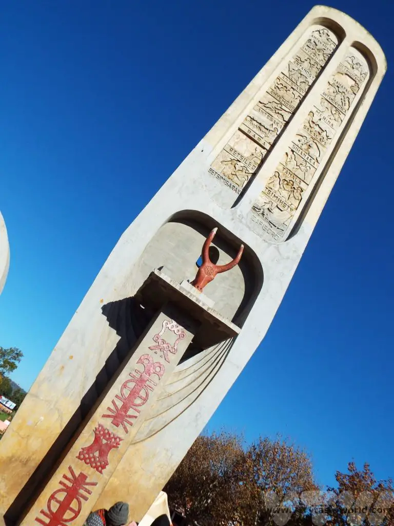
We also visited Independence Square, a long avenue which contains a park. It commemorates Madagascar’s independence from French colonialism. The monument represents every tribe within the country.
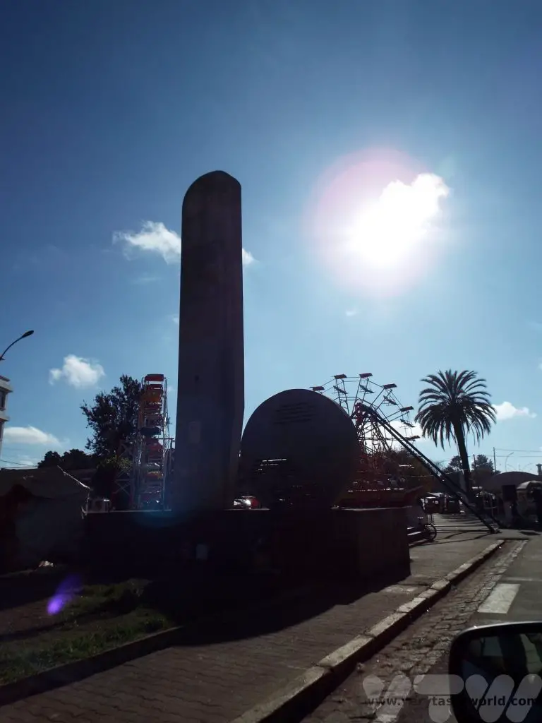
The RN7 then takes us to Madagascar’s sprawling capital, Antananarivo.
This trip along Madagascar’s RN7 took a week to complete. While we were in the country we also spent some days in the east, driving along RN2 to explore the rainforests in the highland regions. We’ll write about that another time…

Traveller Tips For Madagascar
What Is The Food Like?
We plan a much longer post on Malagasy food in the future but here’s a brief overview.
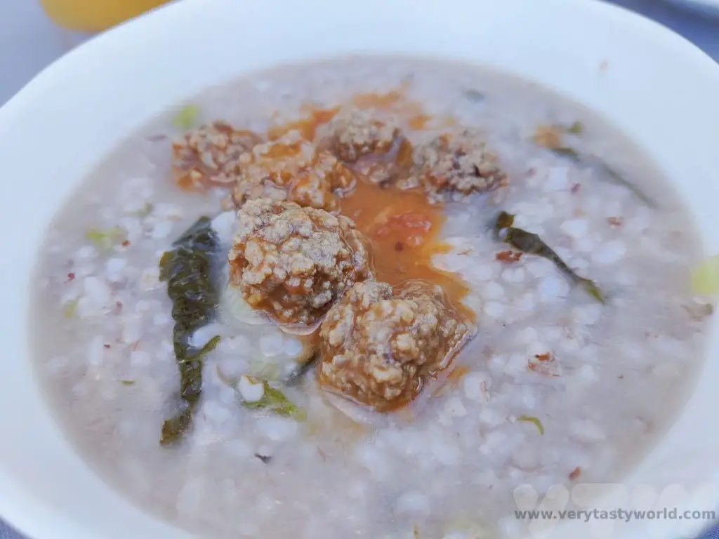
Firstly, most of the hotels we stayed in offered European food. We found this to be really disappointing as we always want to try the local fare. That said, many hotels were very happy for us to go off-menu at breakfast provided we ordered a Malagasy breakfast the night before. So we often enjoyed rice porridge with zebu steak or meatballs – a delicious, filling start to the day.
Malagasy people love rice. It is eaten for breakfast, lunch and dinner and in enormous portions. We have big appetites but had a standard portion of rice was too much for us, so we generally shared it between us.
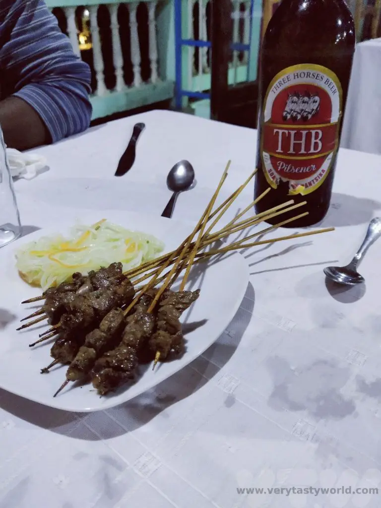
Zebu is a popular meat. It tastes just like steak. Zebu hump is a delicacy – it’s meaty and slightly fatty but very soft. Zebu skewers with a nice cold THB beer are a perfect snack food.
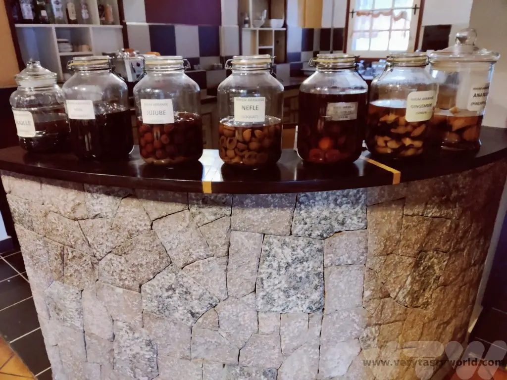
The local tipple is rum. We would see distilleries along with RN7. Rhum Arrangé is a wonderful way of drinking it. This is a great jar of rum infused with different flavours – vanilla, coconut, lychee, tamarind, ginger, mixed fruit, local fruit such as tapia amongst many, many more. We did our best to try as many variations as possible.
How Do You Get Around?
We booked a tour with a local company who were excellent. They provided a 4WD and a wonderful driver-guide, Farley, who knew his way around the country. The roads in Madagascar can generally be described as awful. Think of the biggest pothole in your local street? That’s nothing compared with Madagascar – some of the potholes in the roads are like craters. This makes driving very slow and occasionally extremely bumpy. To make up for this scenery is wonderful. If the government could do one thing to make the country more accessible it would be to fix the roads.
It is possible to hire cars and the RN7 is probably the best road for a fly-drive trip if you want to drive yourself. That said, some of the national parks were located several kilometres from the main road and towns were extremely busy with all sorts of vehicles to drive around. We often love driving ourselves when we travel, but were very glad that we had a driver, who knew the roads well, on this trip.
Public transport is available if you are feeling hardcore. The buses are generally mini-buses that are usually bursting at the seams – luggage goes on top and people fit into the vehicle. The buses will be a lot slower than private cars.
The national airline Air Madagascar can transport you between major cities. It doesn’t have a great reputation for timeliness but it has a good safety record and we found the service to be fine. We recommend giving yourself a bit of leeway in terms of arranging connecting flights. We were extremely lucky that, when our international flight arrived 14 hours late, we managed to get an internal connection thanks to receiving lots of help from our tour company.
What is the Language of Madagascar?
Local people speak Malagasy, which is derived from a number of languages, and French, the language taught in schools. Most hotels and tourist attractions will have someone who can speak English.
Any attempt to speak Malagasy will be appreciated. These are the words we picked up.
Hello – salaam (salaama, salaame also work but don’t say salami!)
Thank you – misaotra
Slowly, slowly – mora mora (be careful, mola mola means crazy!)
Delicious – matsiro
Can I drink the water?
No, you will need to use bottled water. It is cheap to buy – around £3/$4US for 8 x 1.5L bottles and all towns will have a store that sells water. Some hotels do provide water. And the tour company we travelled with supplied us with 1.5L each per day. We also recommend brushing your teeth using bottled water.
How Do I Get Money?
Money was a bit of an issue in Madagascar. The unit of currency is the Malagasy Ariary. Cash is king and there were only a very few places where we could use credit cards. Even gift shops at tourist attractions are largely cash only. ATMs are available but only in large towns, so make sure you get enough cash to get by between towns.
There is a cashpoint at the airport and we recommend getting a reasonable amount of money on arrival, although even then there was a restriction on how much you can withdraw – it wasn’t enough for the entire trip. The notes dispensed will be 20,000 Ariary (around £3.50/$4.50 at May 2023). These are actually large denominations and we found it difficult to get change from a large notes when spending them in shops or restaurants. Hotels were quite helpful at changing these for smaller notes, but bear in mind that it’s worth getting hold of those smaller denomination notes if possible.
Is Tipping Expected?
We were expected to tip our guides and this was fine, we incorporated it into the cost of the trip. The going rate at the time of travel (May 2023) was 20,000 Ariary per person per day. What we didn’t quite expect was that, along with guides who took us through the national parks, spotters were also employed. These lovely people would run through the rainforests and national parks looking out for interesting wildlife and then phoning our guides to let us know where to find them. They were brilliant and thanks to these spotters we saw a lot of wildlife. So it’s worth planning extra cash for tipping the spotters as well.
Are There Any Health Considerations?
There aren’t many dangerous creatures in Madagascar but undoubtedly the mosquito is one of the most hazardous. Malaria is prevalent throughout the country. We used DEET jungle spray and slept under mosquito nets. Unfortunately we did get bitten because we are strawberry-flavoured to mosquitos who just love munching on us. Like Achilles’ vulnerable heel, just a little bit of flesh exposed to the elements and they were feasting on us – so we also took anti-malarial pills. We recommend speaking with your healthcare professional before travelling. And, obviously, take any prescription medicines you need.
Packing Essentials For A Madagascar Trip (aside from your usual clothes and things)
Good walking shoes or boots. We recommend wearing these on your flight just in case your main luggage doesn’t arrive.
Waterproofs – rainforests are called rainforests for a reason!
Swimming gear – there are hot springs and natural pools to go swimming in. (You could also bring a travel towel but our hotels were happy to lend us additional towels.)
Torch for night walks. A head torch is often useful as well. The power did go out briefly a couple of times in some of more remote regions.
Binoculars for viewing wildlife, especially if you are interested in birdwatching.
Camera with a good zoom lens and quick shutter speed to captures those leaping lemurs.
Sun protection – sun hat and suncream.
Usual medication and talk to your doctor about anti-malarial protection.
Jungle insect spray which contains at least 50% DEET.
Will I See Penguins in Madagascar?
No! While the Hollywood movie raised a lot of awareness about this magical country, you won’t find penguins in Madagascar. Neither will you find any of the Big Five game animals of Africa. But Madagascar’s wildlife is unique and emphatically worth travelling to see.

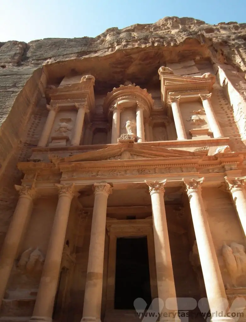
Tourist Attractions In Ethiopia
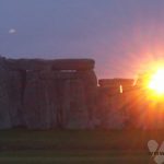
Ethiopia is a country we had long wanted to visit. When we visited Armenia in the late 1990s a number of people we met were travelling there because they seemed – to us youngsters – to have visited everywhere else. On a trip to the beautiful Armenian rock-hewn Geghard Monastery a couple told us about the underground churches of Lalibela and in that moment Ethiopia was added to the To-Visit list. It would be many years before we could make the journey but we found a local company who were able to offer us a tour.
Although it was Lalibela that piqued our interest, we discovered that this wonderful country has so much more to offer than its star attraction. With a rich history, stunning landscapes and amazing wildlife, here is our guide to the tourist attractions in Ethiopia.
A Northern Ethiopia Itinerary
Ethiopia is huge. Our itinerary covered some of the best historical sites and spectacular landscapes in the northern part of the country. Although the route involved a lot of driving, we also needed to fly between key locations. This itinerary took 13 days to complete. This post is intended to provide an overview of the tourist attractions. We have some other posts on the blog that provide more detail about some of the places we visited.
Addis Ababa
We started off in Addis, Ethiopia’s sprawling capital city. Emperor Menelik’s third wife Empress Taytu Betul settled in the region in 1886. Eventually the emperor established himself there in 1887 and the city started developing. Addis became the capital in 1889 after It has continued to expand to this day. Its name means ‘new flower’. It is a lively, bustling city and a centre of commerce. The Merkato district is home to the largest open market in Africa. There are plenty of interesting places to visit .
National History Museum
This museum houses a collection of artefacts, set out in chronological order, depicting Ethiopia’s long and fascinating history.
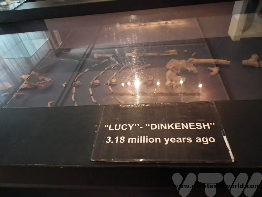
One of the most interesting exhibits is that of ‘Lucy’ – a 3.2 million year old skeleton, who was discovered in the mid-1970s and became enormously famous as the oldest human. Lucy is no longer the oldest since ‘Ardi’ was discovered – she predated Lucy by about 1.2 million years, but she was a local lass as well, suggesting that Ethiopia could well have been the place where humans evolved to stand upright.
Ethnographic Museum
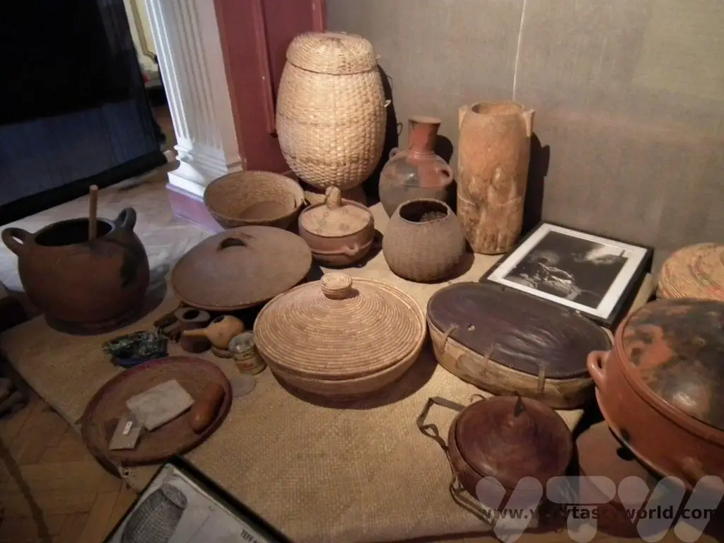
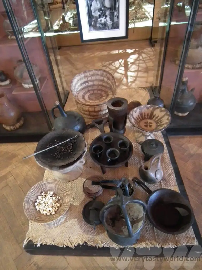
This museum, located at Addis university, exhibits all sorts of cultural artefacts, including tools, clothing and cooking implements.
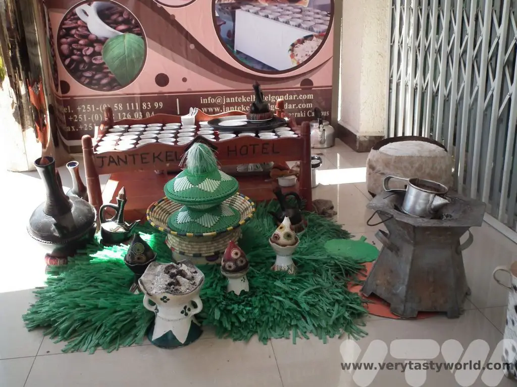
A coffee ceremony set – something that is hugely important in Ethiopian culture.
The entrance is interesting – it has a staircase to nowhere constructed by the Italians who occupied Ethiopia from 1935/6 until 1941. Each step represents a year of Mussolini’s power. But at the top of the staircase is the Lion of Judah, which represents the Ethiopian monarchy. It was placed there as an insult to the occupation.
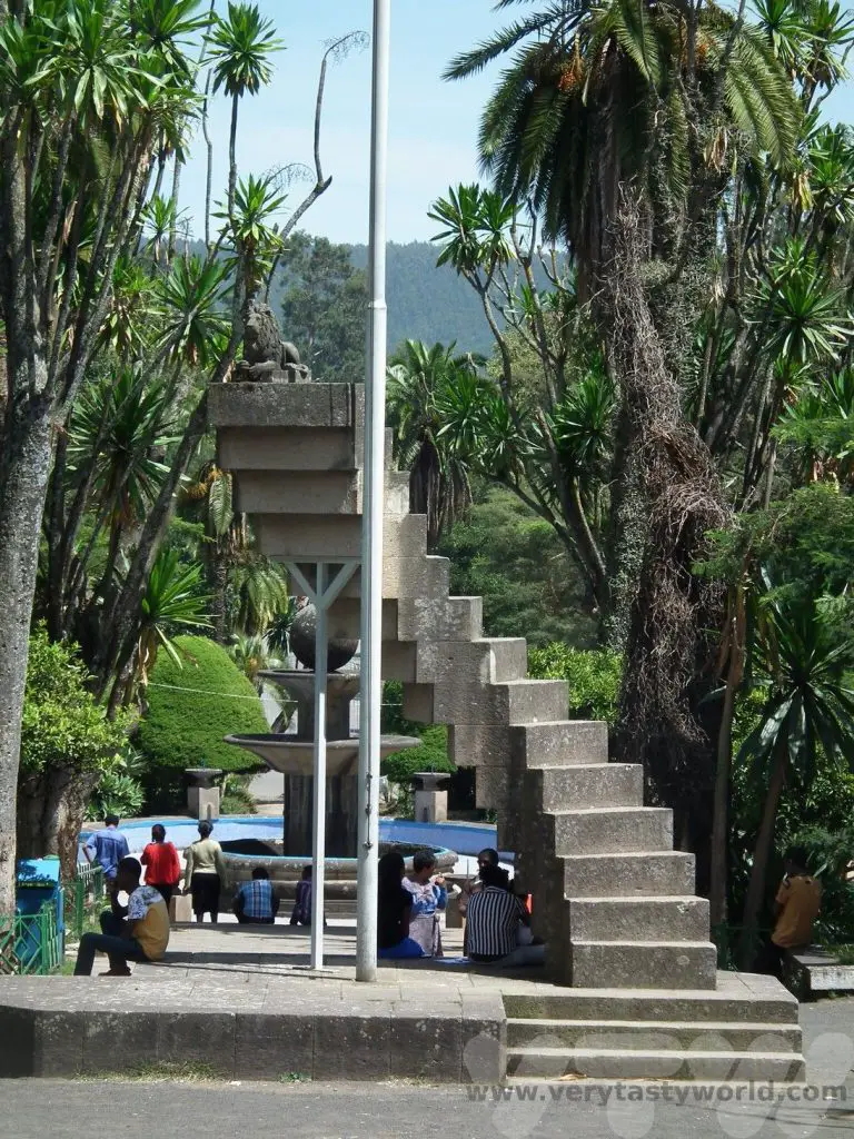
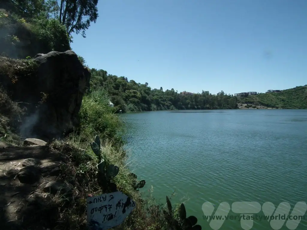
Day trip to Bishoftu
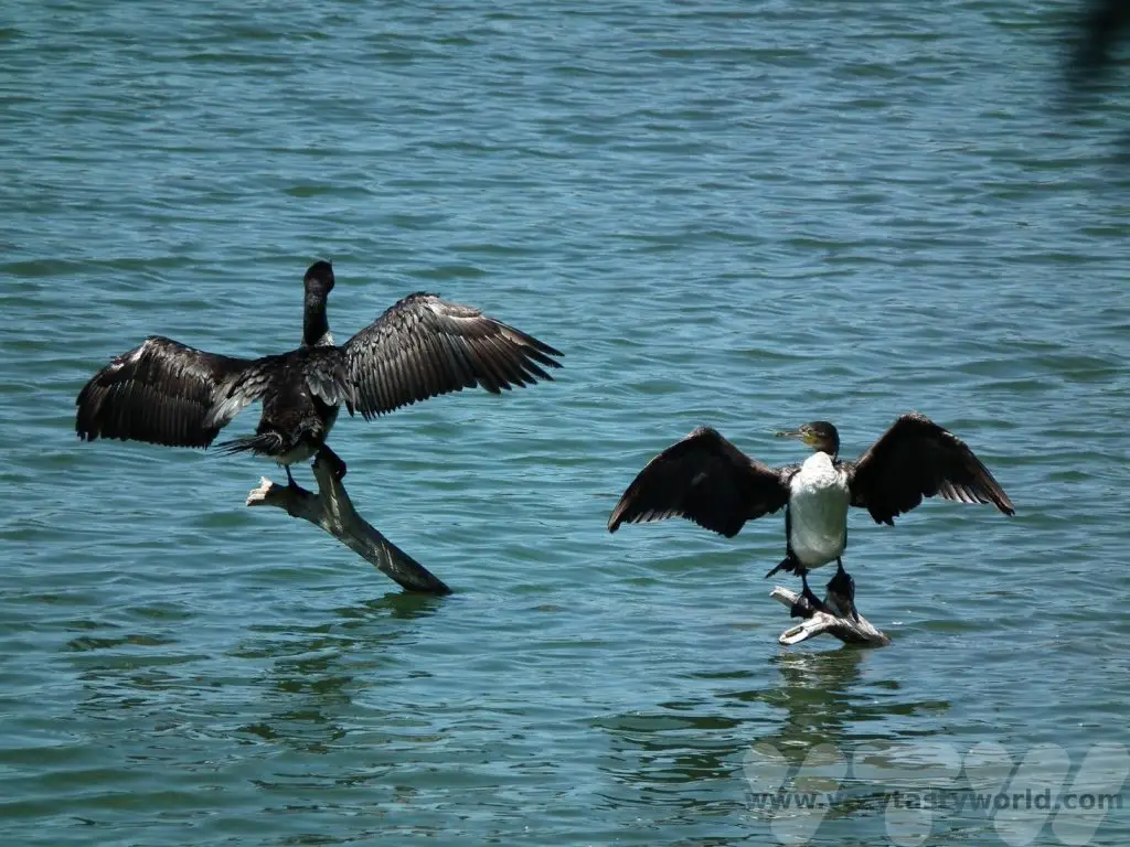
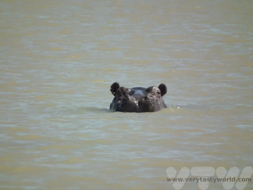
A visit to the resort town of Bishoftu (formerly known as Debrezeit) which is located around 50km southeast of Addis, is a popular day trip. There are five crater lakes to visit. These formed following a number of volcanic eruptions which created the craters that then filled with water over the years.
It’s a very pleasant area to go walking and there are plenty of places to enjoy a nice meal with some drinks while observing the plethora of birds that can be found in the area. These cormorants were enjoying drying their wings in the sunshine.
Fly to Bahirdar
Lake Tana
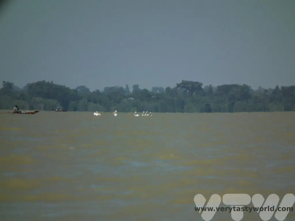
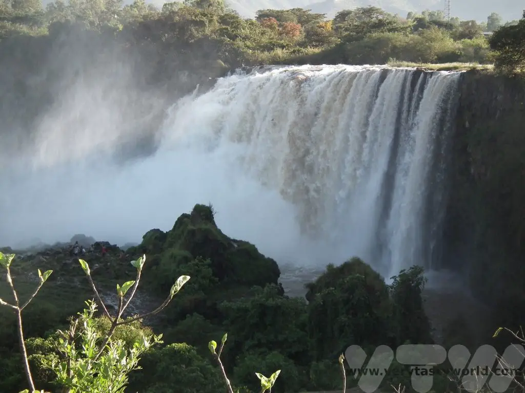
We flew from Addis to the town of Bahirdar. Its main attraction is Lake Tana which is the source of the Blue Nile. It’s a lovely place to visit where you can see a variety of wildlife and, of course, the amazing Blue Nile waterfall.
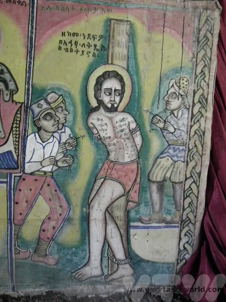
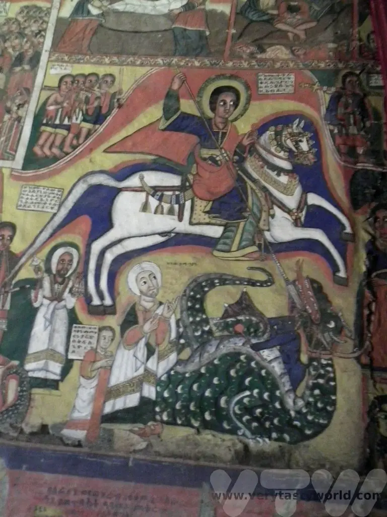
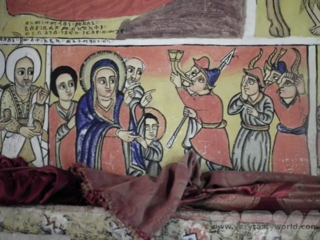
A boat trip across the lake took us to the the Zege peninsualar where we visited the Ura Kidanne Mehret convent. This is a living church where services still take place.
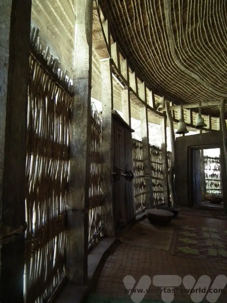
The structure is circular and the inside is decorated with beautiful centuries-old murals, many painted by Alaga Engida. We would see these distinctive designs through out this region.
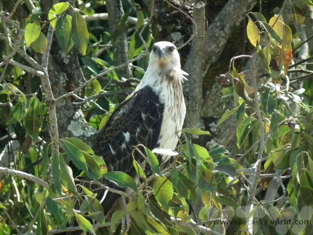
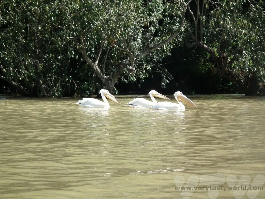
We saw lots of wildlife on the boat trip on the way back.
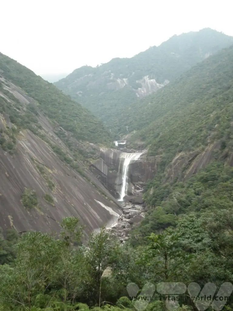
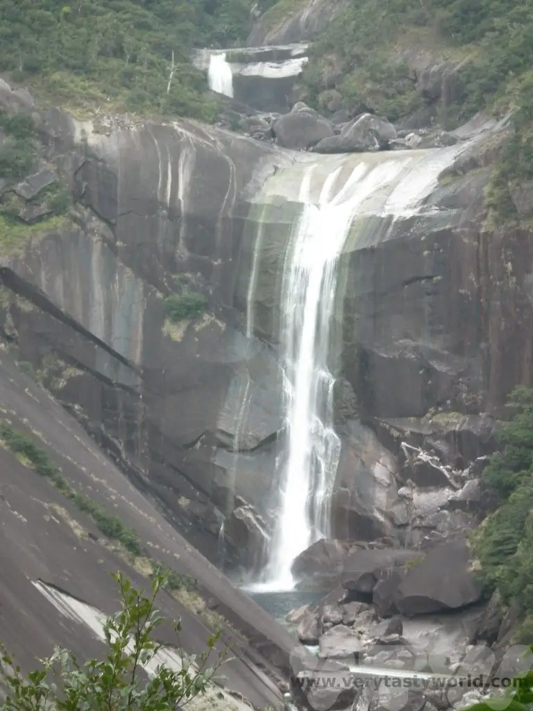
Lake Tana is the source of the Blue Nile and is located around 30 km from the lake itself is the Blue Nile waterfall. The 42m high falls are known as Tis Abay, meaning ‘great smoke’ in Amharic, which is a far more romantic name than Blue Nile Waterfall. The moniker is highly appropriate- they are spectacular. But it’s worth noting that they are spectacular in the rainy season. There is a hydro-electric power station which regulates much of the water flow these days, so it’s worth checking whether you are likely to see a cascade or a dribble.
Drive to Gondar
The City of Gondar
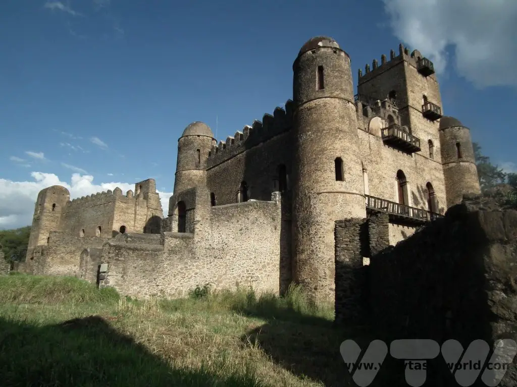
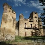
Gondar sounds like a city from Lord of the Rings and also looks like a city from Lord of the Rings. It has a grand history. It was the central location of the Ethiopian government and home of the Ethiopian emperors for several centuries and is a UNESCO heritage site.
Established by Emperor Fasilides in the 17th century, the city of Gondar boasts a number of castles and palaces that were residences to successive Ethiopian leaders. The buildings are particularly interesting because they resemble European mediaeval castles.
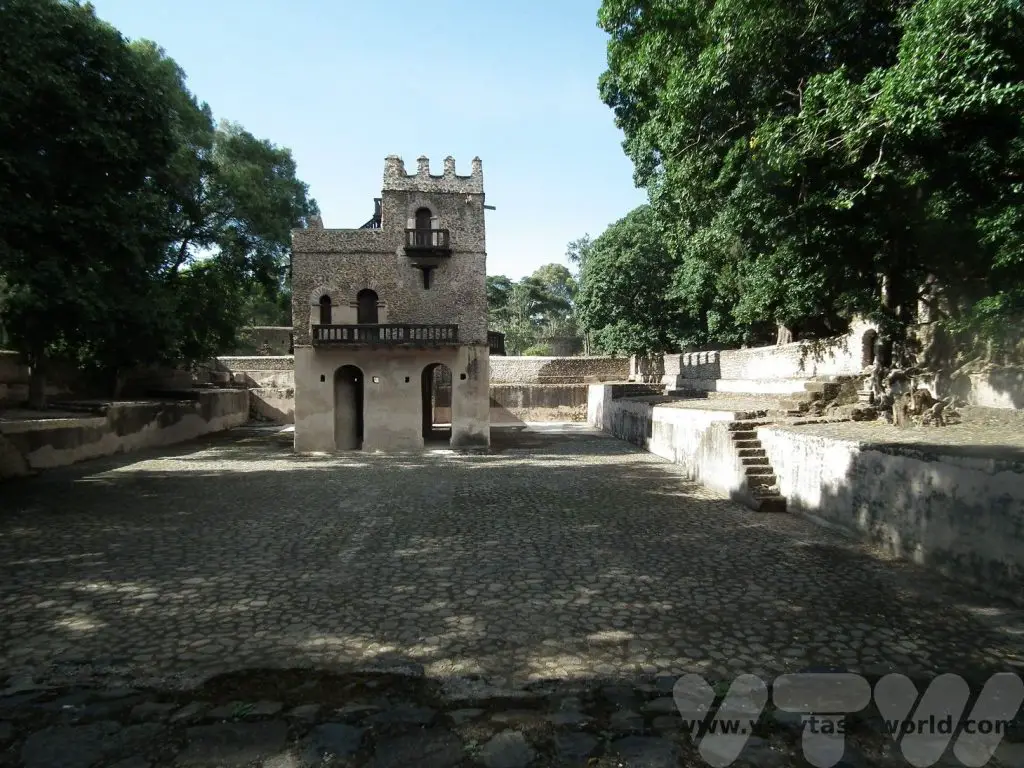
The history of the emperors is fascinating. There are all sorts of tales of skullduggery – poisonings, murders and mysterious deaths. It is possible to explore the ruins of the castles, palaces and royal baths.
Fasilides was emperor of Ethiopia from 1632 until 1667 and decided to establish Gondar as the capital of Ethiopia. He built the Royal Enclosure which was further developed by his successors. A little way out of town he also constructed a remarkable bath complex, compete with bathing pool, tower and bridge. It is considered a sacred site to this day.
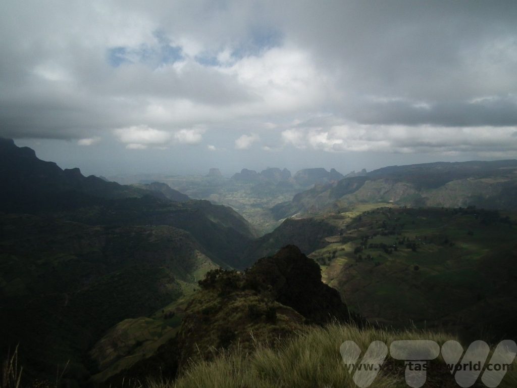
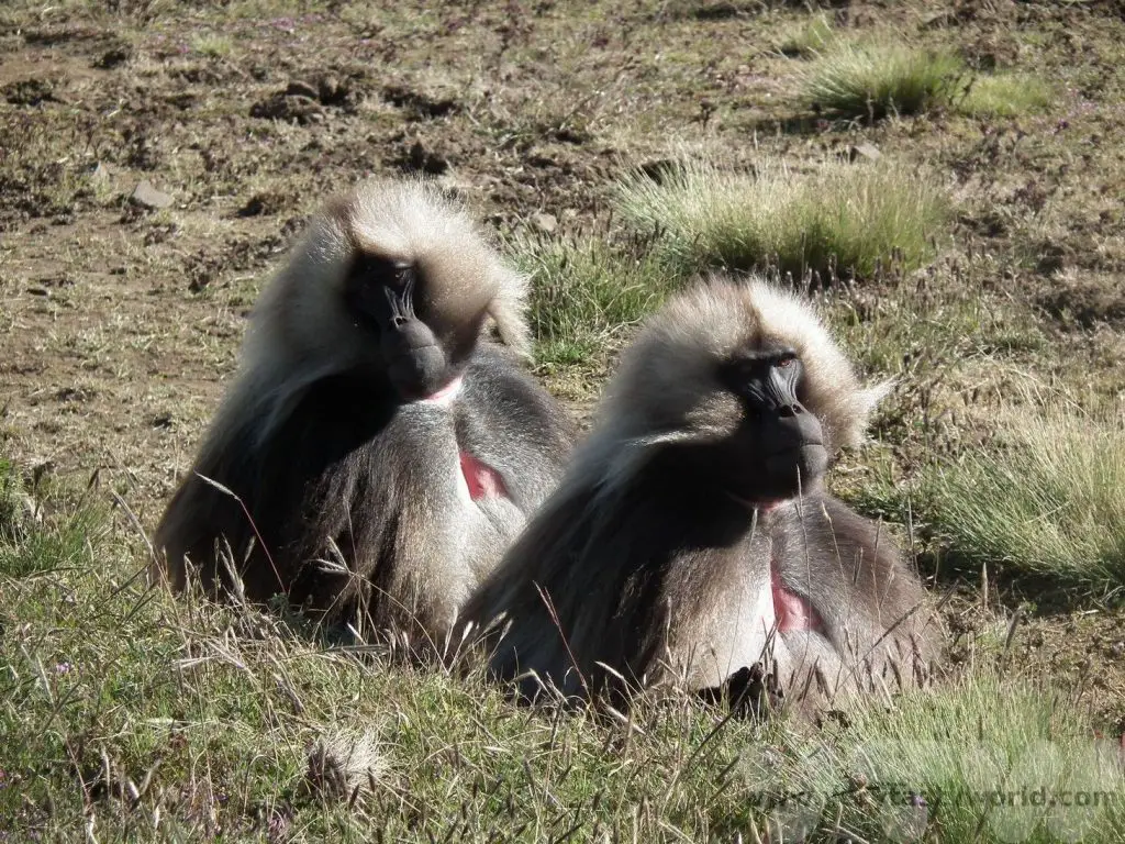
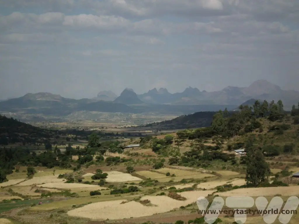
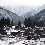
Simien Mountains
On leaving Gondar we got into a van and had a bumpy ride to the spectacular Simien mountains national park. This is another UNESCO world heritage site. There are plenty of opportunities to go hiking amidst spectacular scenery and have a drink at the highest bar in Africa.
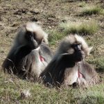
In the Simien mountains you can walk among wild gelada monkeys in fields scented of wild thyme, a magical experience.
You can read more about the fascinating history of Gondar and see the beauty of the Simien mountains.
Fly to Lalibela
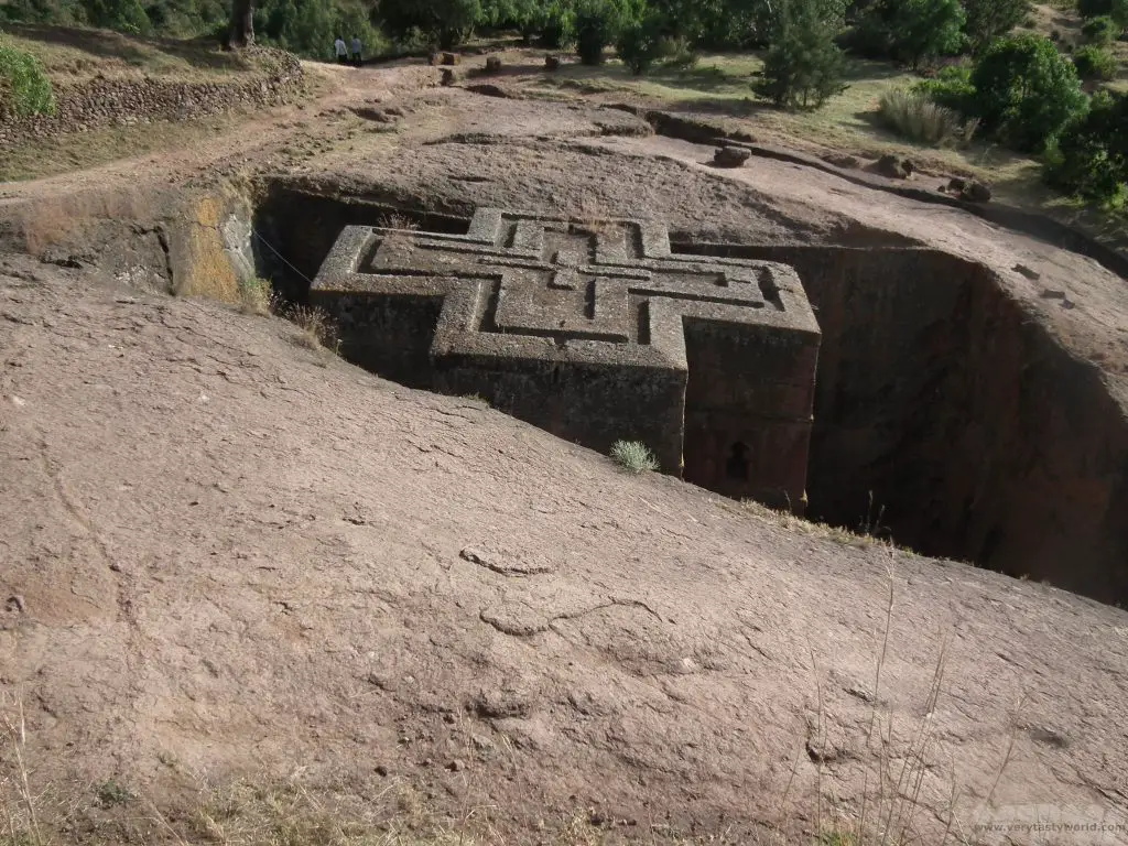
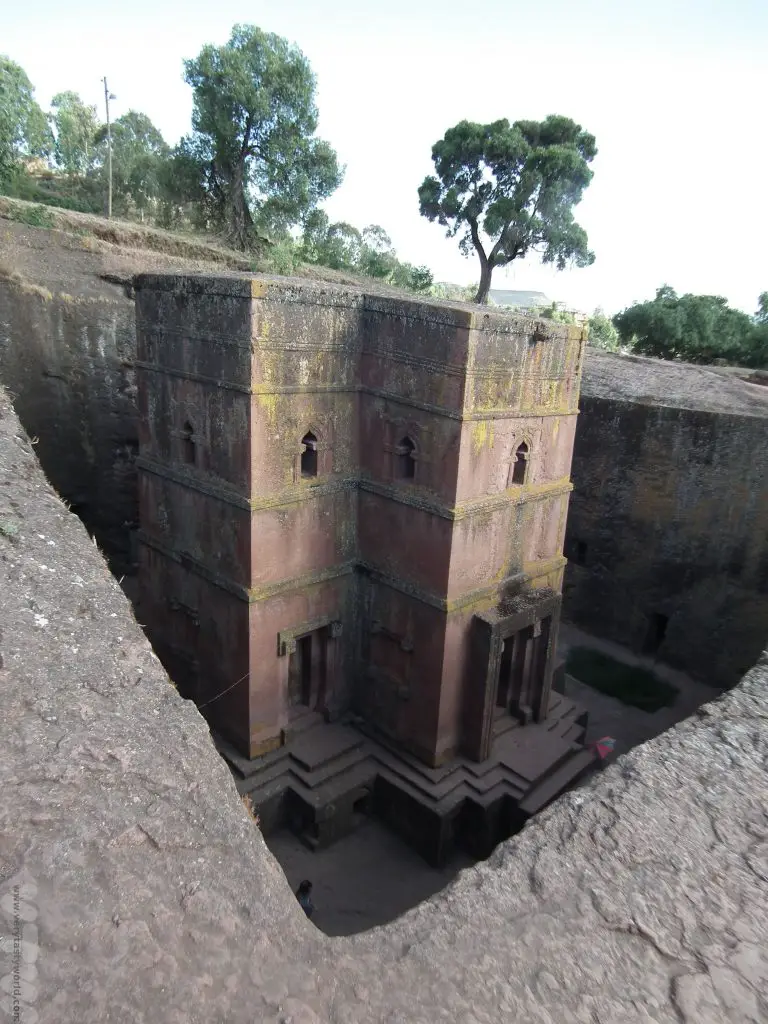
We caught a flight from Gondar to Lalibela where we spent a couple of days exploring the astonishing rock-hewn churches. They were as spectacular as we had been promised many years before.
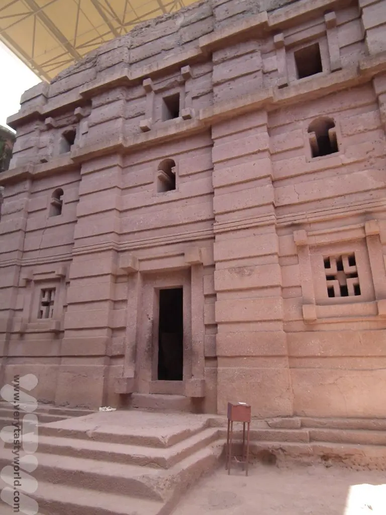
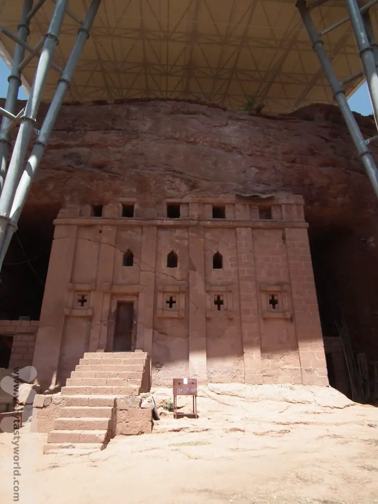

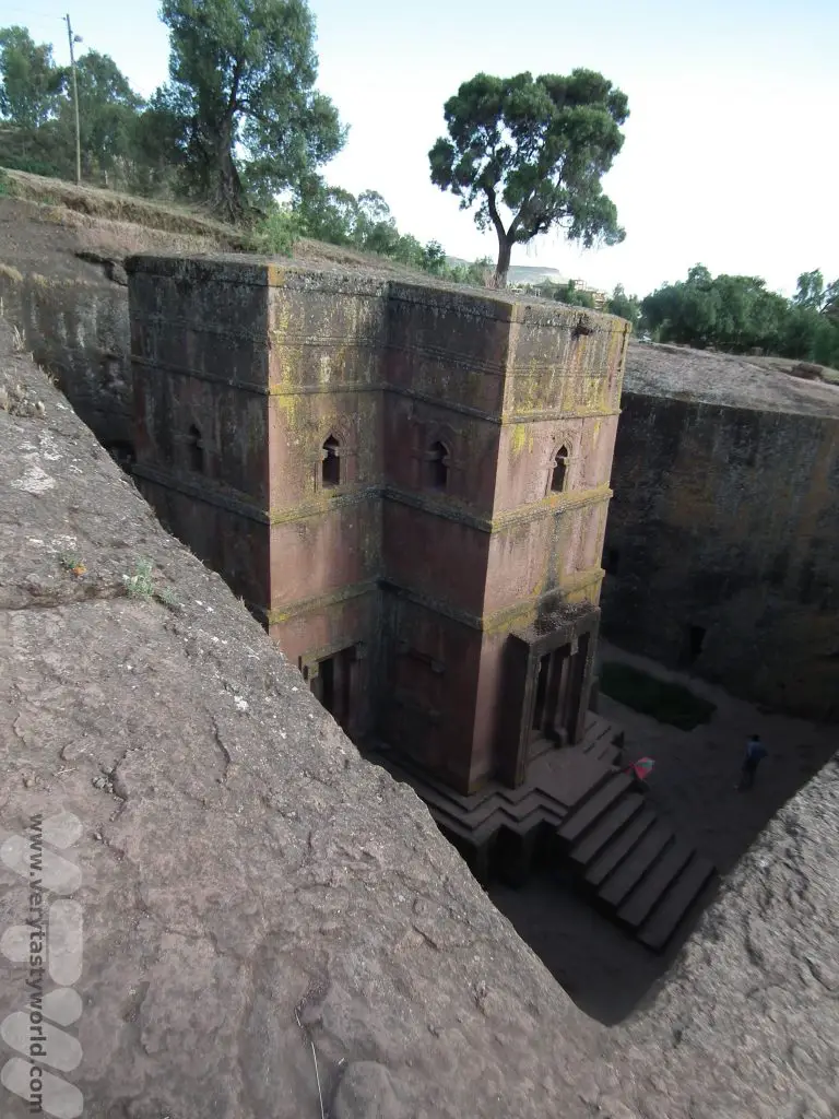
Another UNESCO world heritage site the churches date from the 7th to the 13th centuries. They are remarkable because rather than being constructed from the ground up, they have been hewn from within the rock, using basic tools such as chisels and hammers, and were built from the top down. This meant that they couldn’t be seen from a distance.
Fly to Tigray
More history beckoned when we flew to the far north of the country to the region of Tigray. Tigray has had a difficult history in recent times. It was the location of the Ethiopian famine of the 1980s, which prompted the Band Aid and Live Aid appeals. And recently it has been engaged in a civil war between the Tigray People’s Liberation Front and the Ethiopian government. A peace treaty was signed in November 2022 and we very much hope that tourism will be able to be revived in the area once more.
Axum
First stop was Axum, which has a history dating back to 400 BCE. It was the capital of the Aksumite empire which ruled the region until the 10th century. It is famous for its towering stelae, obelisks that are around 1700 years old. They were designed as impressive grave markers for royal burial chambers. They are huge – the tallest is 33m. Some of them have fallen and others were taken, notably King Ezana’s obelisk which was transported to Rome after Italy’s occupation of Ethiopia ended.
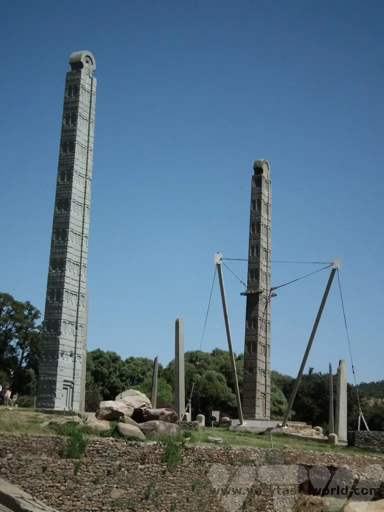
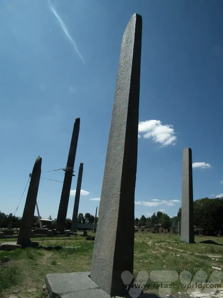
The Aksumite Empire ended in the 10th century and the emperors of Ethiopia moved southwards, eventually settling in Gondar some centuries later, when Fasilides established his government there.
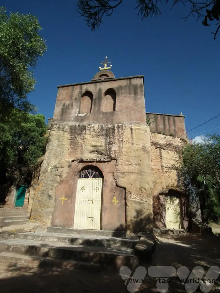
Churches of Our Lady Mary of Zion
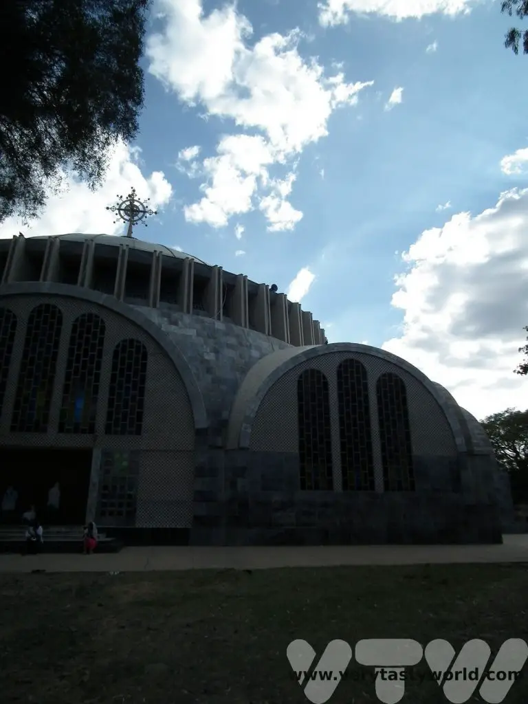
Axum is also home to two important churches. The church of Our Lady Mary of Zion was built by Fasilides in 1665. It is rumoured to have housed the Ark of the Covenant.
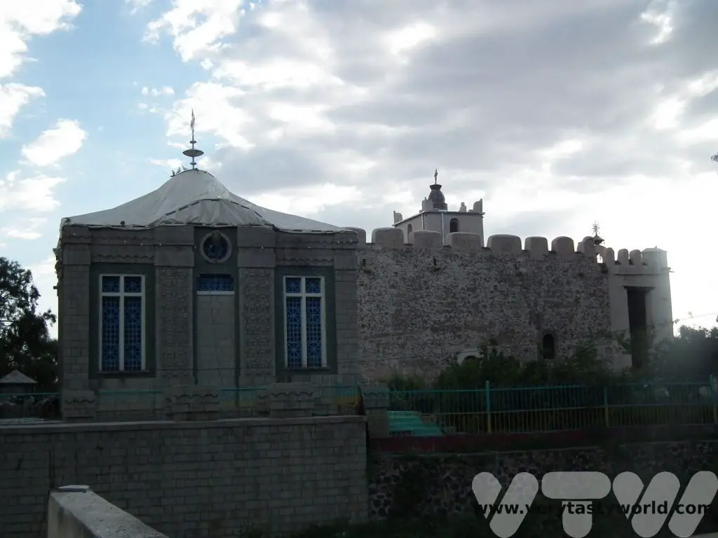
Emperor Haile Selassie built a new cathedral of St Mary of Zion next to the old church. It is possible to enter this church and to watch the services.
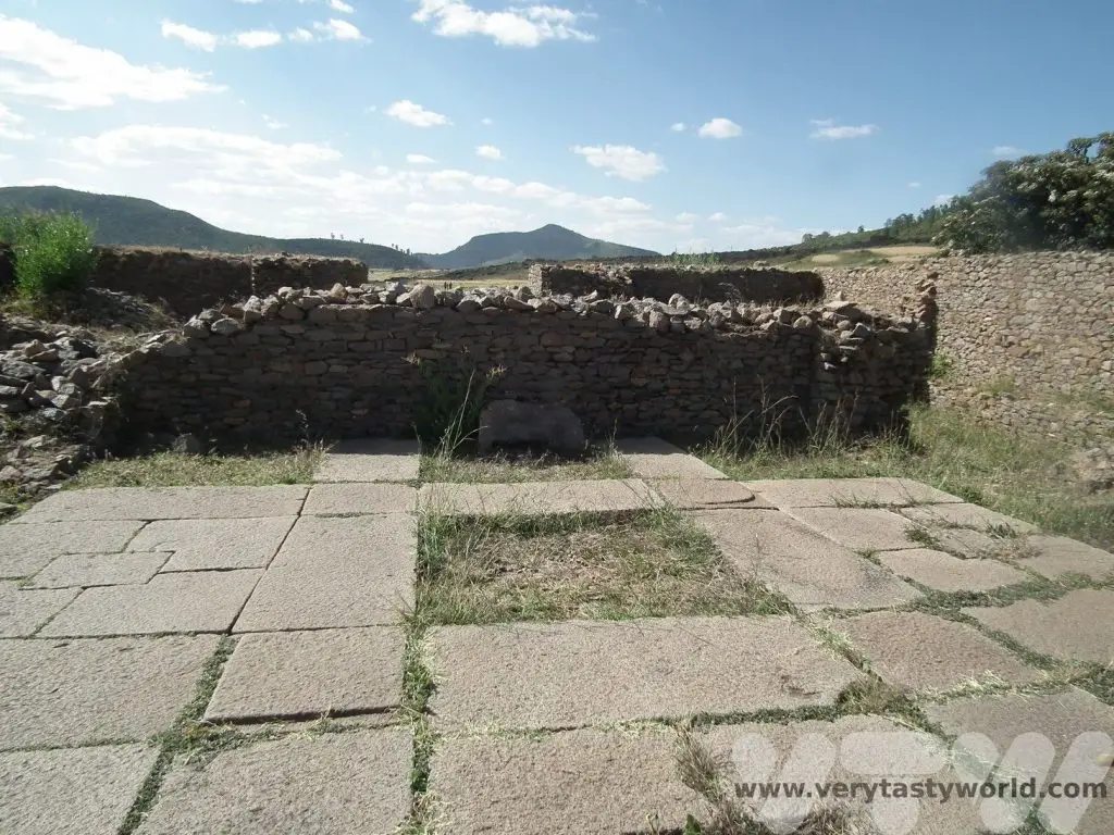
Tombs of the Kings
A few kilometres out of the town of Axum are the Tombs of the Kings which date from the 3rd century.
King Kaleb’s tomb is located here. Kaleb was king of Axum between 514–542 CE.
Nearby is the Ezana Stone, a stelae, which shows an inscription in three different languages: Ethiopian Ge’ez, South Arabian Sabaean, and Greek. It’s similar to the Rosetta Stone.
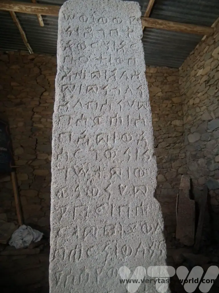
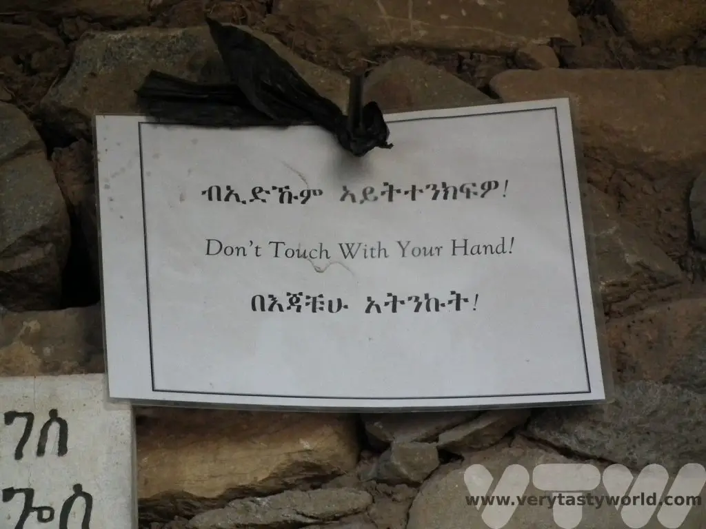
Beware though, the stone is cursed and anyone who touches it is likely to meet an untimely end. (No, we didn’t dare!)
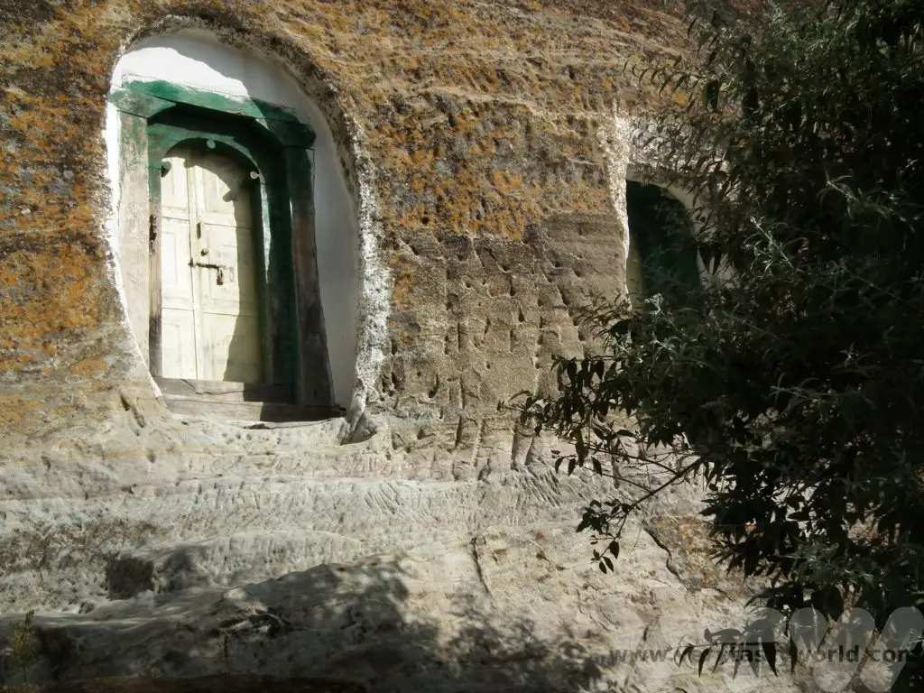
Gheralta
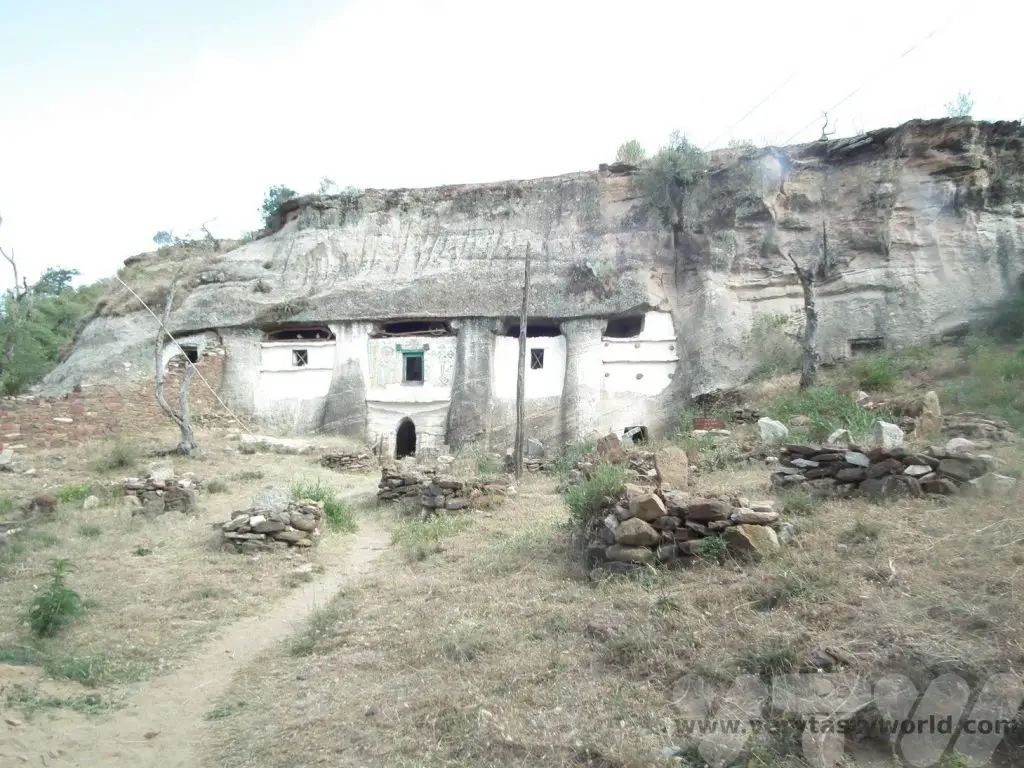
The final stage of our journey through the Tigray region involved a drive across the countryside to Gheralta where we could view the rock churches of Tigray.
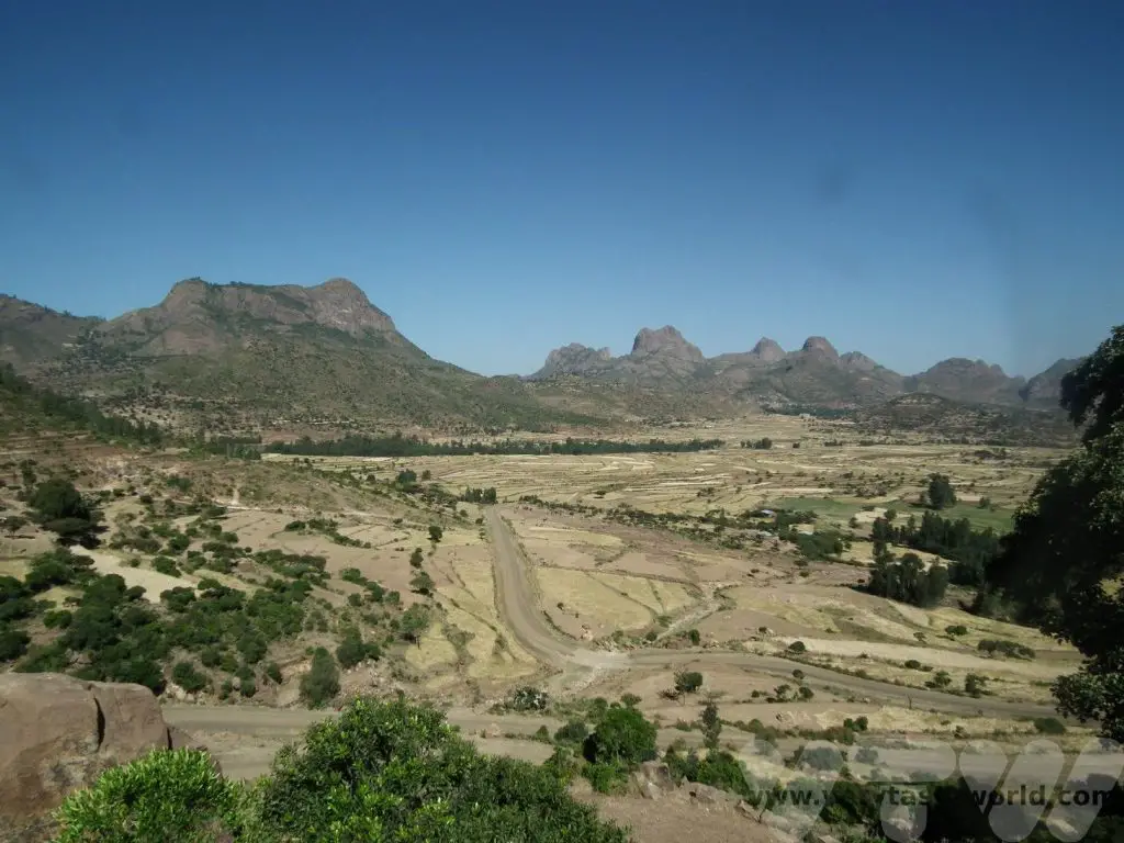
There are over 100 churches in the regions, largely dating from the 6th to the 14th centuries and they are mainly carved into cliff sides or rocky outcrops.
And that concluded our Ethiopian itinerary. We drove to Mekele, the major city in the region, and caught a flight back to Addis before our return home.
Ethiopian Food
Something that intrigued us before we arrived was Ethiopian food: we had absolutely no idea about what to expect. A quick internet search revealed ‘injera’: Ethiopian traditional bread.
We still had no idea what to expect.
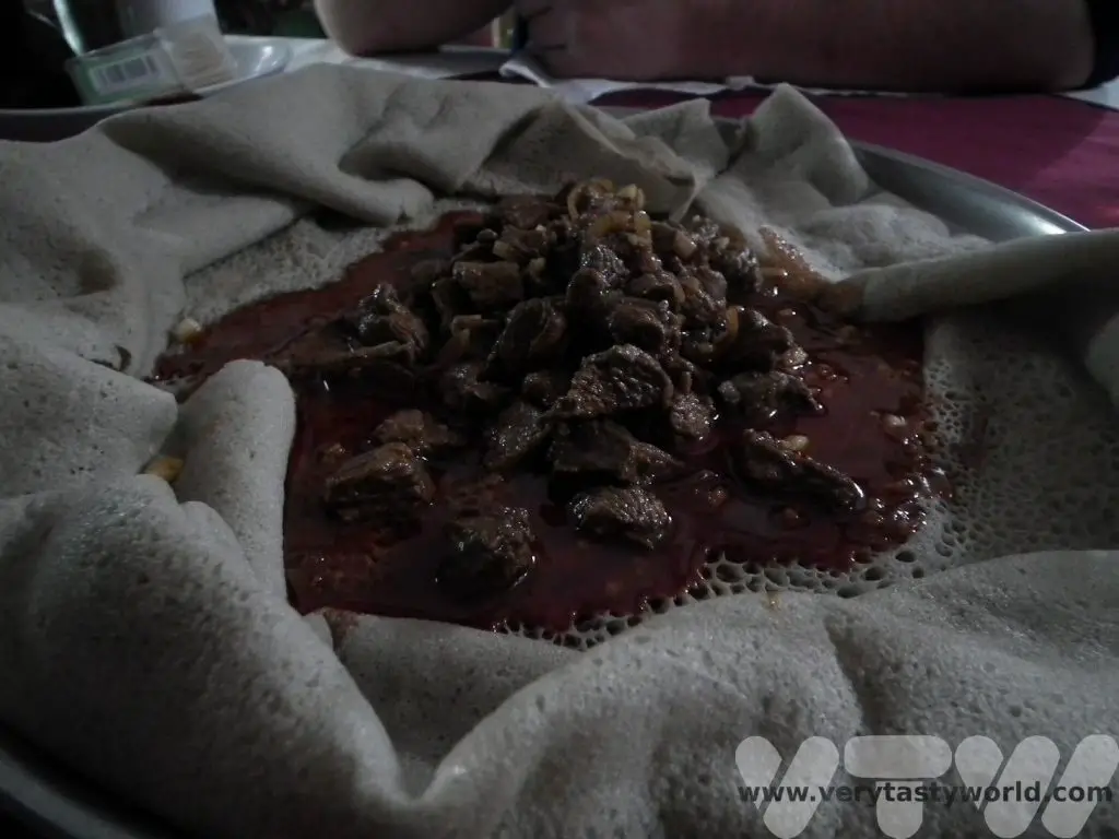
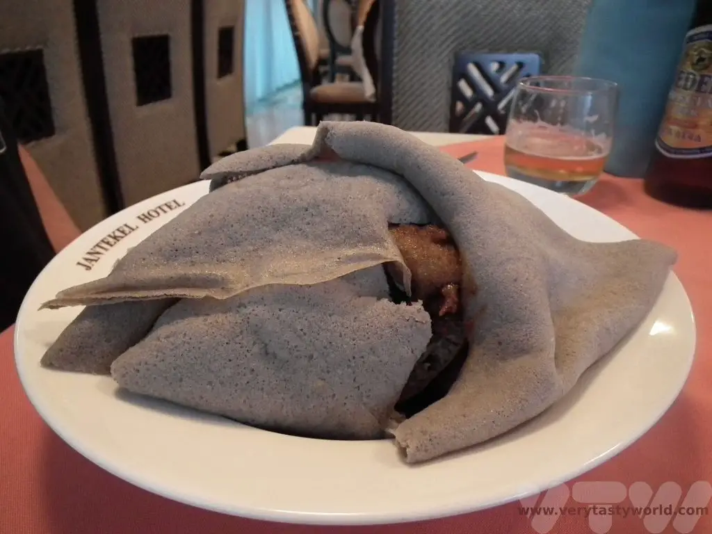
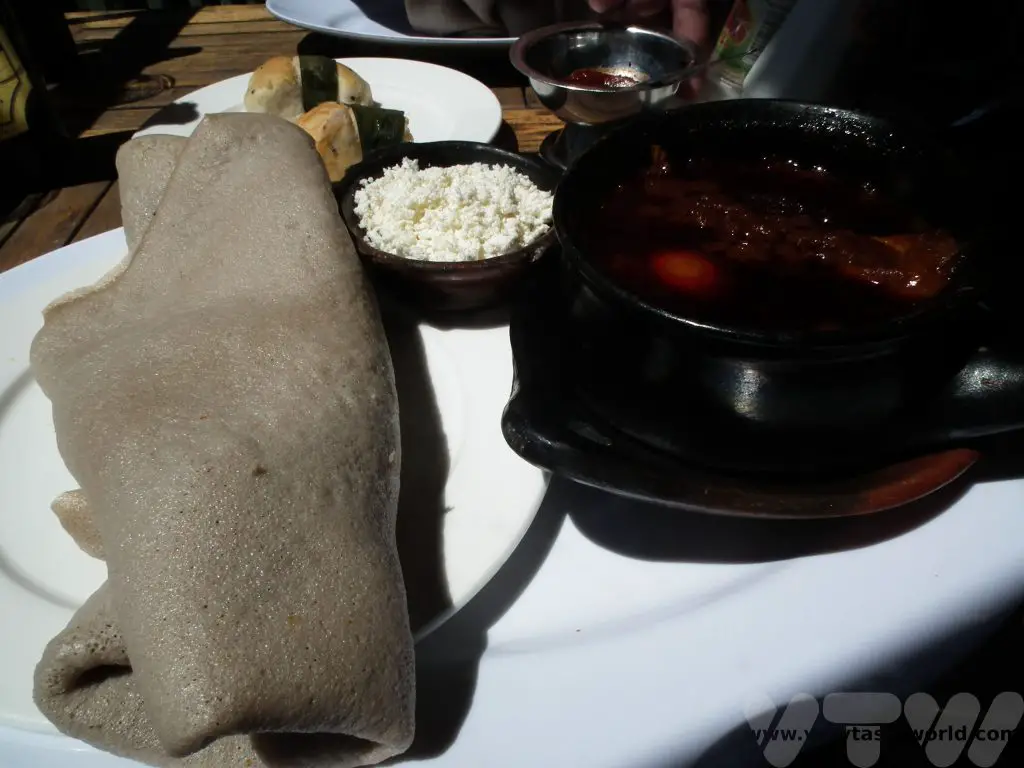
Injera is a flatbread that looks like a cross between a dirty dishcloth and a sponge.
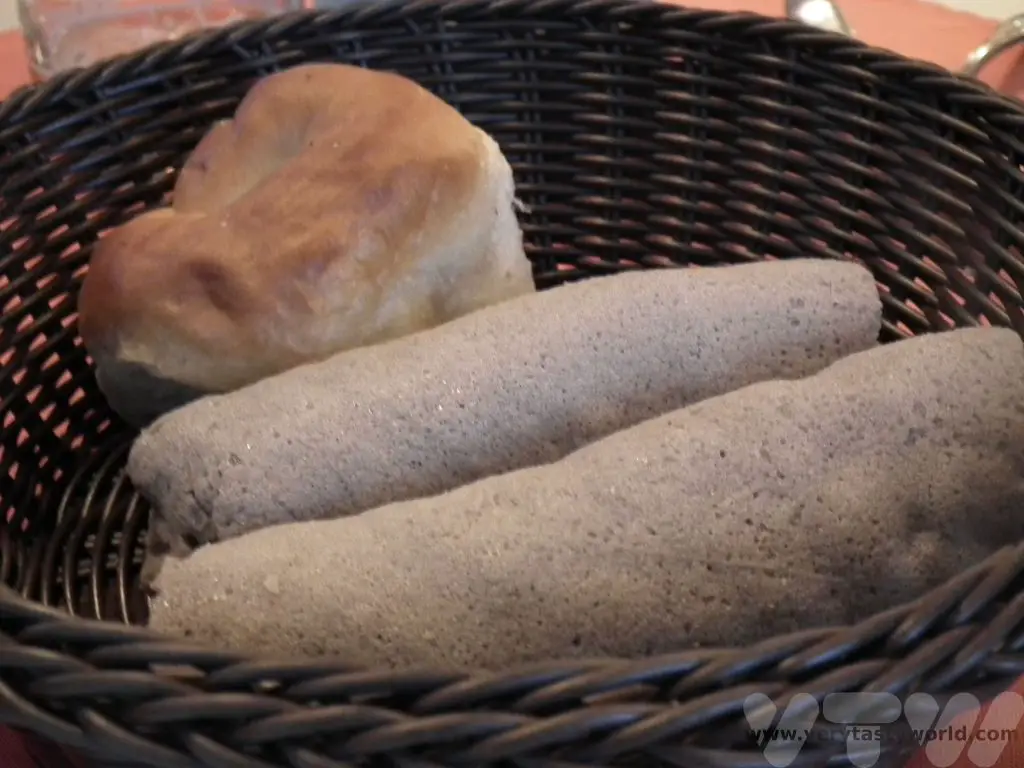
It really doesn’t look enticing at all. This was about as attractive as it got.
Actually, it tastes really good. It has soft texture and a slightly sour flavour. Injera is made from teff, apparently the world’s latest superfood – a grain that is highly nutritious. Injera is made using a fermenting process rather like sourdough or dosas. A combination of teff flour and water are combined to make a batter which takes a few days to ferment. When the mixture is bubbly and smells sour it is ready. It can be fried on a skillet (on one side only) until the characteristic bubbles appear in the surface.
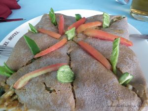
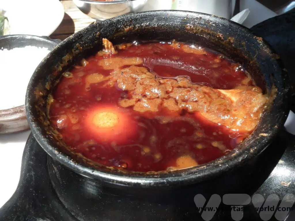
It is often served laid out flat with stew (wat) or with meat and vegetables placed on top – you can pull off chunks of the injera to scoop up the stew. So it serves as plate, cutlery and delicious food.
The local people we met were quite surprised that we were willing to eat injera and that we enjoyed spicy food.
In the UK the county of Yorkshire is renowned for providing large portions of food. Ethiopian portions are so enormous that we quickly discovered that one meal between the two of us was more than enough to fill us up. We generally only needed to eat brekkie, then we shared all other meals.
Ethiopian Coffee
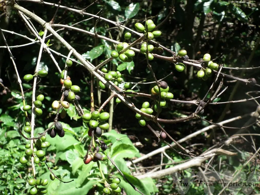
Ethiopia can claim to be the country where the coffea arabica originates. Coffee has been grown in Ethiopia for centuries and it forms an important part of the culture.
Coffee ceremony is highly social activity and the ceremony is usually performed by the female members of a household. The process starts with green coffee beans which are roasted in a pan over a flame and then ground using a mortar and pestle. Then the ground coffee is placed into a pot which has a spherical base and long neck and water added. It then boils on the flame so that the coffee can infuse and is then filtered using a sieve. The finished drink is poured from height into small cups. The grounds may be brewed a couple more times.
It is also possible to drink home-made beer in Ethiopia. Bars aren’t common in rural areas so you need to know someone local because the beer is only available in private homes. These are called tella places. We were lucky to have a guide who invited us to a tella place to enjoy the beer. It’s a beer brewed with teff or sometimes sorghum and the variety we tried was quite light – around 3%. Drinking beer in a home was a nice way to enjoy a tipple with local people.
Some Interesting Facts About Ethiopia For Travellers
Because Ethiopia isn’t located too far from the equator daylight and nighttime are pretty much equal all through the year. The Ethiopian time system is very different to ours and uses a 12 hour clock. Sunrise, at 6am, is 12:00 dawn time. Night starts at 12:00 dusk, which is the equivalent to 6pm international time. While many tour guides will work on international time, it can get a little confusing if you are looking at a local clock, especially if you have a flight to catch.
Additionally, Ethiopia has thirteen months in its year. This means that, at the time of writing in 2023, it is still 2015.
Another interesting element to Ethiopian culture is that many people follow the Ethiopian Orthodox church and hence don’t eat meat on Wednesdays and Fridays. This is great for vegetarian/vegan visitors as there is a good selection of veggie food available. Ravenous meat-eaters don’t need to worry though, hotels and restaurants will still offer meat on those days.
Ethiopia has so much to offer – a fascinating history and culture, remarkable architecture and really beautiful landscapes and wildlife. We received a warm welcome wherever we visited and would love to return to explore the south of the country.
Related Posts You May Enjoy
- Mora Mora on the RN7 Madagascar – A Road Trip
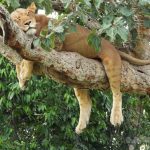
- Tree Climbing Lions, Hippo Hordes and Safari Shenanigans in Uganda
- Tourist Attractions In Ethiopia
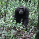
- Kibale National Park Chimpanzee Trekking
- Visit Ethiopia – Gondar and the Simien Mountains
- Ziwa Rhino Sanctuary Uganda
Visit Yakushima Island in Japan
The Island That Inspired The Setting of Studio Ghibli’s Princess Mononoke
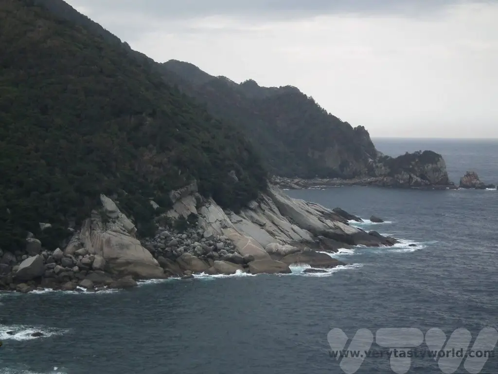
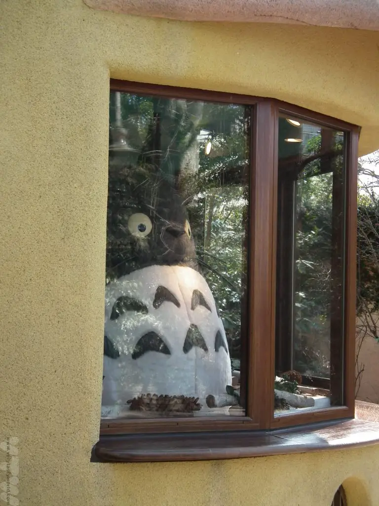
Anyone who is familiar with the delightful animations of Japan’s Studio Ghibli will that know that its founders, Hayao Miyazaki and Isao Takahata, created very distinctive locations for the settings of their films. Princess Mononoke was one of the first Ghibli films really to break into public consciousness, albeit largely with animation fans, in western countries in 1998 (the smash hit Oscar winning Spirited Away in 2001 ensured that the studio’s fame was assured). Princess Mononoke’s setting was inspired by the island of Yakushima, located around 60km from the southernmost point of Kyushu, Japan’s third largest island, which is part of the Osumi chain of islands. The island is almost perfectly round and mountainous. It’s also very beautiful indeed. And even if you aren’t familiar with the films of Studio Ghibli there are all sorts of things to do if you visit Yakushima.
Getting To Yakushima
Being big fans of Studio Ghibli and, having visited the fabulous Studio Ghibli museum on previous visits to Japan, we decided that we definitely wanted to visit Yakushima for a couple of days. On this trip we had decided explore Kyushu. We flew into Osaka and then caught the shinkansen (bullet train) to Nagasaki and then across to the southern city of Kagoshima. Kagoshima is a lovely laid-back city set in the shadow of the active volcano Sakurajima, which regularly emits rumblings of ash and smoke. It’s possible to visit the volcano by crossing the picturesque bay on a ferry.
In Kagoshima we chose a business hotel that was close to the port. The staff were happy to look after our luggage for a couple of days, so we just packed a small bag, which meant that we could travel light. The excellent YesYakushima company helped us to visit Yakushima – they booked ferry tickets, car hire and accommodation for us. (This isn’t an affiliate link but we’ll happily recommend their free booking service which was absolutely excellent.) We were happy to explore for the island for ourselves but YesYakushima do offer guided tours if desired.
We caught the mid-morning Toppy/Rocket hydro-foil from Kagoshima port. It’s a picturesque journey as you sail across the bay. There are other options, such as a car ferry, but this was the quickest means of transport and it took around 2.5 hours.
Our boat stopped off at Tanegashima island before arriving at Yakushima. (Some boats go direct, so check the timetable.) When we arrived at Anbo port our hire car was waiting for us, so we picked it up and were on our way. Driving was mainly very easy but if you don’t fancy getting behind the wheel buses are available.
Visit Yakushima – Staying On The Island
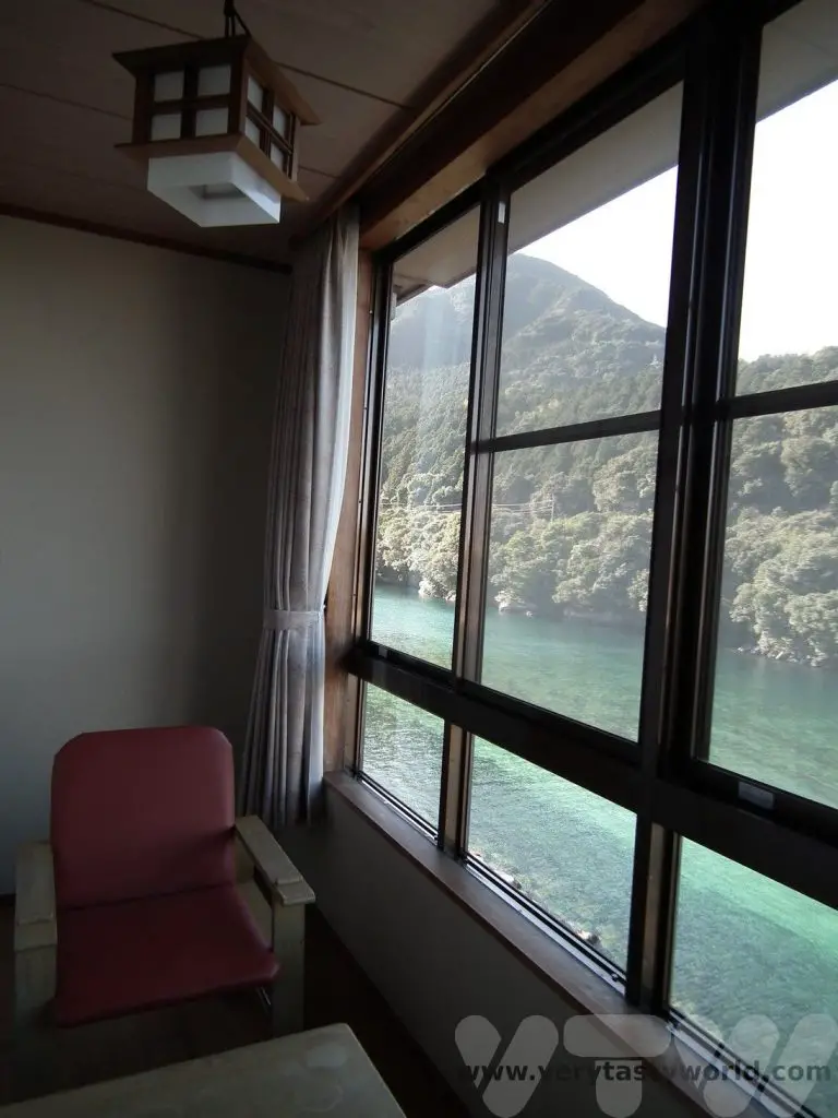
We treated ourselves to a stay at a ryokan, a traditional Japanese inn. Usually when we plan our trips to Japan we use a combination of cheap business hotels and then splash out on a few nights at a ryokan or two, which is more expensive but definitely worth the extra cost. The traditional inns usually have tatami (reed mat) flooring and you sleep on a futon, which is usually laid out for you while you eat dinner. We stayed at Tashiro Bekkan at Miyanoura.
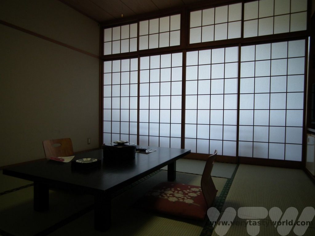
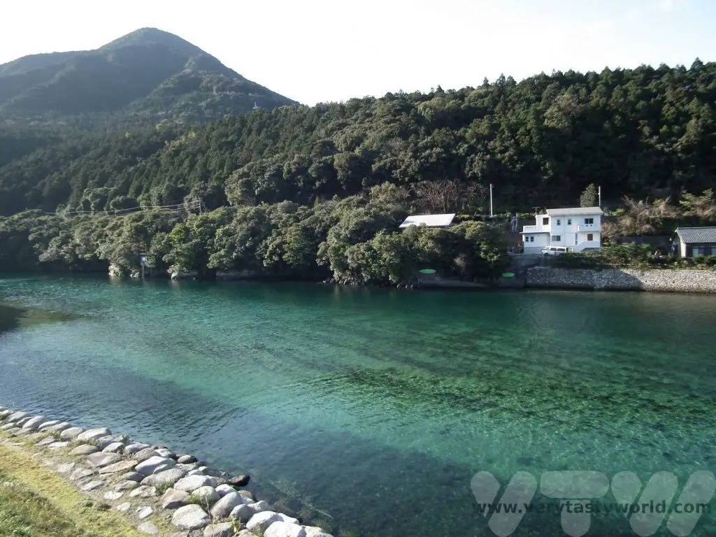
The ryokan had a large tatami room, private bathroom and balcony with a view across the crystal clear Miyanoura river.
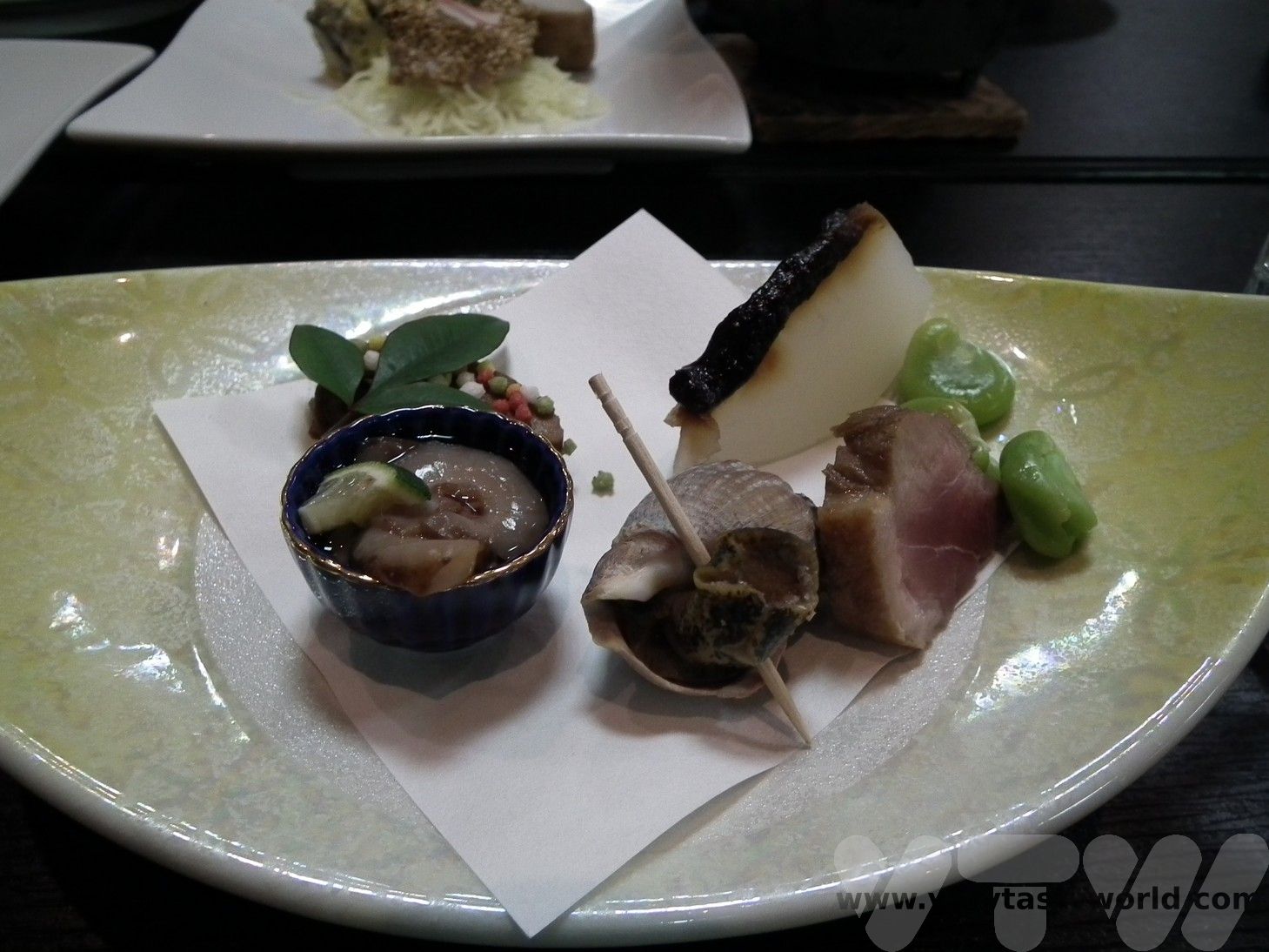
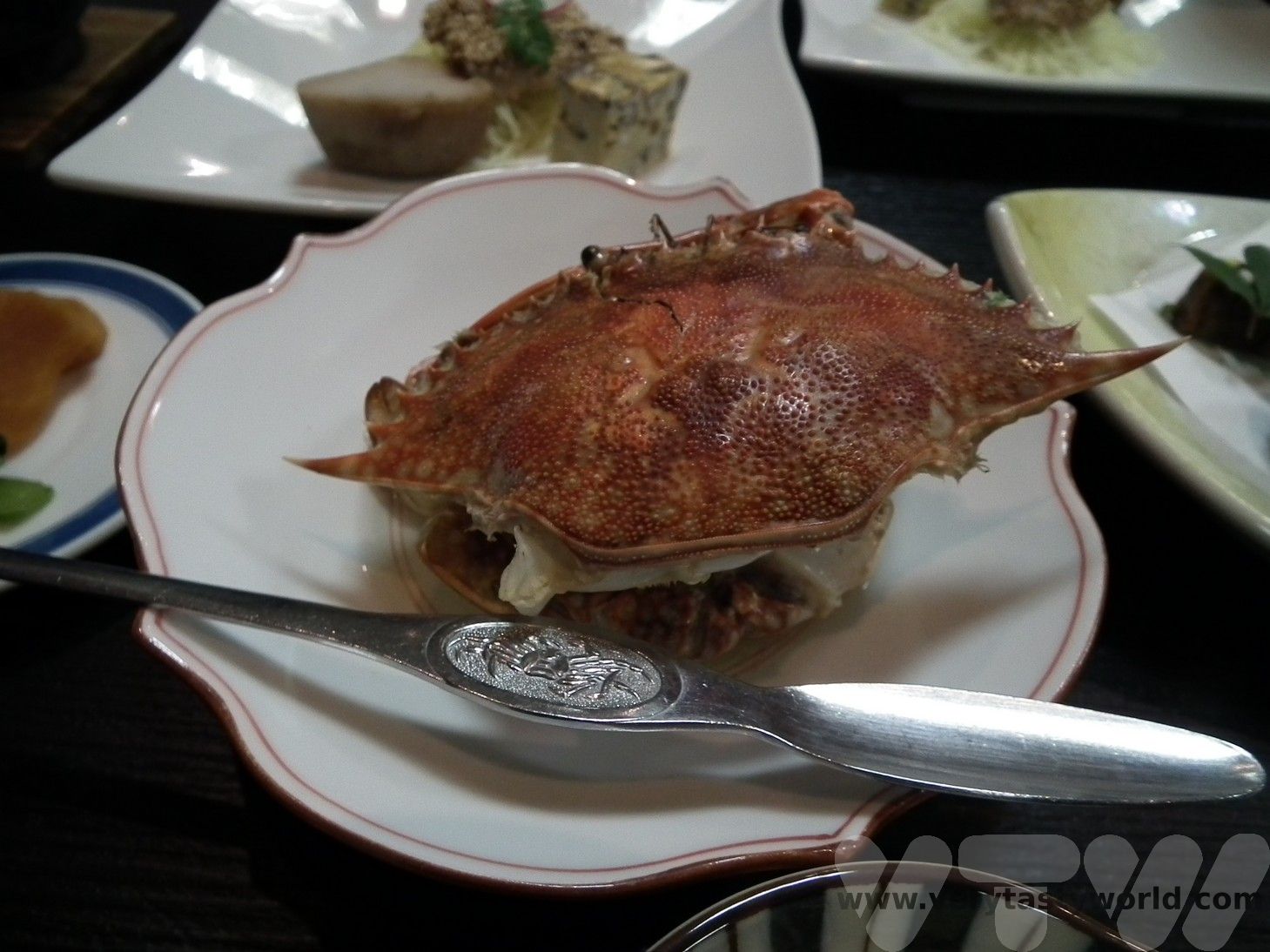
We chose to stay on a half-board basis, so ate the most exquisite food which included local ingredients such as seafood, mountain vegetables and, of course, kuro buta (black/Berkshire pork), a speciality of the region. The staff were delightful and we managed to have a few conversations with them in bad Japanese (our Japanese was bad, theirs was fine!)
The ryokan was also able to offer us a bento lunch box – we simply placed an order the night before – and then picked it up before we went hiking the following morning.
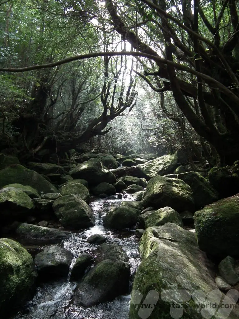
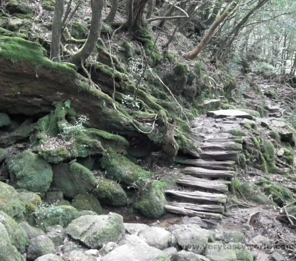
Hiking In The Shiratani Unsuikyo Park
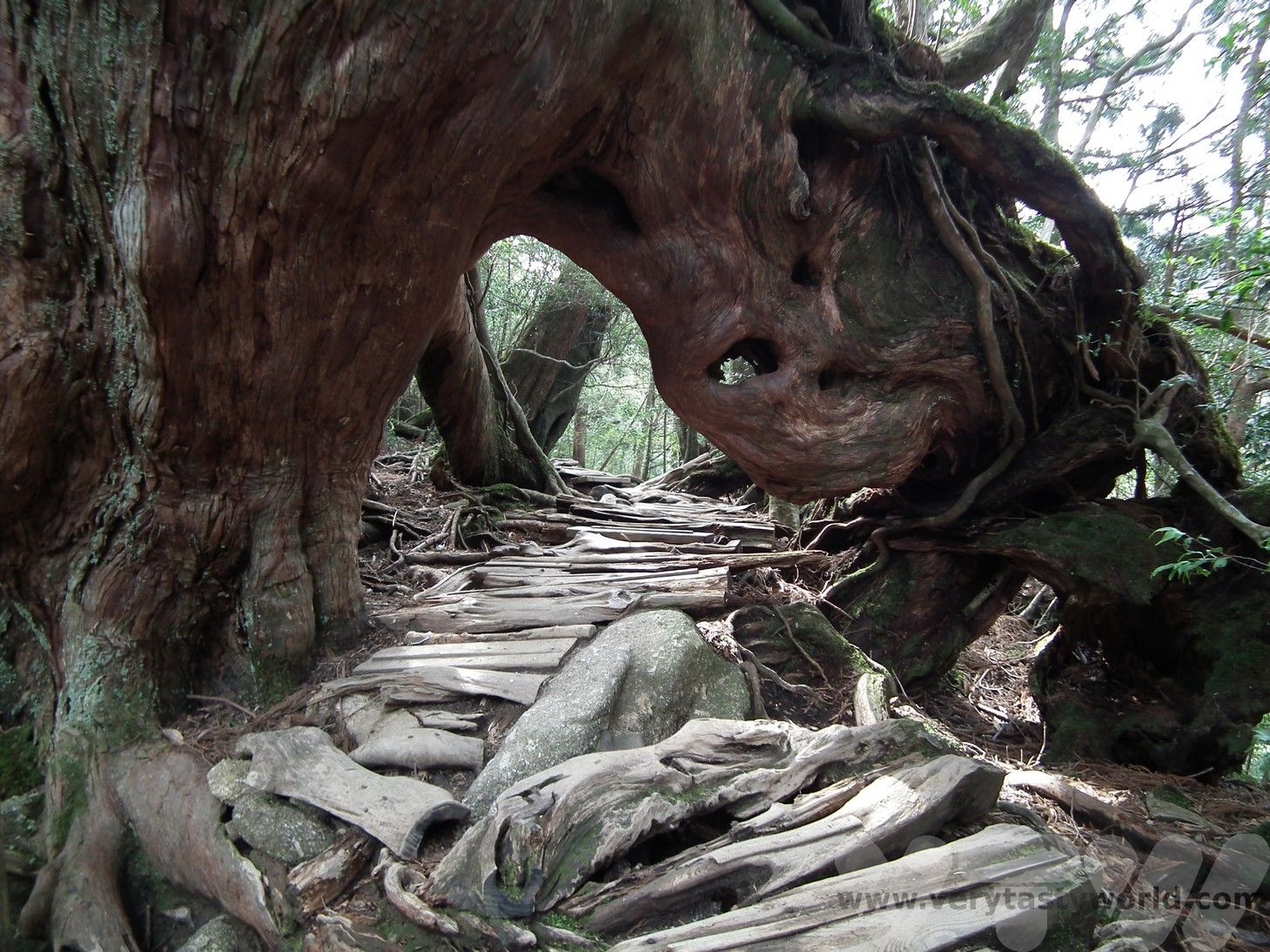
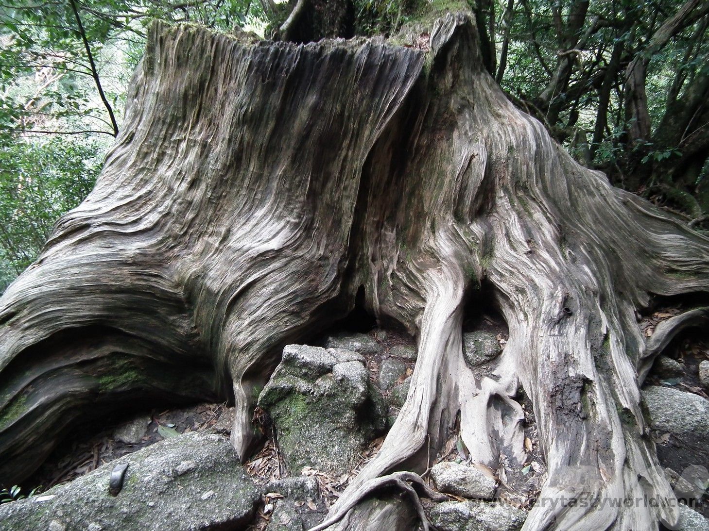
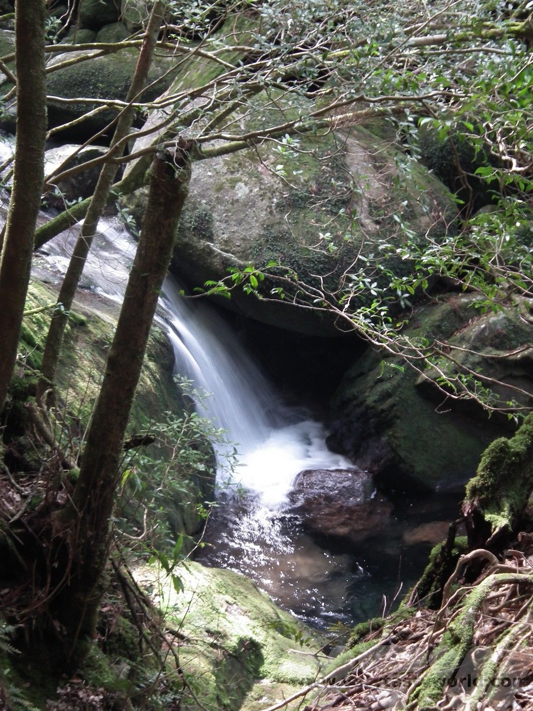
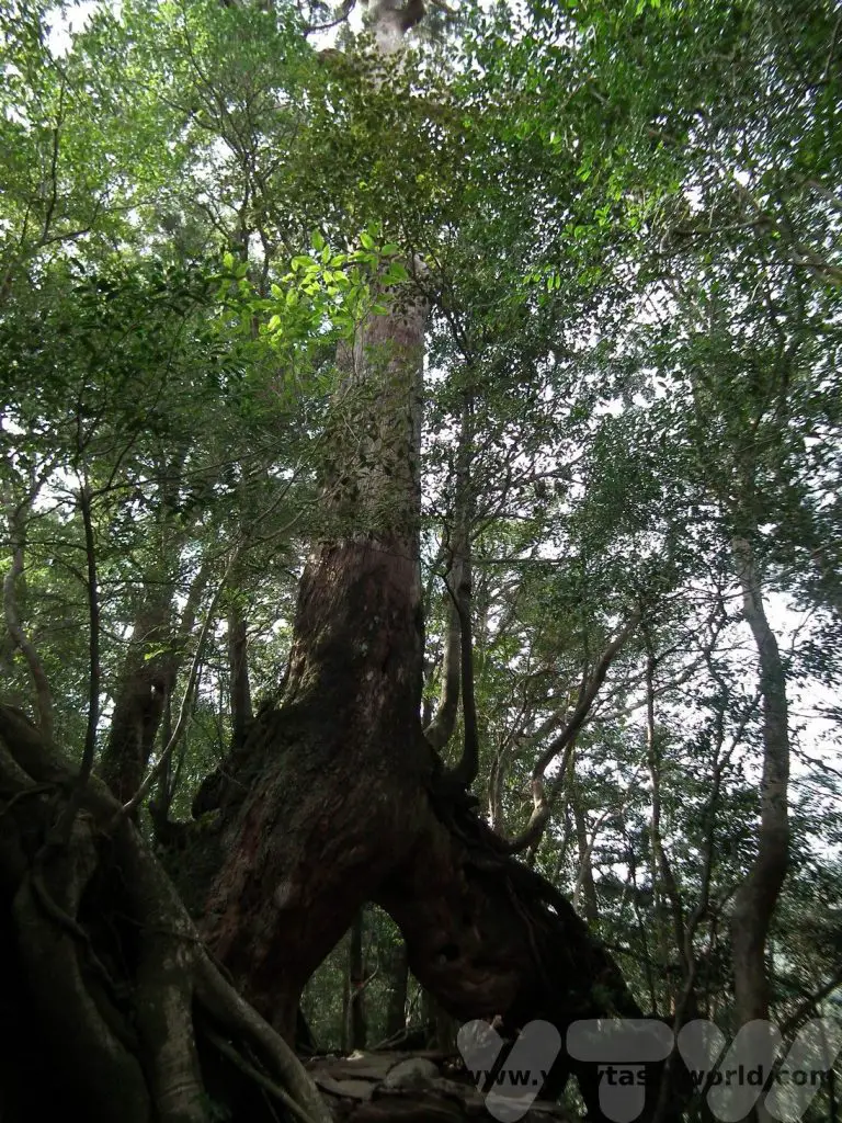
This park was the inspiration for the forest in Princess Mononoke and it is very clear to see how the artist Oga Kazuo used the stunningly beautiful landscape for the setting of the animation. It has ancient cedar trees and mossy paths as well as streams and waterfalls running through it. There are multiple trails from the car park and the walking is generally easy, although you need to take care of large tree roots that have grown across the path.
Visit Yakushima – Circumnavigate The Island
On our final day we decided to circumnavigate the island in the car before heading back to the hydrofoil. It’s largely a very easy drive but on the Seibu Rindo Forest path on the western part of the island the road narrows through the forest and becomes single track in some places, so you have to take care. We narrowly avoided a minor collision with a coach coming the other way.
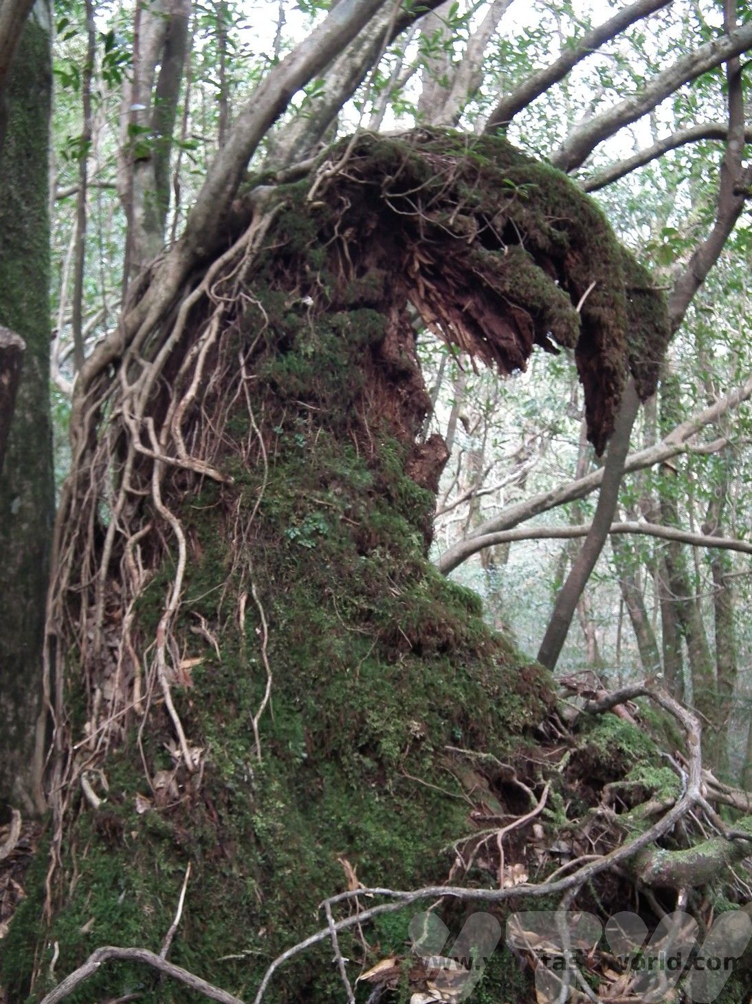
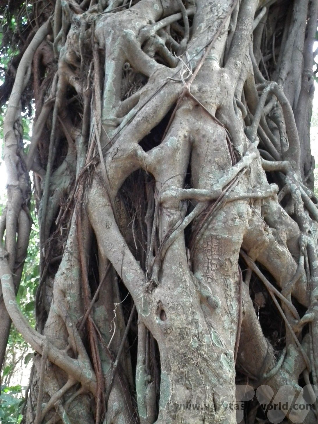
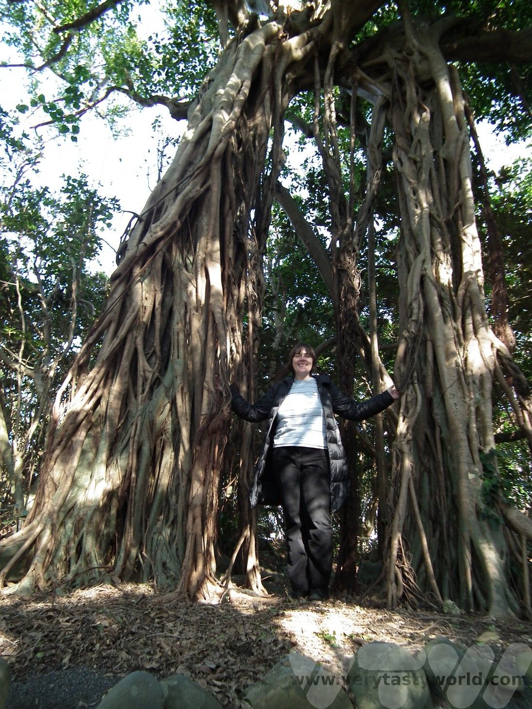
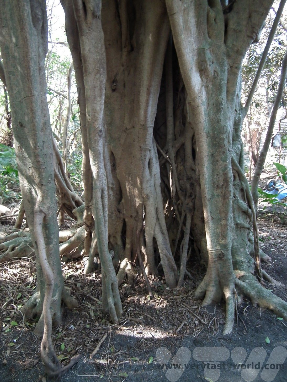
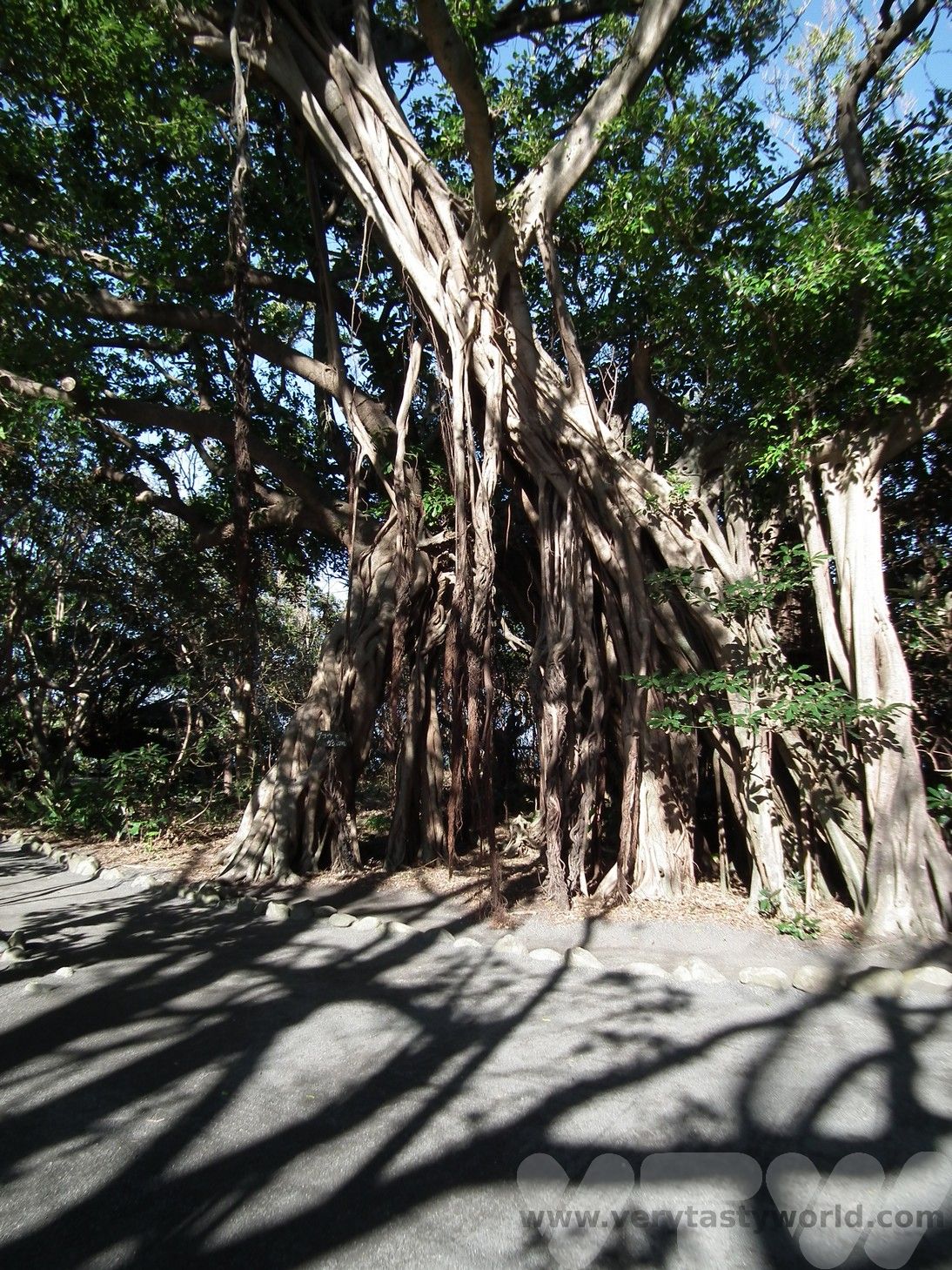
From Miyanoura we drove north, stopping at the Shitoko Banyan Tree Park. Banyan trees are a complete contrast to the cedars of Shiratani Unsuikyo. These trees grow by dropping roots from the branches which eventually reach the ground and embed themselves in the soil creating additional roots to support the tree. They can also form around other types of tree and can eventually kill them as they choke the existing root system.
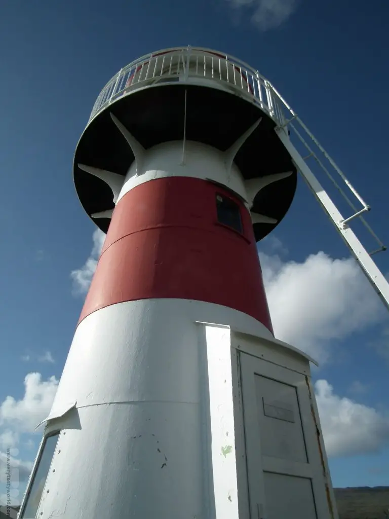
Isso Beach and Isso lighthouse on the peninsular.
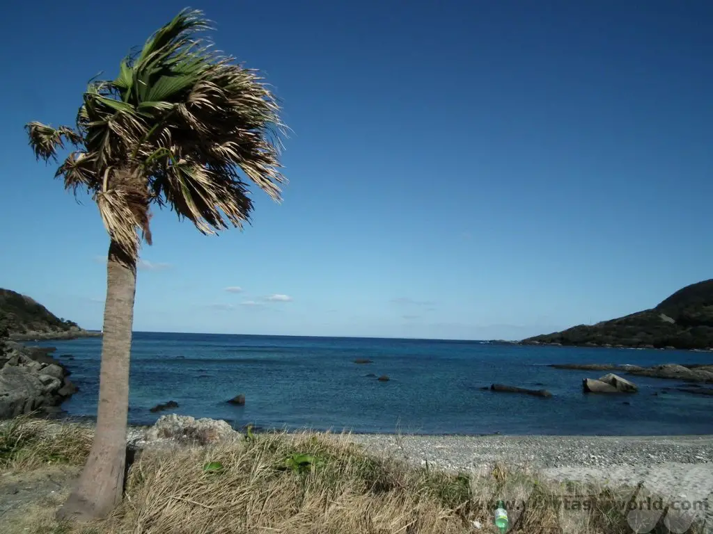
Swimming is only possible on the beach in the summer months when lifeguards are available. Also, turtles nest here during May and June, so care must be taken so as not to disturb them.
Then it’s a beautiful drive through the Seibu Rindo Forest. The road can be narrow and very winding as it wends its way through the mountain forest.
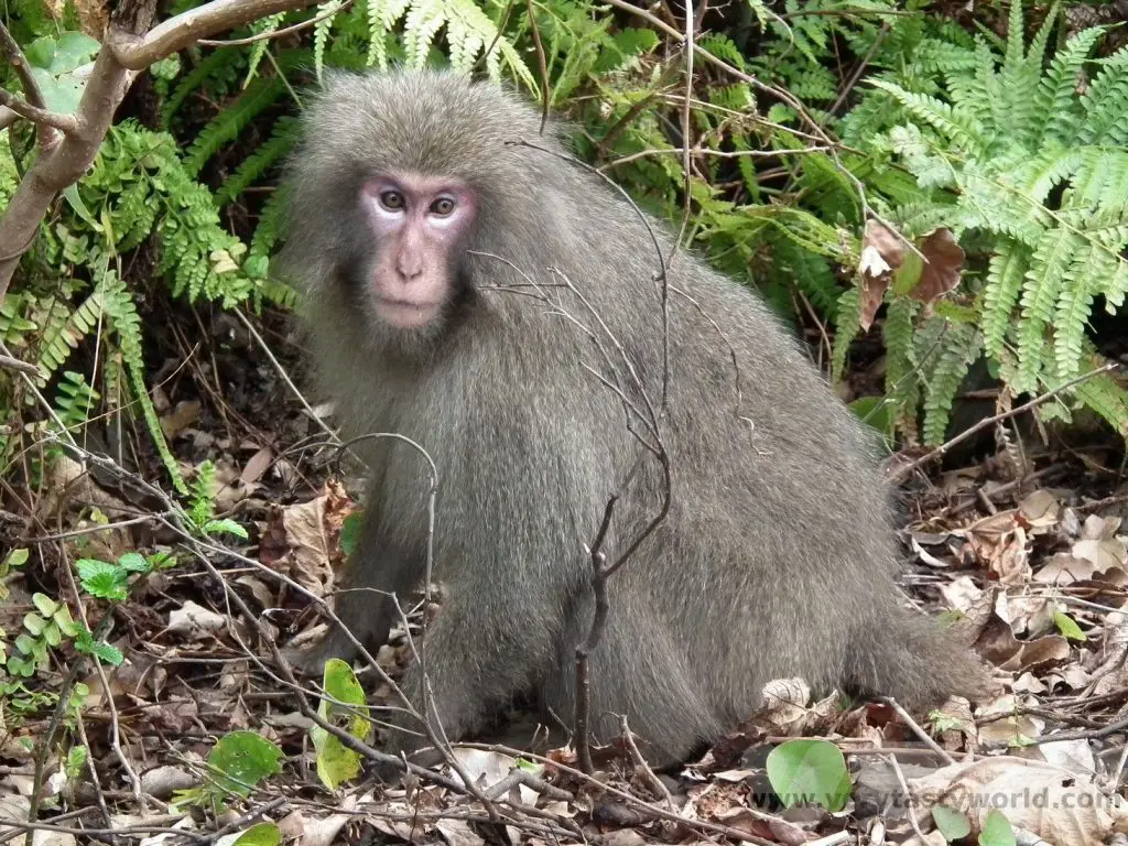
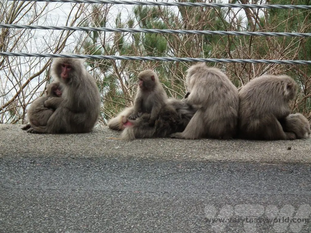
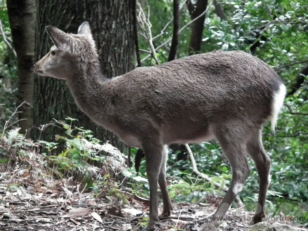
There’s an excellent chance of seeing Yakushika (native deer) and Yakuzaru (the Yakushima macaque) – and indeed we did.
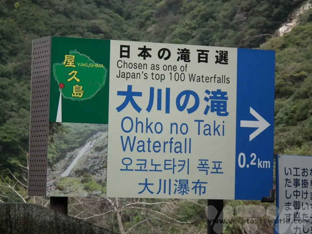
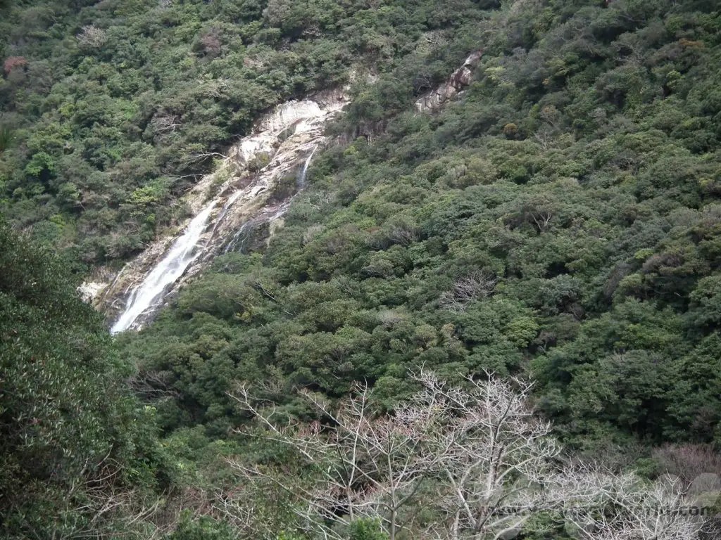
Yakushima has a number of waterfalls to explore. The falls are usually well signposted from the main road and there is usually a car park close by.
At 88m high, Ohko no Taki waterfall in the south west corner of Yakushima is one of Japan’s top 100 waterfalls. Sadly we didn’t have time to hike to the falls but even from a distance, it’s an impressive drop.
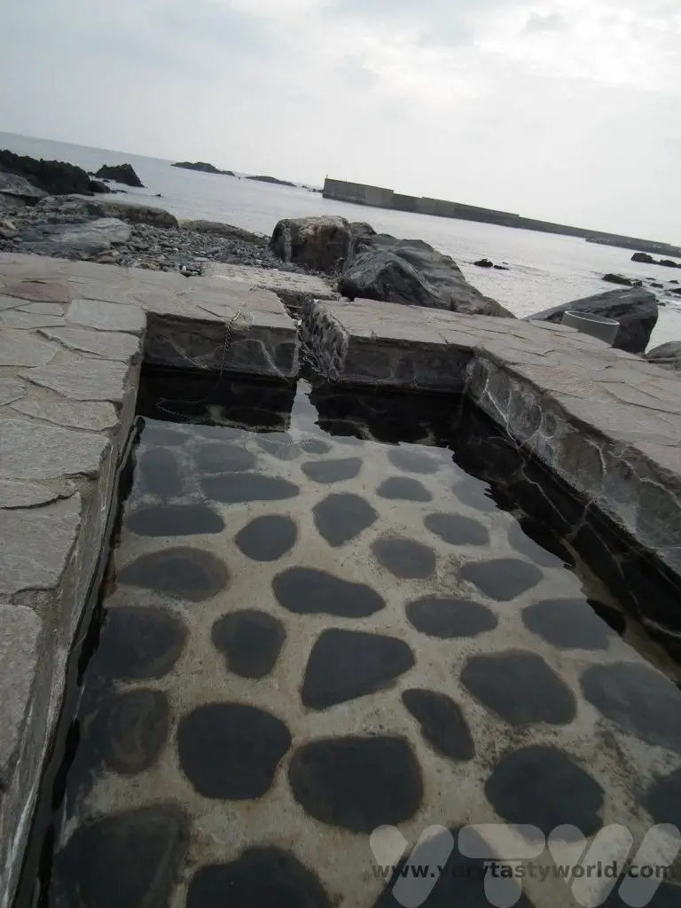
There are a number of outdoor onsen (hot springs) by the coast, which are worth a visit. Some of these are tidal, so are only accessible at low tide. There are a couple of neighbouring villages on the south cosast, Yudomari and Hirauchi, accessible by single track roads off the main circular route on Yakushima. It’s important to note that tattoos are something of a taboo in Japan as they are associated with gangsters, so is it worth covering any with sticking plaster. We enjoyed a warm footbath whilst looking out across the sea. (There are other onsen resorts at some hotels on the island if hot spring bathing is your thing.)
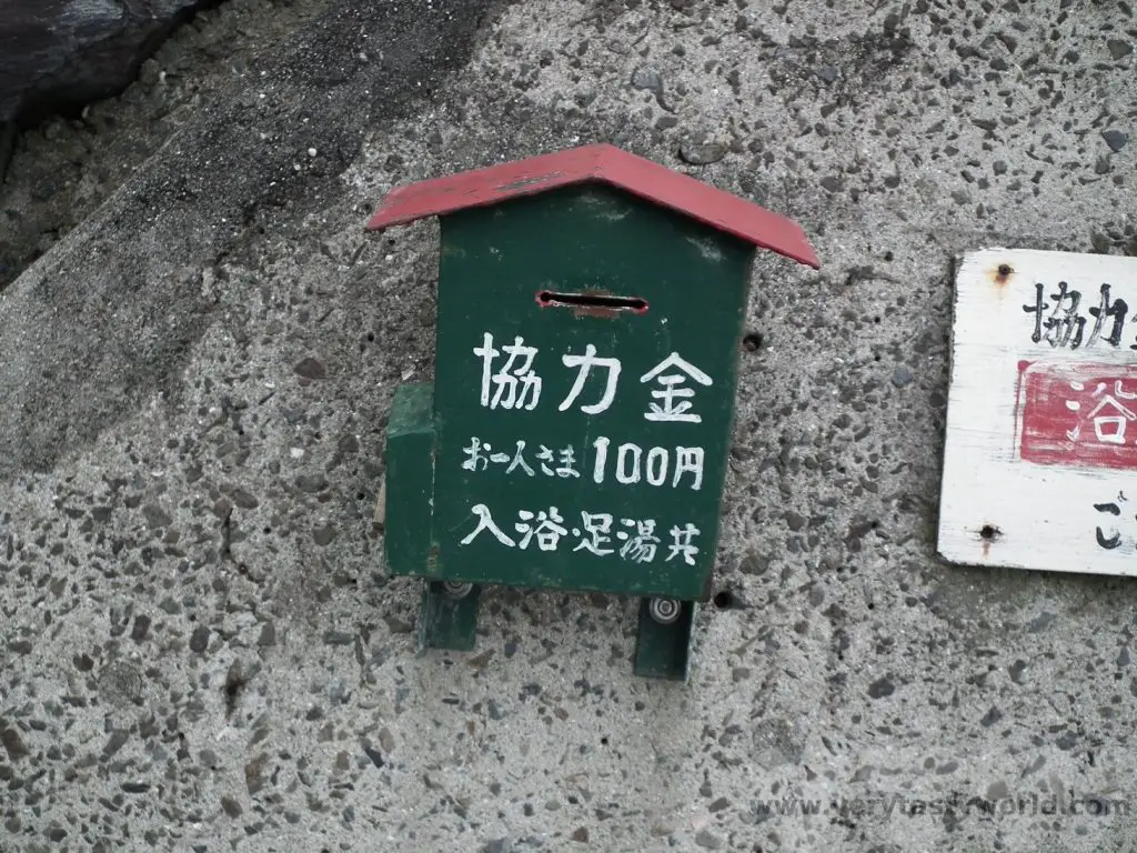
There’s an honesty box for payment (N.B. the price has increased to 200 yen since we visited).
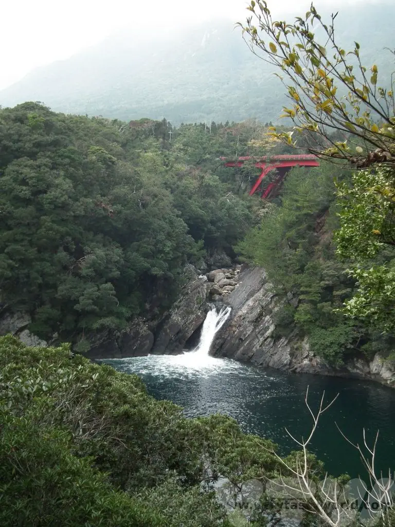
Sempiro-no-taki is another impressive waterfall which falls across an extensive granite gorge.
Toroki falls are just downriver from Sempiro and can be seen after walking a short distance from the road. You can see the vermillion bridge in the background.
Then it was time to head north towards Anbo port. There was a convenient petrol station right by the turn off to the port’s car park so we filled up the car and experienced the best in Japanese service – a full tank of fuel, windscreen cleaned and, best of all, the attendants running out to the road to stop the traffic so that we could exit the petrol station. Then it was a hop onto the boat to return to Kagoshima.
Yakushima is a destination that is off the beaten track but it is a beautiful island with plenty of walking, terrific food and delightful people. It’s a bit of a journey to get there but if you manage to visit you will not be disappointed.
Related Posts You May Enjoy

- Recipe: Simmered Shiitake Mushrooms
- How to Use Public Transport in Japan
- RECIPE Oyakodon Donburi
- Planning a Trip to Japan
- The Makanai: Cooking for the Maiko House
- Setsubun Food – Bean Throwing Day
- The Gassho Farmhouses of Rural Japan
- Recipe: Japanese Simmered Pork Belly – Buta no Kakuni
- RECIPE: How to Make Umeboshi
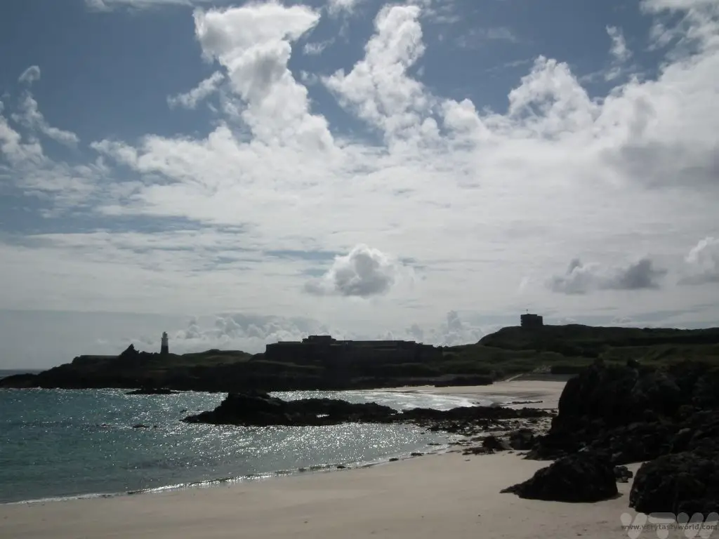
A Walk Around Alderney
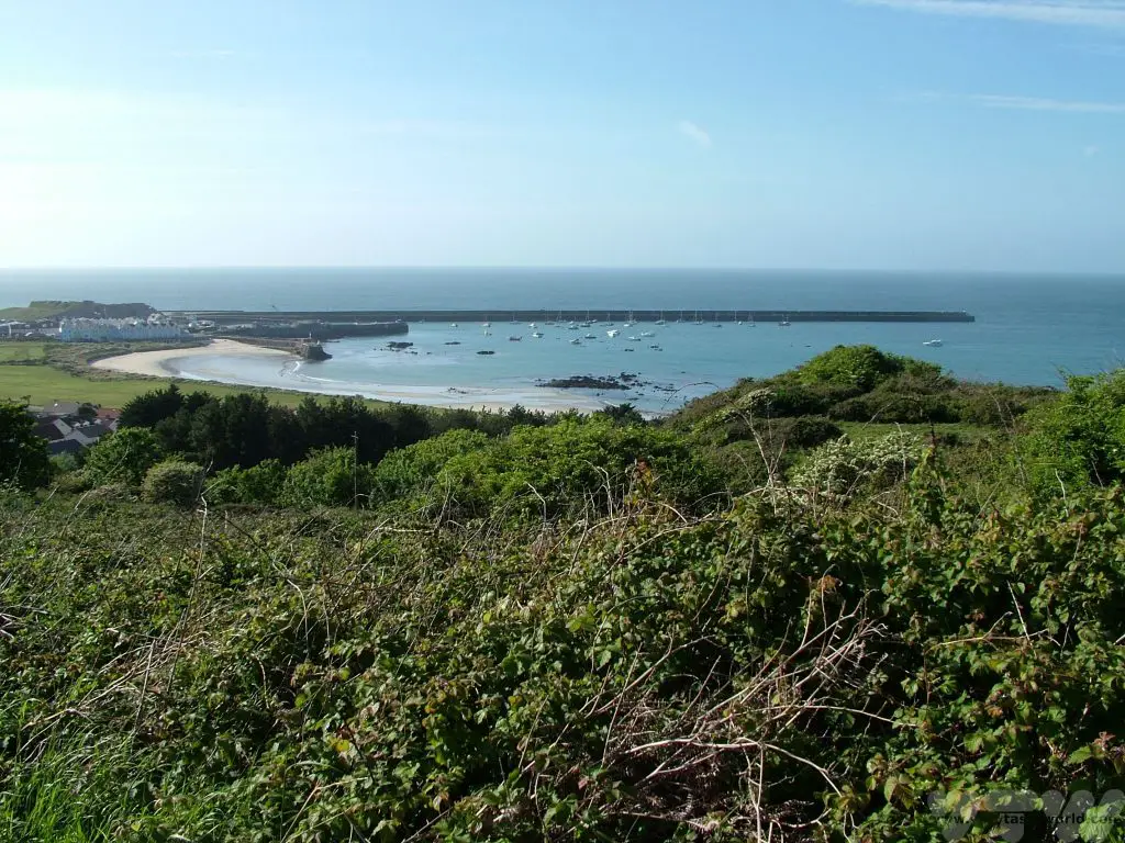
Alderney is the third largest, or indeed, third smallest of the populated Channel Islands, an archipelago in the English Channel, which are closer to the coast of France than to England and a crown dependency of the UK. Alderney is a small island, around 8 square km, and has a population of just 2000 people. It is also very beautiful. One of the loveliest things you can do when visiting Alderney is to walk all the way around it. There are plenty of good footpaths and, although it can be a bit hilly in places, it’s an easy walk that affords the most splendid views all the way around.
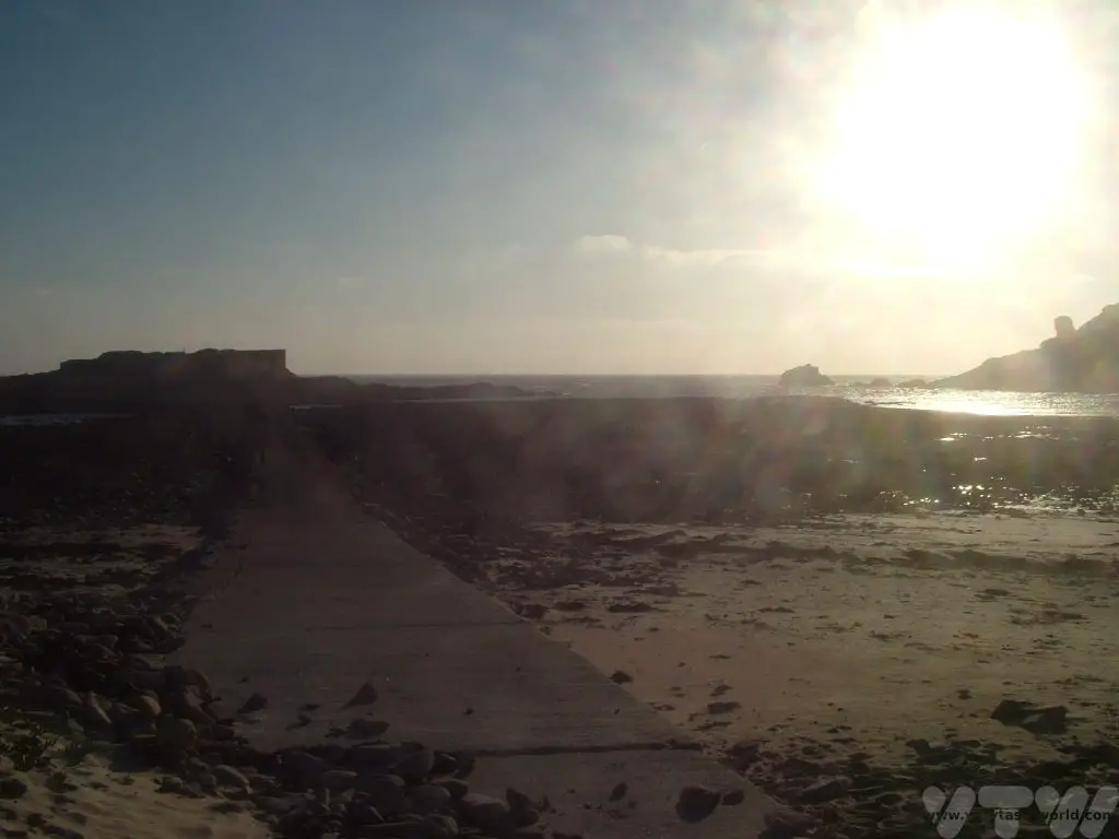
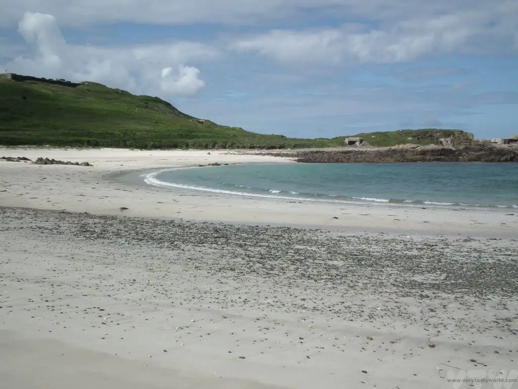
Braye is the obvious place to start a walk around the island. If staying in the pretty town of St Anne, let gravity guide you to the beach along the main road, passing the railway station. Braye Bay is the largest bay on the island and is characterised by its breakwater, a construction that stretches about 1400m into the sea, shielding the harbour and beach from the treacherous currents of the Swinge tidal race. It’s a beach with a broad sandy area on the western shore and rockpools to explore at the eastern end. It’s possible to walk the length of the breakwater but make sure the weather is fine – it is dangerous to do so on a windy day as waves do crash over it. It can be spectacular during a storm.
On an anti-clockwise tour, walking west, past the inner harbour and electricity generator station, lies the tiny rocky inlet Crabby Bay before the coastline stretches to the sand flats of Platte Saline. Despite its inviting appearance, the tidal currents are swift and it is not safe to bathe on this beach.
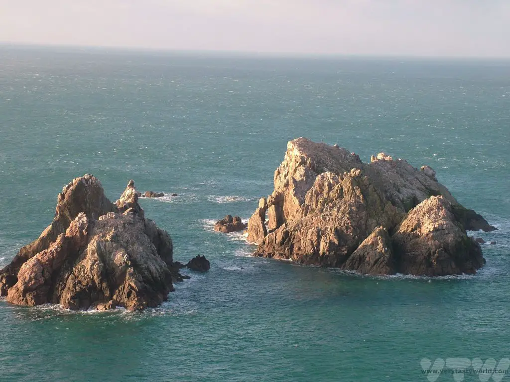
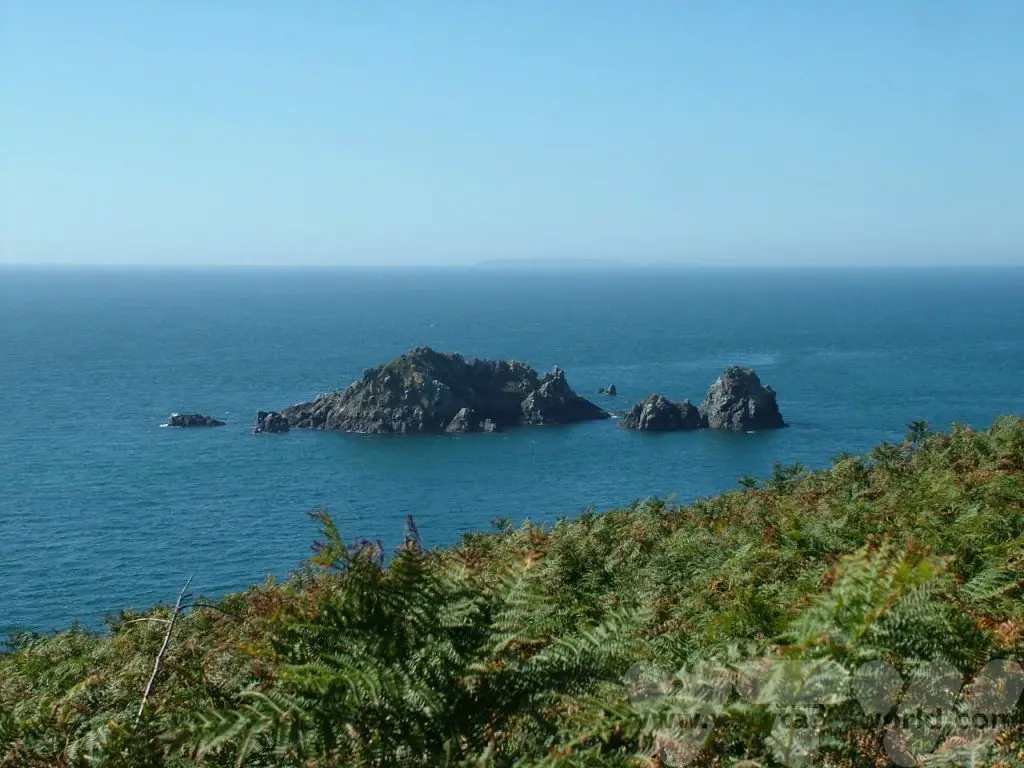
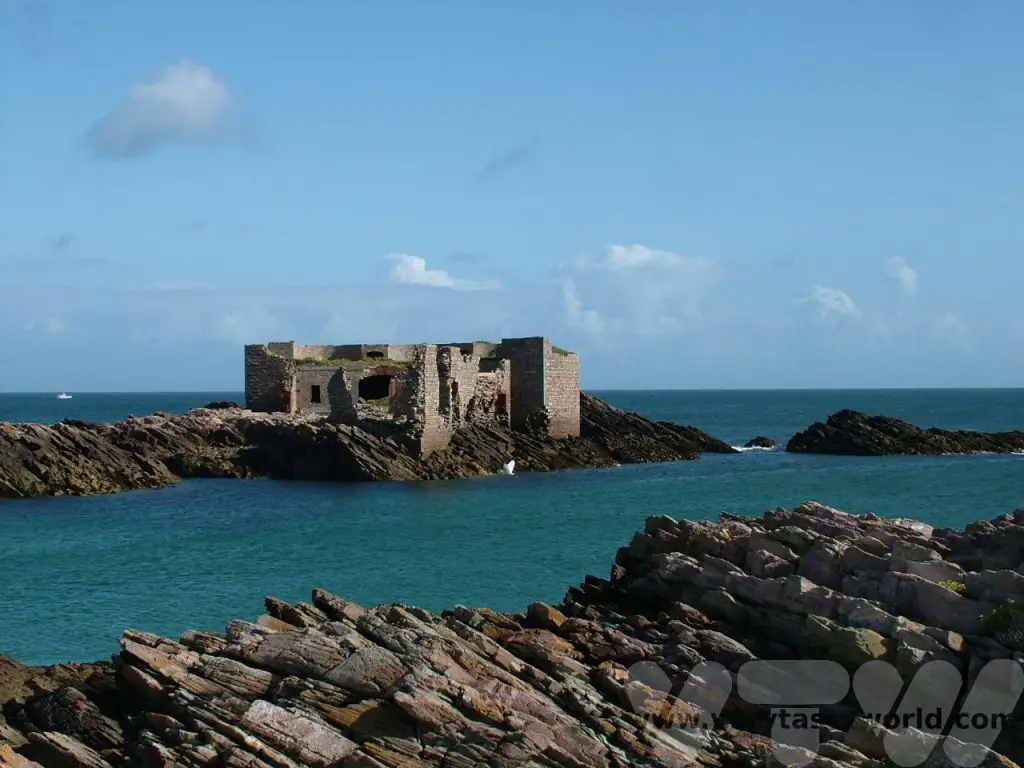
Heading towards Fort Tourgis, one of the many Victorian fortifications on the island, the coastline becomes rockier. Clonque (pronounced ‘clonk’) is a wonderful beach for walking and exploring. The bay overlooks the tiny uninhabited island of Burhou, a puffin colony, which is a protected site, and, further out to sea, the big oval rock Ortac, and Les Casquets with its automated lighthouse.
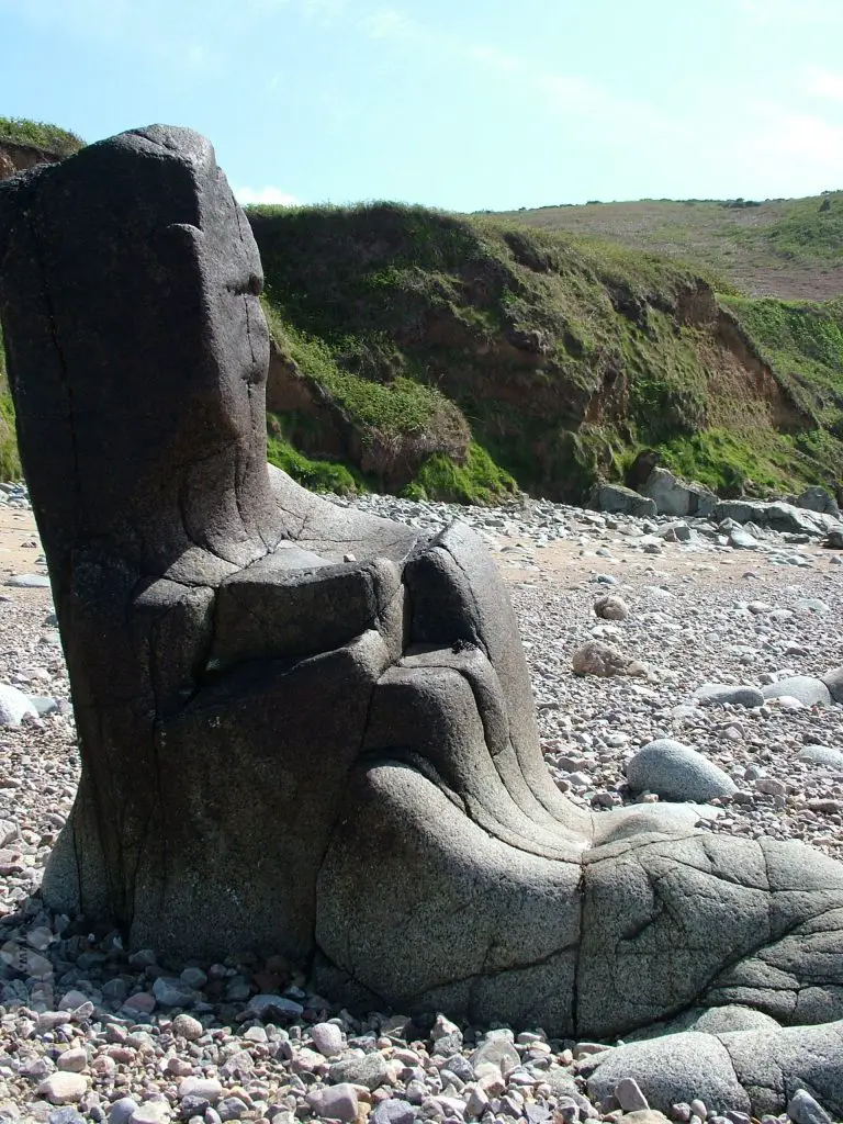
About two thirds of the way along the beach is a chair-like rock, known as the Monk’s Chair. Legend has it that a monk fought the devil there and, having vanquished his opponent, the monk sank onto the rock, whereupon it transformed into a chair to provide some comfort.
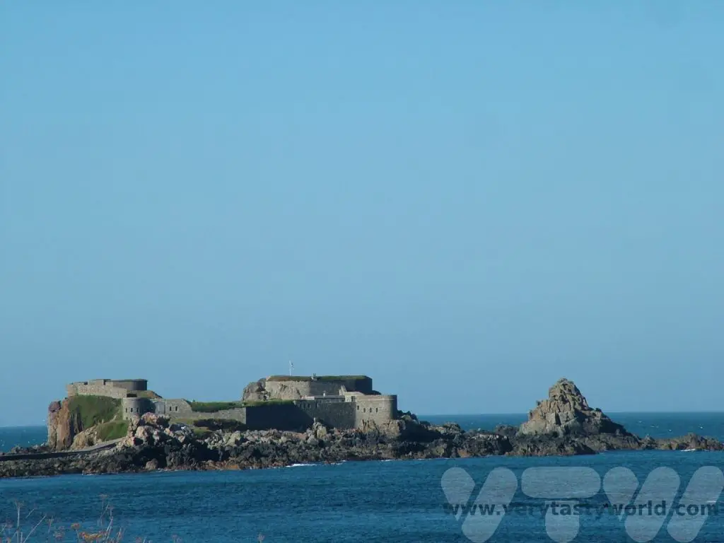
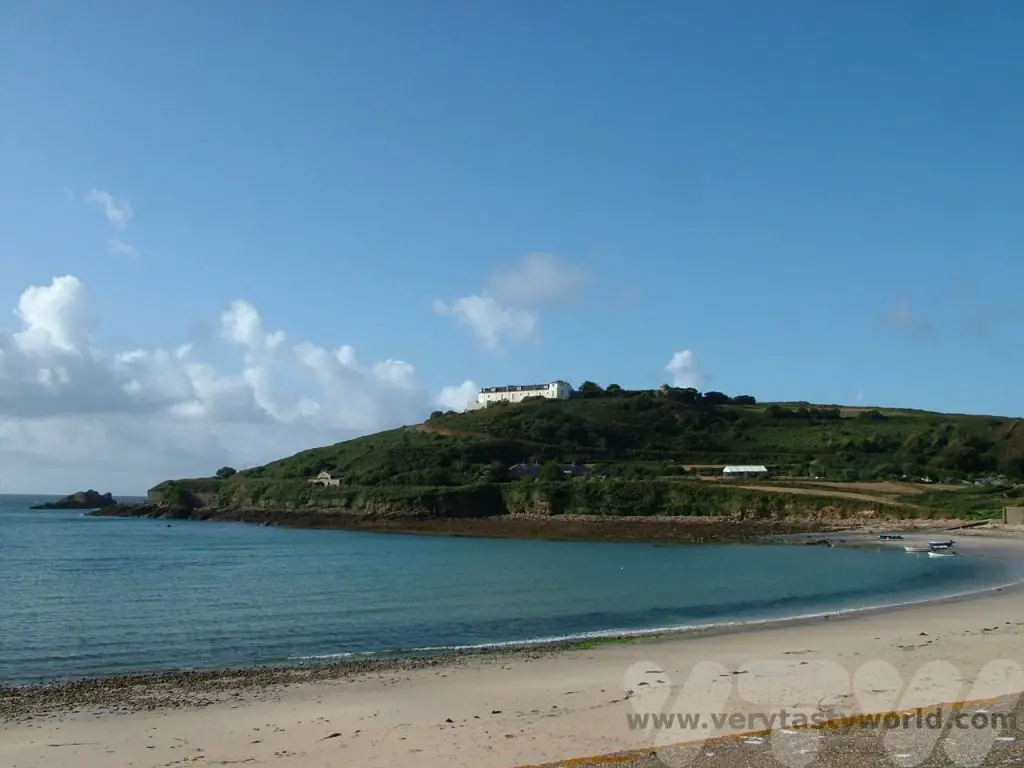
At the far end of the bay is Fort Clonque, another Victorian fort located on an island and accessed via a causeway, which is cut off from the main island at high tide. The property is owned by the Landmark Trust and it is possible to stay there. If you are travelling with a large group (it can sleep up to 13 people) it represents really good value and is a tremendous place to stay.
A Walk Around Alderney – Along The Cliffs
Continuing the walk around Alderney The terrain climbs rapidly and it is not possible to continue along the shoreline, so following a zig-zag up to the south-west end of the island it is possible to walk along the top of the windswept cliffs. Along the Giffoine you can look out to the Garden Rocks where a noisy gannet colony has made its home.
In this area there are several German fortifications from World War 2 when the island was occupied during the war and the local people evacuated. (The larger islands Jersey and Guernsey were also occupied and the residents remained under Nazi rule for five years.)
A walk along the undulating paths of the south coast is always a delight especially in spring and summer when the flowers are in bloom and the area is scented with the coconut smell of gorse.

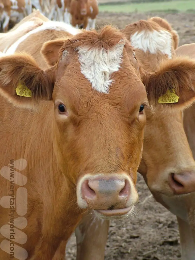
It used to be possible to climb down steps cut into the cliff to reach the charming Telegraph Bay but the beach is now only accessible from the sea. The walk is adjacent to farmland so it is likely that you encounter some beauties such as these.
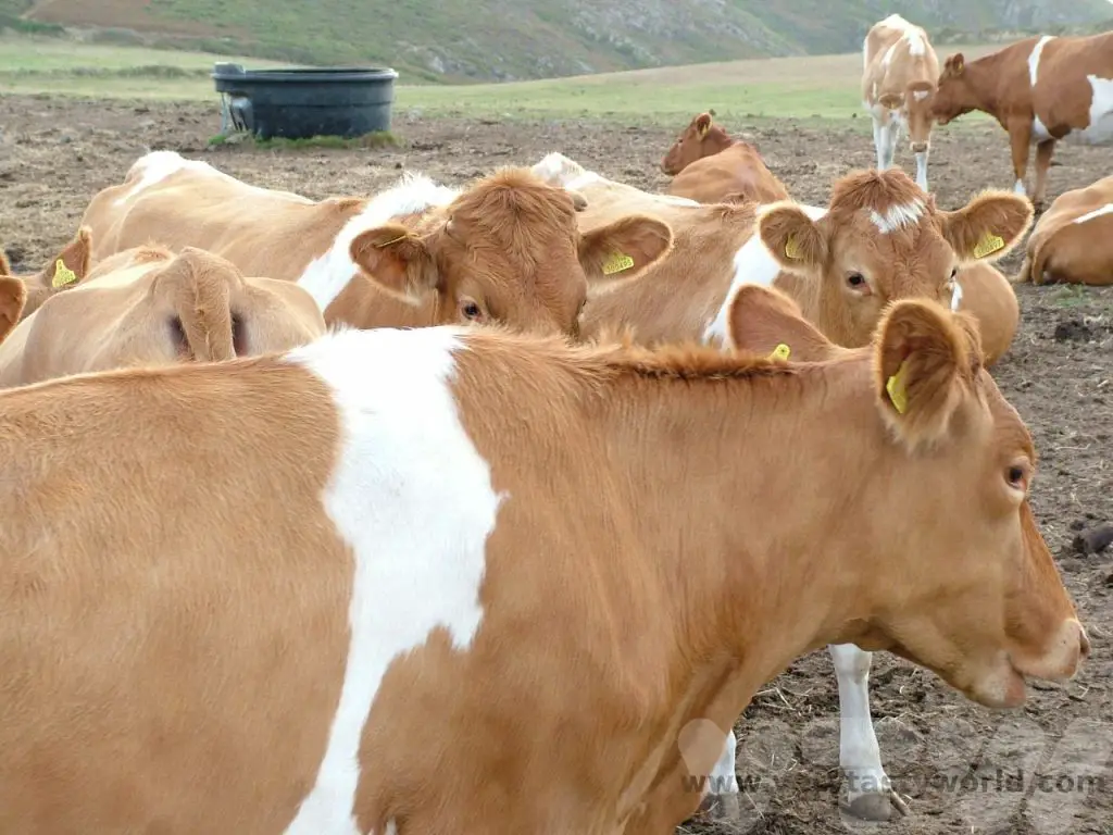
They are not Alderney cows, even though the breed is quite famous, having appeared a number of times in literature, from Jane Austen’s Emma to AA Milne’s poem, The King’s Breakfast:
The King’s Breakfast
The King asked
The Queen, and
The Queen asked
The Dairymaid:
“Could we have some butter for
The Royal slice of bread?”
The Queen asked the Dairymaid,
The Dairymaid
Said, “Certainly,
I’ll go and tell the cow
Now
Before she goes to bed.”
The Dairymaid
She curtsied,
And went and told
The Alderney:
“Don’t forget the butter for
The Royal slice of bread.”
The Alderney
Said sleepily:
“You’d better tell
His Majesty
That many people nowadays
Like marmalade
Instead…”
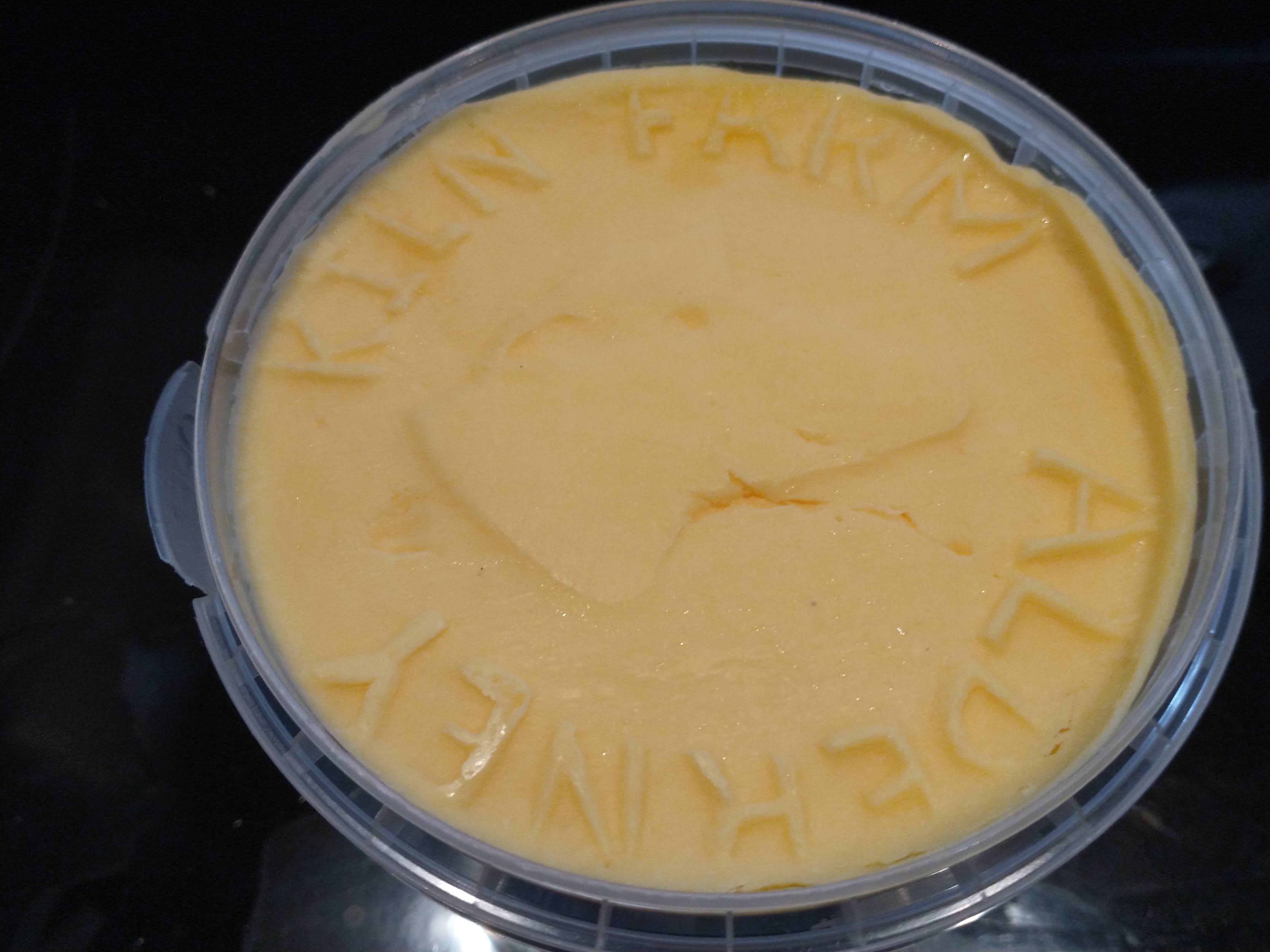
Sadly the breed was lost during World War 2 when the animals on Alderney were sent to Guernsey to help the islanders stave off starvation. But while the cows that graze on the lush grass may not be Alderneys, they do produce the most amazing dairy products. Alderney has its own dairy and produces a variety of delicious products including the creamiest milk and butter so yellow it rivals the colour of buttercups. It is absolutely delicious and a real treat to eat. Forget the marmalade, it’s best on bread, spread so thickly that you can see your teeth marks when you bite into a slice.
The journey continues past the airport along the cliffs to Essex Hill.
A Walk Around Alderney – Descent To The Beaches
The Hanging Rock (far right of the picture) overlooks The Race, another treacherous tidal stream across a reef of sharp rocks and the cause of many a shipwreck over the centuries. There is a legend that the people of Guernsey tried to pull Alderney to across the sea by throwing a rope over the rock and having a really good tug… to no avail, of course.
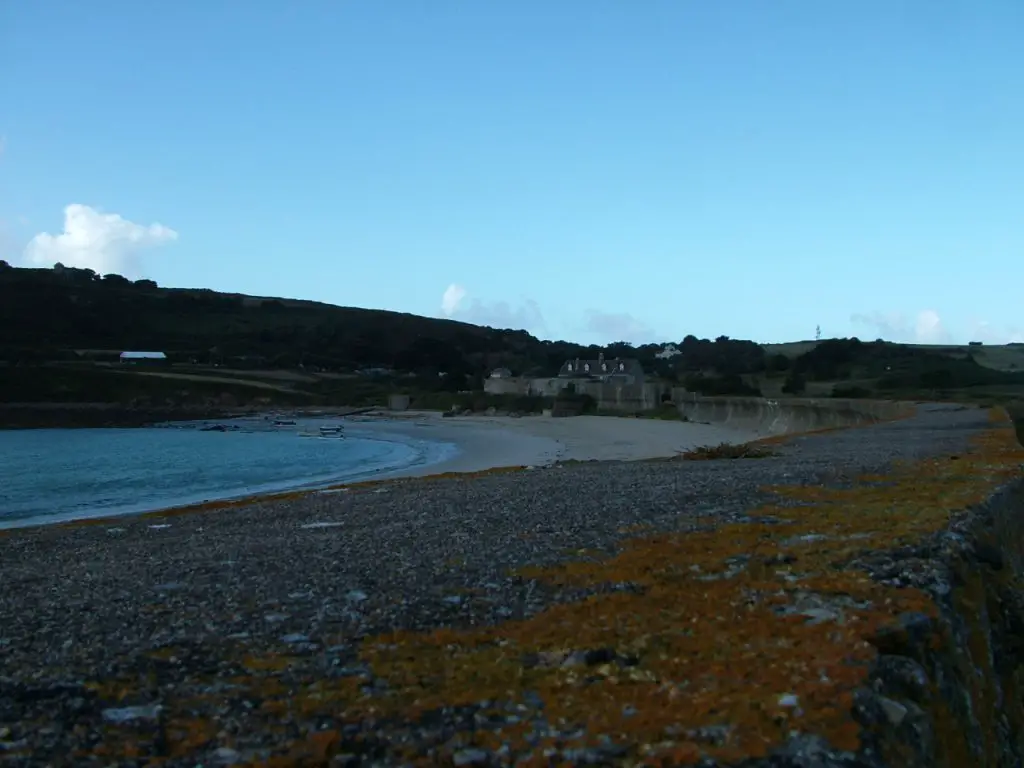
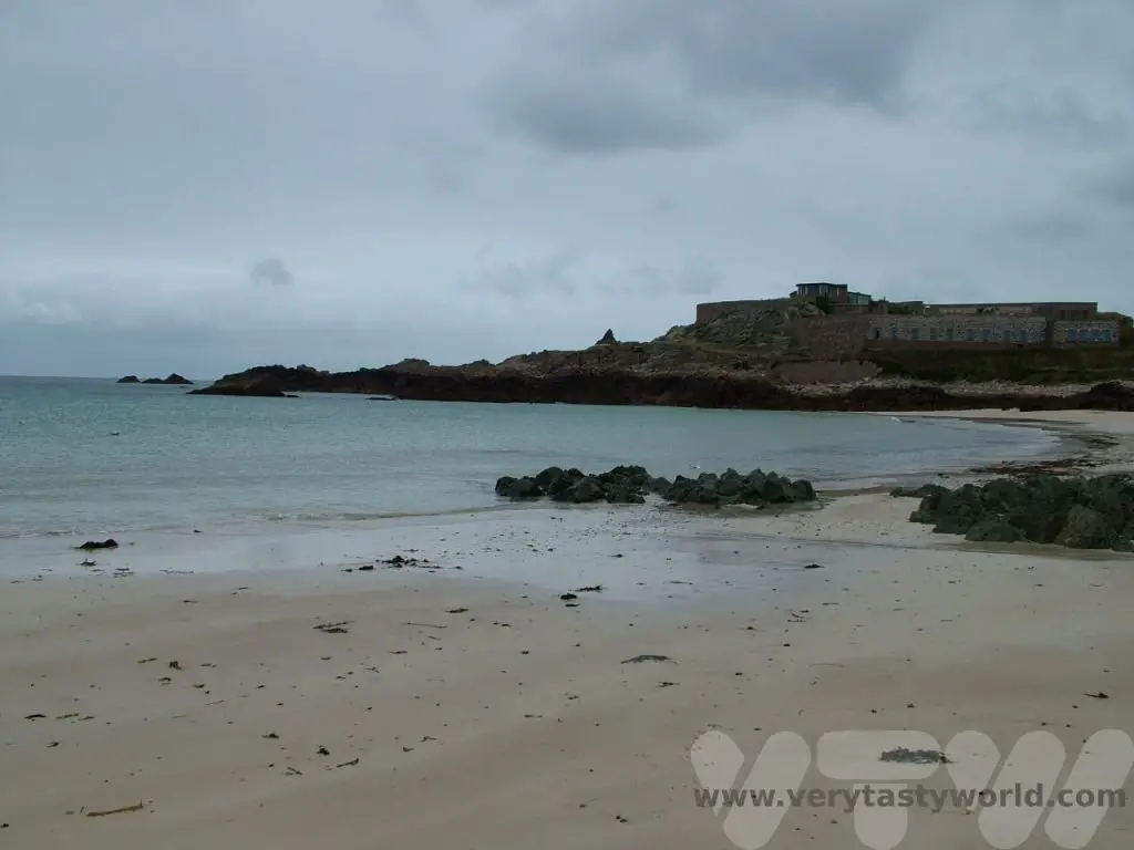
Then the cliffs fall away and you can stroll downwards to Longis Bay, Alderney’s original harbour. It’s a popular bay for bathing, the sandy beach shielded from the inevitable Alderney breeze by a concrete wall that spans the length of the bay, again built during the occupation.
Raz Island, with another fort at the end of the causeway marks the limit of the bay. There used to be some tourist attractions at the fort but it’s no longer possible to visit Raz, although some work is currently being undertaken to open it up again. A gentle stroll along the coast brings you to Houmet Herbe, a ruined fort again constructed on an island and only accessible at low tide.
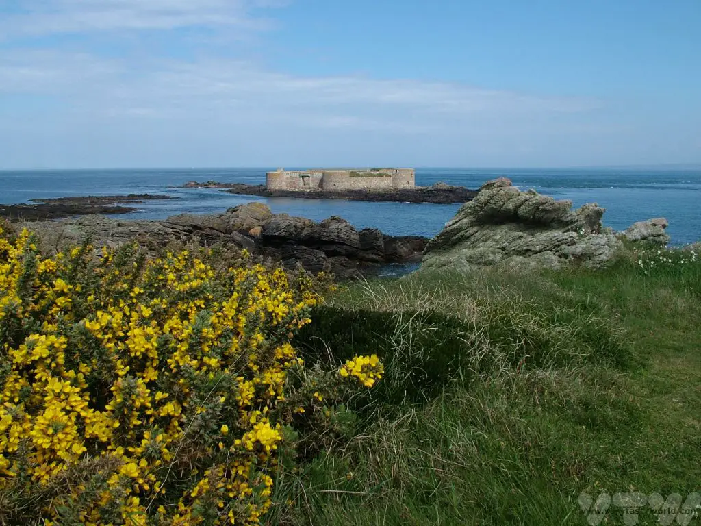
Remnants of a basic causeway remain and, if you’re willing to scramble over the rocks, it’s possible to explore the fort. On a clear day you will get a fantastic view of the French coastline and Cherbourg, around 11km across the sea. Keep an eye on the tide, though, you will get cut off and have to wait a few hours for the tide to turn again.
A Walk Around Alderney – From The Lighthouse Back To The Beach
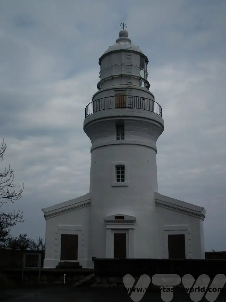
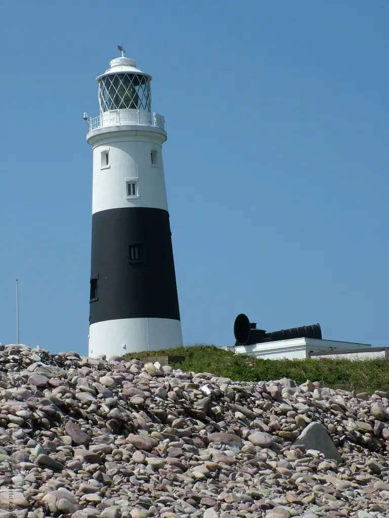
Continuing along the coastal path you will arrive at the island’s lighthouse. It’s fully automated these days.
Opposite the lighthouse is Fort Les Hommoux Florains, which has largely been destroyed – each year battered by relentless winter storms. It is possible to get out there to view but you may need to swim across a small channel if the tide isn’t especially low, which probably isn’t worth the effort.
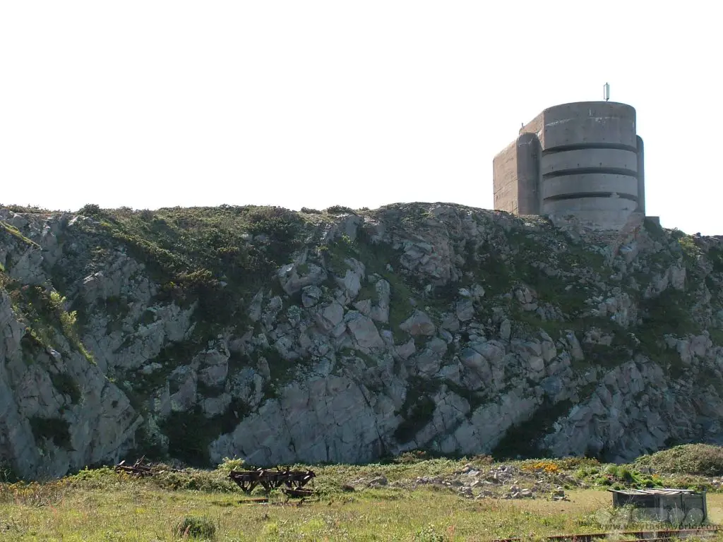
Close to the lighthouse, and overlooking Mannez quarry is a German fortification known locally as The Odeon. It is one of the most distinctive buildings on the island; an enormous concrete tower that was built by forced labourers in 1943. It was planned to be used as a range-finding location to observe enemy ships. It was derelict for many decades but it is now possible to visit The Odeon.
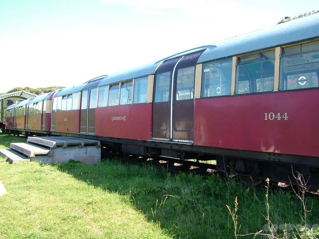
Also at Mannez Quarry is the end of the line for the Alderney railway. Yes, those are London Underground carriages in the photo below! The railway was originally constructed to bring stone from Mannez to the harbour for construction of the breakwater. It is now open as a tourist attraction for passengers to enjoy a delightfully scenic journey to the quarry from Braye station.
Further on (and don’t tell anyone) are the very best beaches for bathing: Corblets, Arch and Saye (pronounced ‘soy’). Overlooked by private residence Fort Corblets, the eponymous bay has a broad sandy beach and is popular for an energetic and invigorating swim. It’s worth bearing in mind that the sea temperature can be pretty cold, even in summer, but the water is crystal clear and it’s an absolute delight to swim there. (You do warm up!)
Arch is also sandy but has a steep incline. It affords a good view of the lighthouse and Odeon.
Saye can be found by walking underneath Arch Bay’s arch, past Château à L’Etoc (another privately owned fort) and beyond the dunes beside the island’s campsite – again it’s sandy but the enclosed geography of the bay ensures that the sea is much calmer than on Corblets.
To complete the walk around Alderney it’s simply a walk around the grassy headland upon the top of which Alderney’s largest Victorian fort is located, Albert, originally designed to protect the harbour, and the familiar view of Braye, the harbour and the breakwater come into view. Burhou, Ortac and Les Casquets can also be seen in the background.
Related Posts You May Enjoy


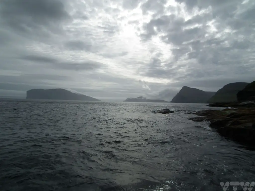
Visit the Faroe Islands
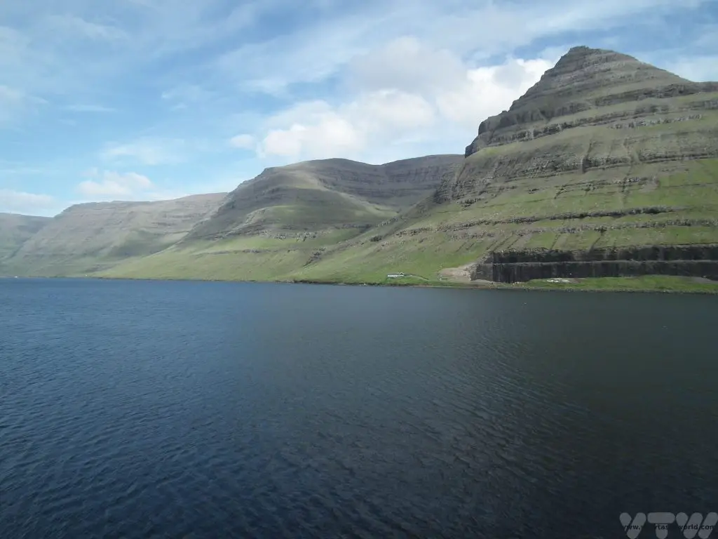
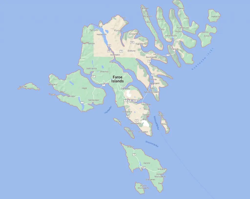
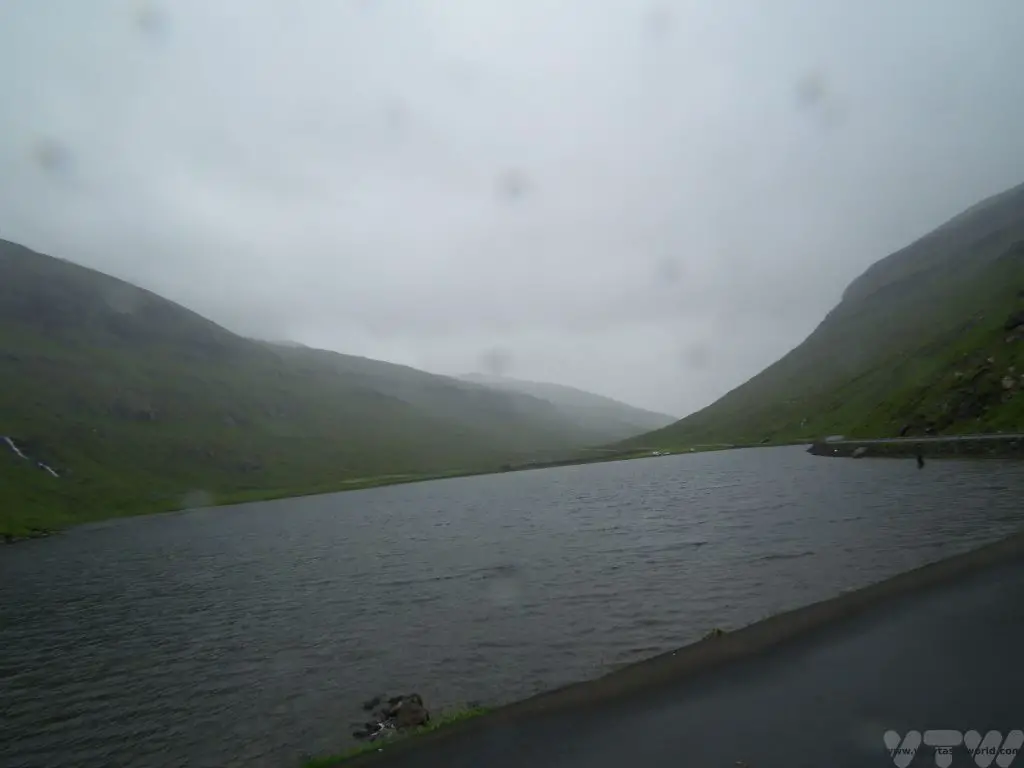
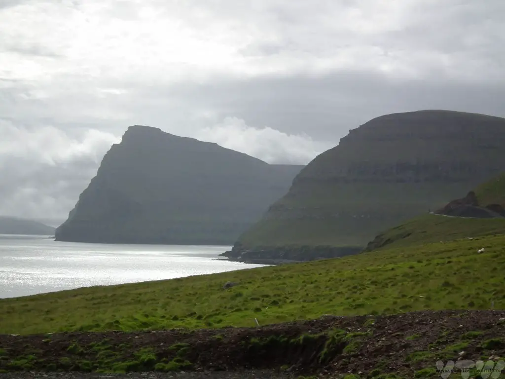
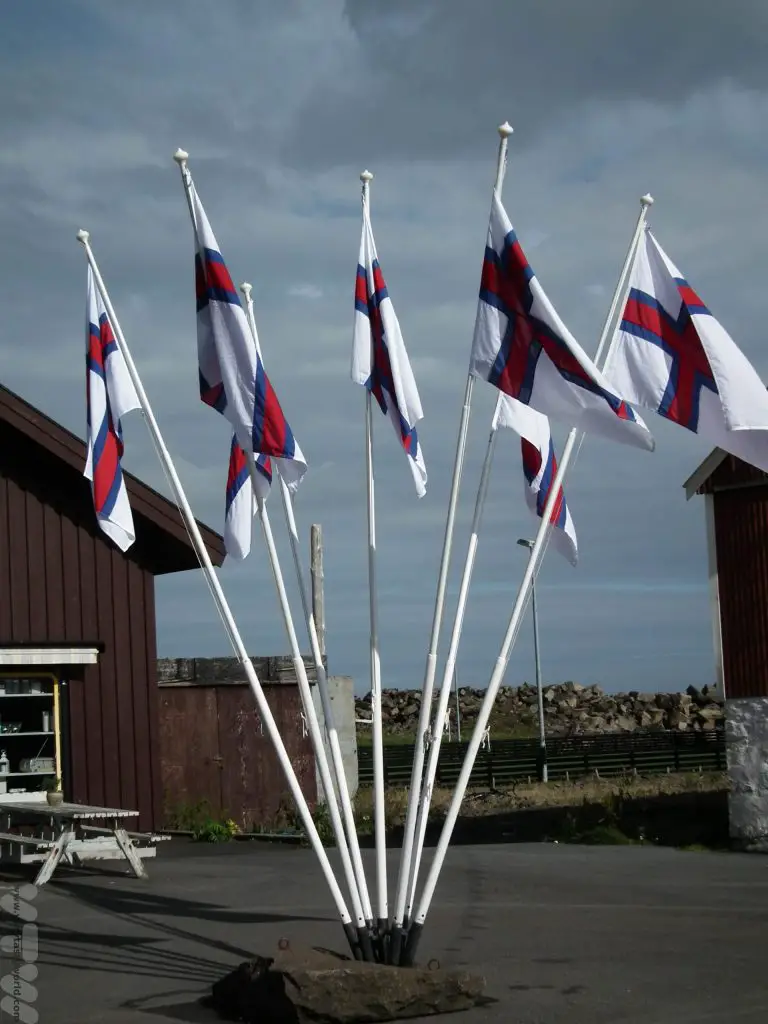
The Faroe Islands are a tiny archipelago located in the Atlantic ocean, just south of the Arctic Circle. If you look at the map you’ll see them around half-way between Norway and Iceland. They are an autonomous territory of Denmark and comprise 18 main islands with a plethora of smaller islands, all of which are stunningly beautiful. A fly-drive journey is the perfect way to visit the Faroe islands.
Heading Out On The Road
The Faroes are ideal for a road trip as most of the main islands are connected via bridges or tunnels and you can explore the spectacular scenery at your leisure. The roads are well made, usually clear of traffic and the distances between locations are relatively short.
You can hire a car at the airport on Vágar. It’s definitely worth booking well in advance to get the best rates. Bear in mind that some of the driving can be a little challenging occasionally. There are a lot of single-track roads, so be aware of how to use passing places – if you see another car heading in the opposite direction towards you, pull over to the passing place on the right.
If there is a passing place on your left, keep right and let the oncoming traffic use the passing place. (It’s similar to driving in the Highlands and Islands of Scotland, albeit on the other side of the road.)
The Faroes also have an awful lot of sheep, some 70,000, more than the human population of the islands, and many of them roam freely. They can be a little skittish, so slow down if there are any grazing close to the road. If you do hit a sheep you have to inform the police by law. Keep your car’s headlights on all the time (many cars will automatically switch on the lights when you turn the ignition but check that they will do this).
Tunnels and Bridges
The major tunnels linking the islands are large and well-lit but probably the scariest driving experience we’ve ever had was going through single-track tunnels which link the northernmost islands. These do have passing places every 100m or so but nevertheless they are mildly terrifying, especially when you aren’t sure where the passing places actually are and the locals are happy to zoom through the tunnels.
Seeing oncoming headlights in a narrow tunnel when you don’t know where to pass is pretty scary so take care when driving through them.
We developed a sneaky trick of parking temporarily by the entrance until a local driver entered the tunnel and then we followed them, which helped a little bit. The tunnels are undoubtedly the most likely places where you might have an accident. It’s advisable to check whether it’s worth buying additional insurance – have a close look at the terms and conditions of the car hire company.
Also, there are tolls for some of the tunnels; our car hire company paid the tolls on our behalf and recharged them to our credit card at the end of the trip, which was very convenient.
Terrifying tunnels aside, driving around the Faroes is actually a very pleasurable and practical way to discover these gorgeous islands. Pretty much everyone starts on Vágar as that’s where the airport is located; we flew in using Atlantic Airways, the Faroese airline.
We undertook a seven day itinerary which offered complete flexibility to explore and enabled us to do a lot of walking. It’s worth noting that the weather can change in an instant – from mild temperatures in the sunshine to rain lashing down and impenetrable fog. But that’s all part of the fun. Make sure you bring clothing for all weathers. We found that a pair of sturdy walking shoes and raincoats were essential and multiple layers of clothing worked very well.
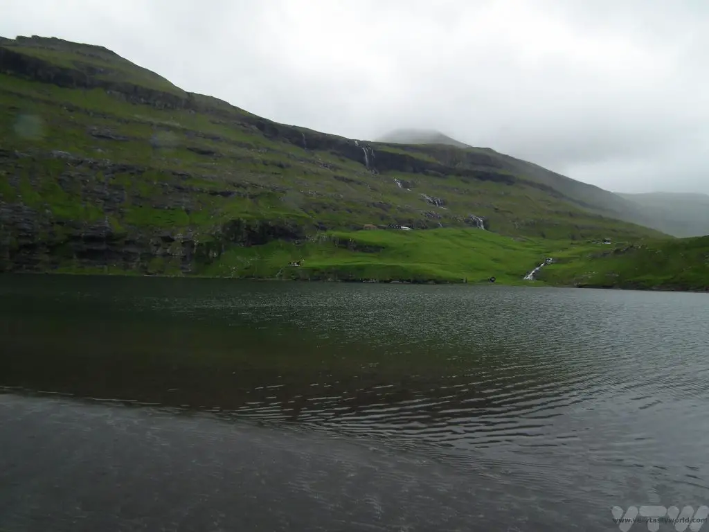
Day 1 Vestmanna on Streymoy
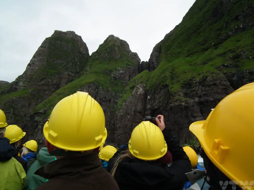
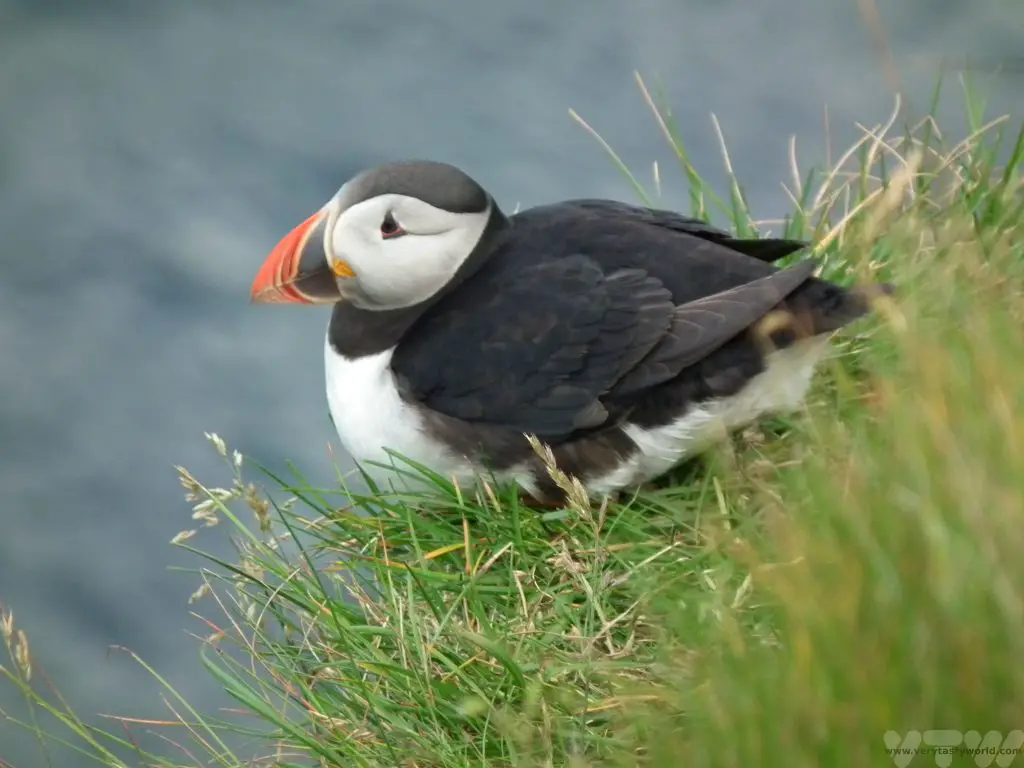
After leaving Vágar we headed to Streymoy via the first sub-sea tunnel, a gentle introduction as it was wide and well-lit. It’s also deep, reaching 105m below sea-level. We headed to Vestmanna as we had pre-booked a boat trip to the bird cliffs. It’s the most popular excursion on the islands and well worth undertaking. There are lots of bird viewing opportunities and puffins are a common sighting.
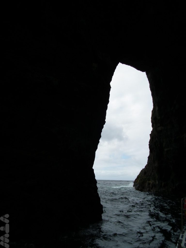
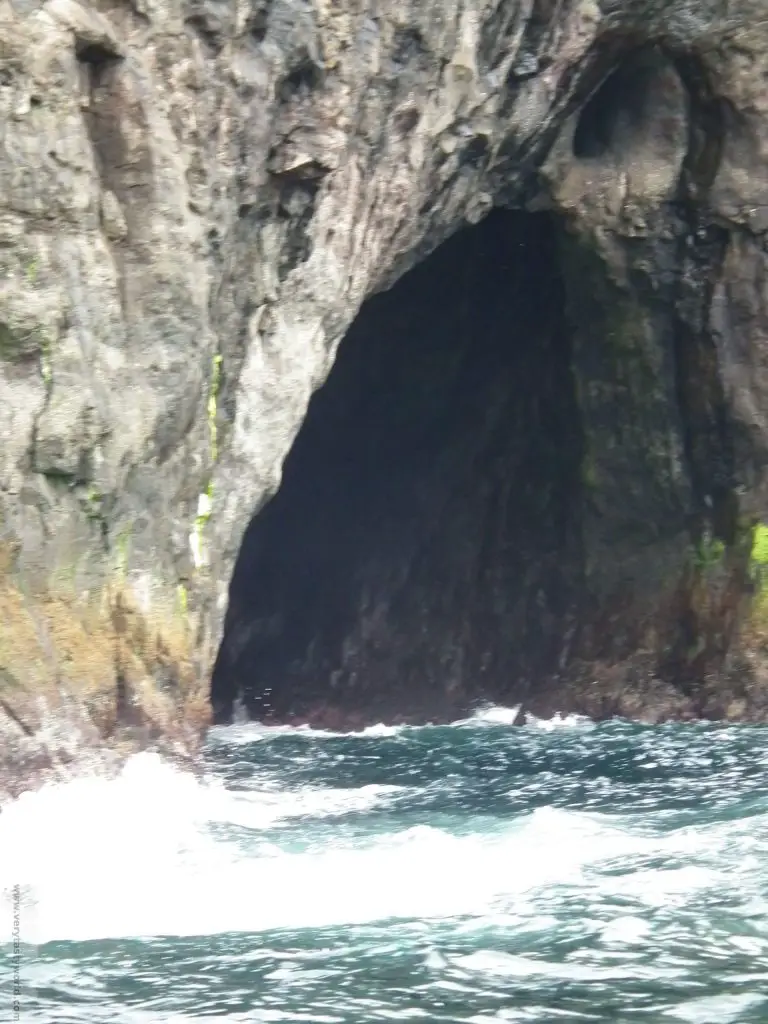
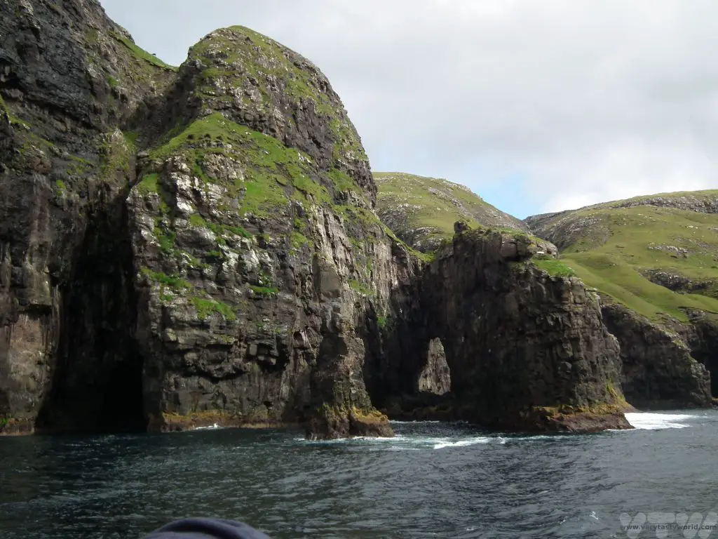
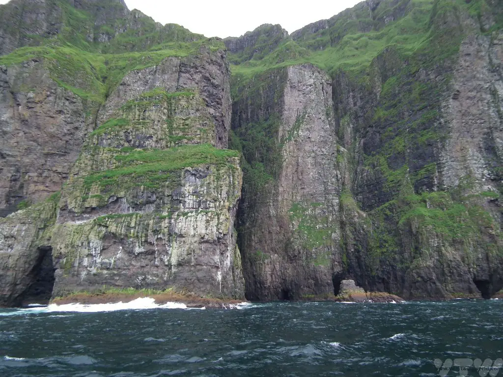
The boat sails very close to the cliffs and around some of the stacks so you are issued with a hard hat, just in case a bit of cliff decides to fall off while you are underneath it. (You’d have to be very unlucky.)
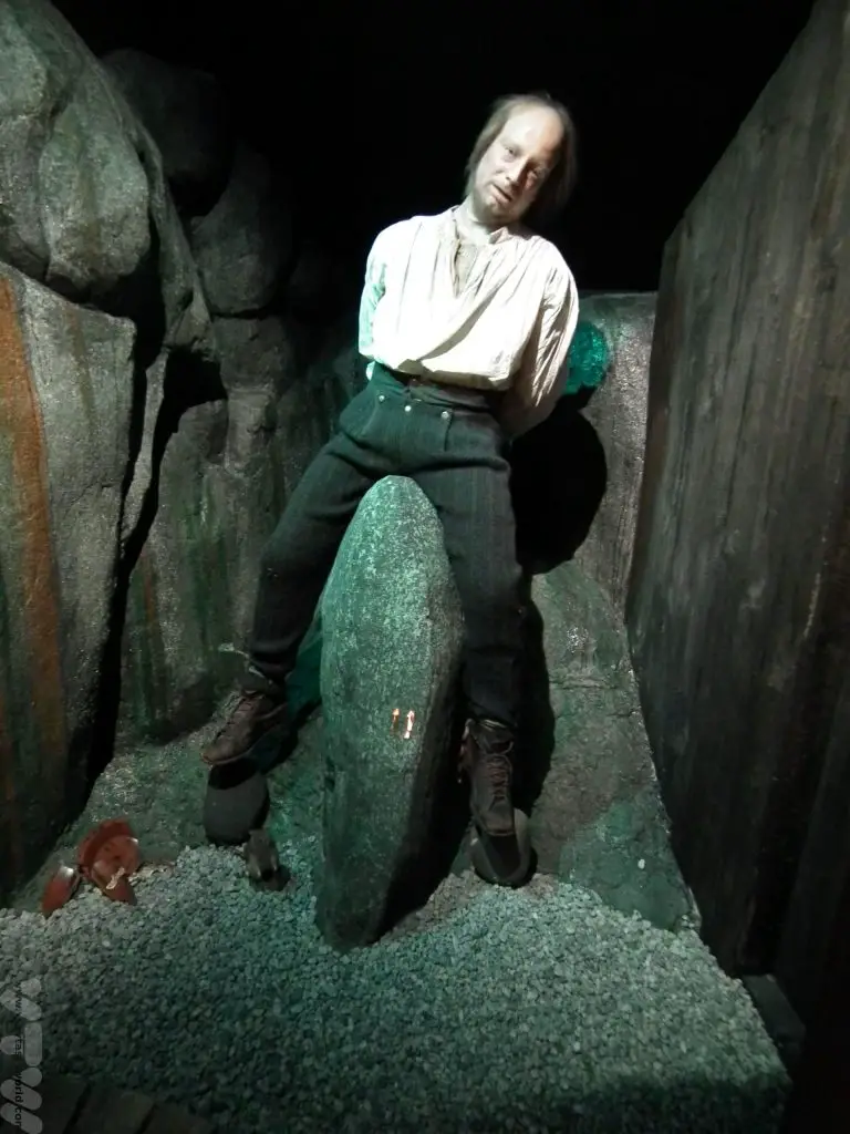
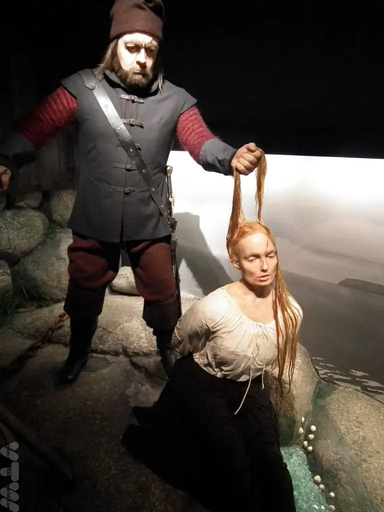
There is also a bizarre museum located close to the harbour which shows some of the history of the Faroes, complete with scary mannequins, while you wait for your boat.
Days 2-3 Gjógv on Eysturoy
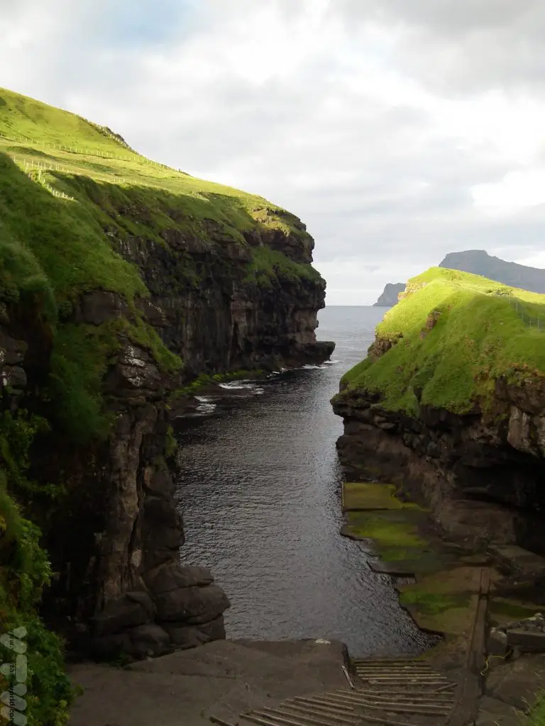
We then travelled across Streymoy to spend a couple of nights in Gjógv on Eysturoy.
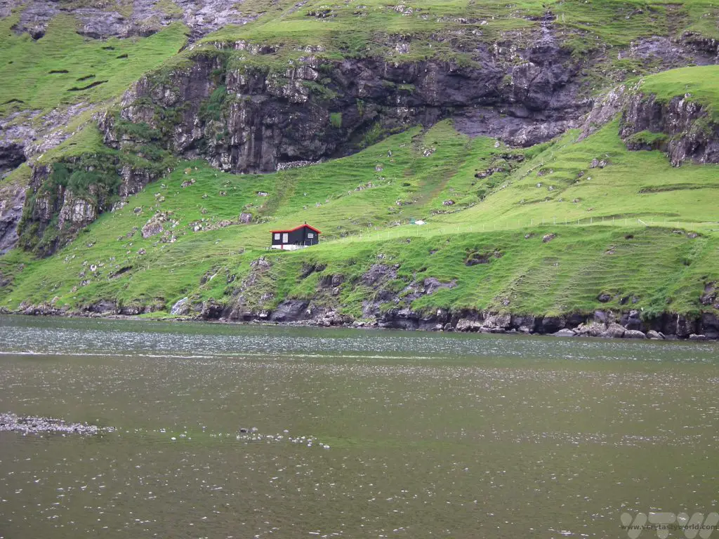
En route we visited Saksun, a delightful settlement on the northwestern coast of Streymoy. It’s a village is surrounded by steep mountains and lake with a sandy beach leading to the Atlantic Ocean. It’s a lovely walk along the beach out to the sea if the tide is out, even though the weather wasn’t really on our side that day.
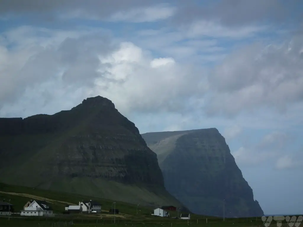
Crossing the small bridge that links Streymoy to Eysturoy, we arrived at Gjógv on the northeast of the island. Gjógv is a delightful rural town with a beautiful natural harbour.
Our hotel offered a cultural evening with local food and the chance to take part in a Faroese traditional chain dance.
You can also go walking on the cliff-tops and view the local puffins.
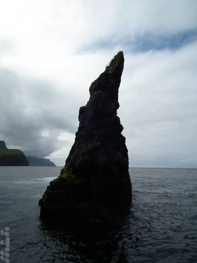
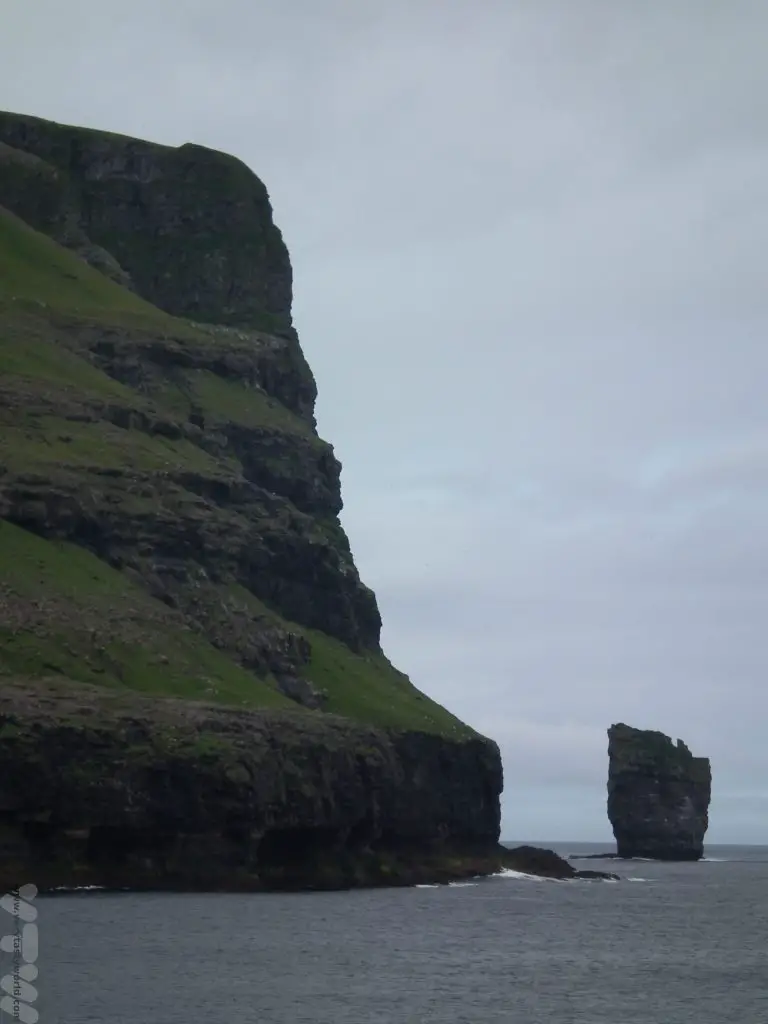
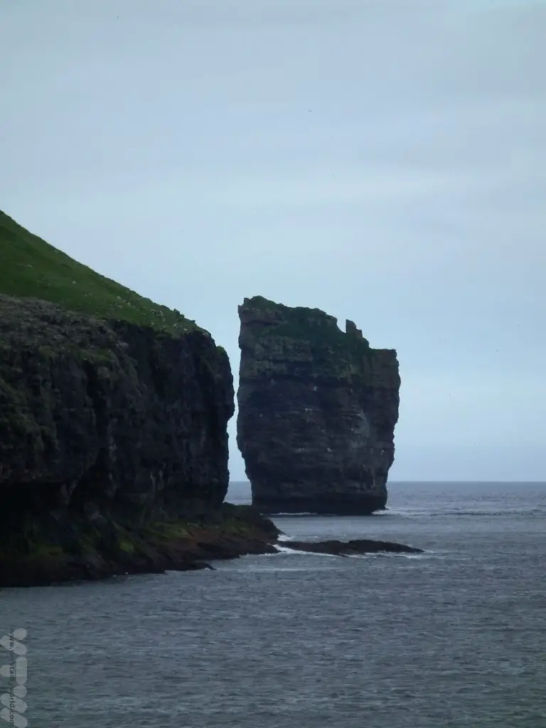
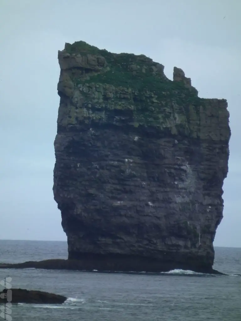
Close to the town of Eiði on the northwestern coast of Eysturoy you can see some famous rock formations – this is the Giant, a stack just off the coast. However, we didn’t get quite far enough around the headland to see its companion, the Hag.
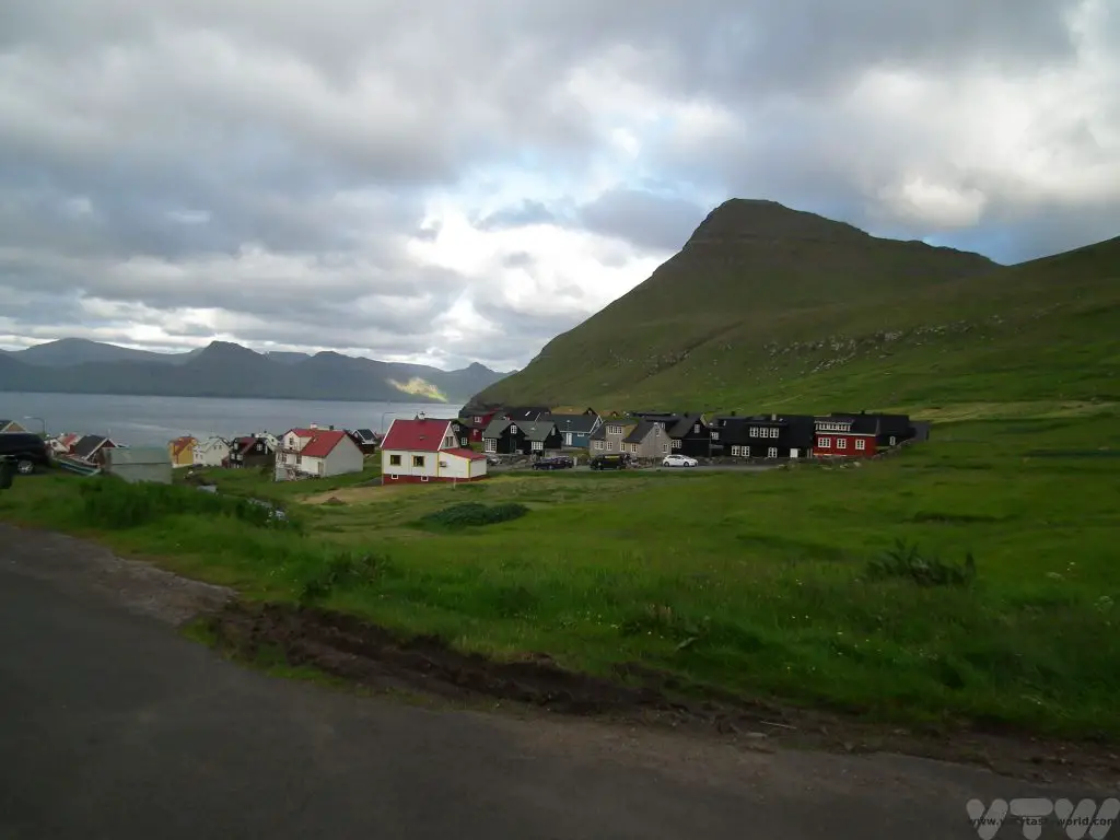
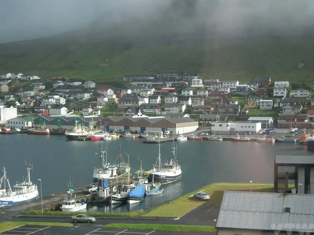
Days 4-5 Klaksvík on Borðoy
We then travelled to Klaksvík, the islands’ second largest city after its capital, Tórshavn. Klaksvik is a modern city with a large fishing industry and it, too, is located in a natural harbour. It is also home to the brewery Föroya Bjór which produces the local beer, characterised by a ram on its label.
The tunnel from Oyndarfjørður to the island Borðoy had some amazing light installations created by Tróndur Patursson at its lowest point beneath the sea.
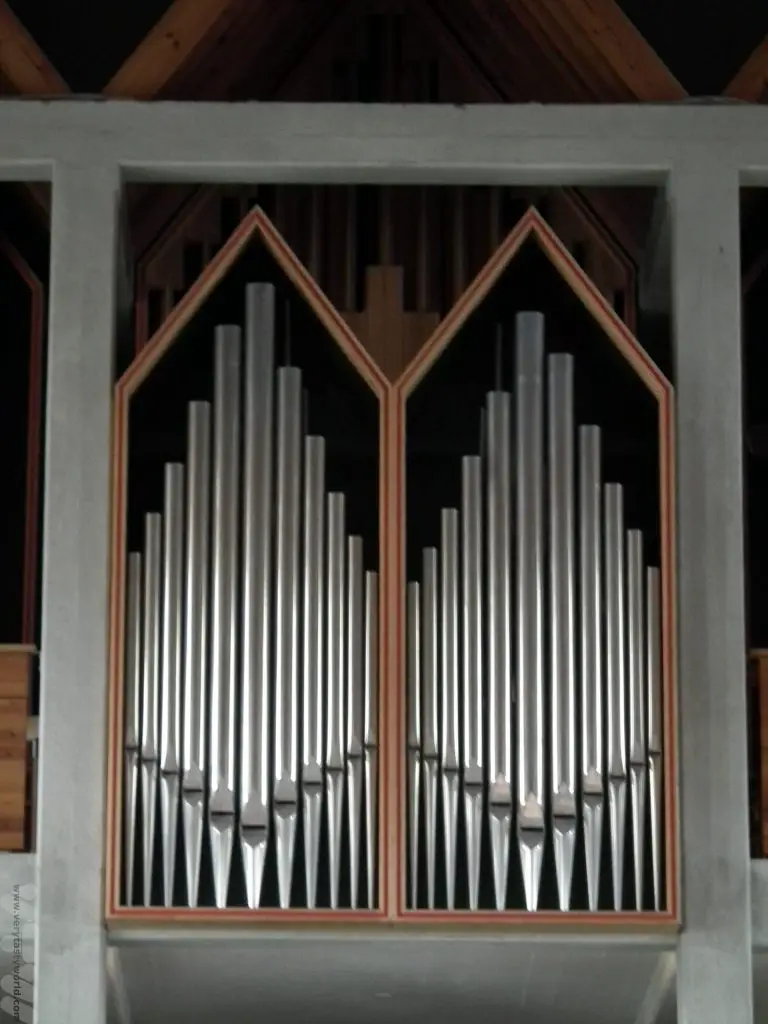
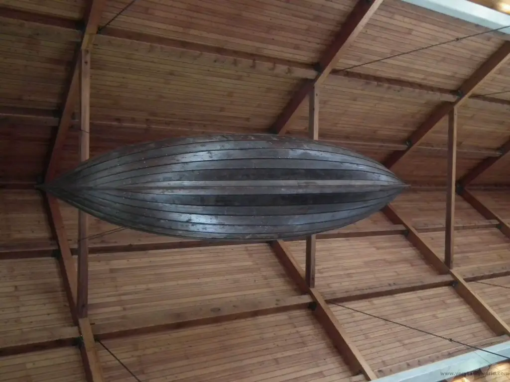
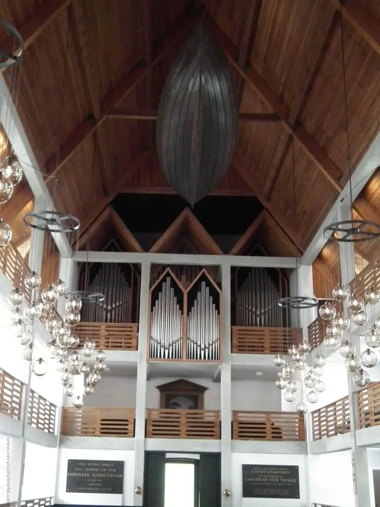
We stayed in the city and used it as a base to visit the northern islands. Klaksvík claims to have the most beautiful church on the Faroe islands and it’s difficult to disagree with this sentiment. There is a rowing-boat hanging from the ceiling. It was used originally to transport the priest between locations on the various islands.
It was during this time exploring the northern islands that we discovered those terrifying single track tunnels. But it was worth it for the scenery: from Viðoy you could see some wonderful views of Svínoy and Fugloy.
Viðoy has some of the archipelago’s most spectacular mountains and is a place where serious walkers do some serious walking.
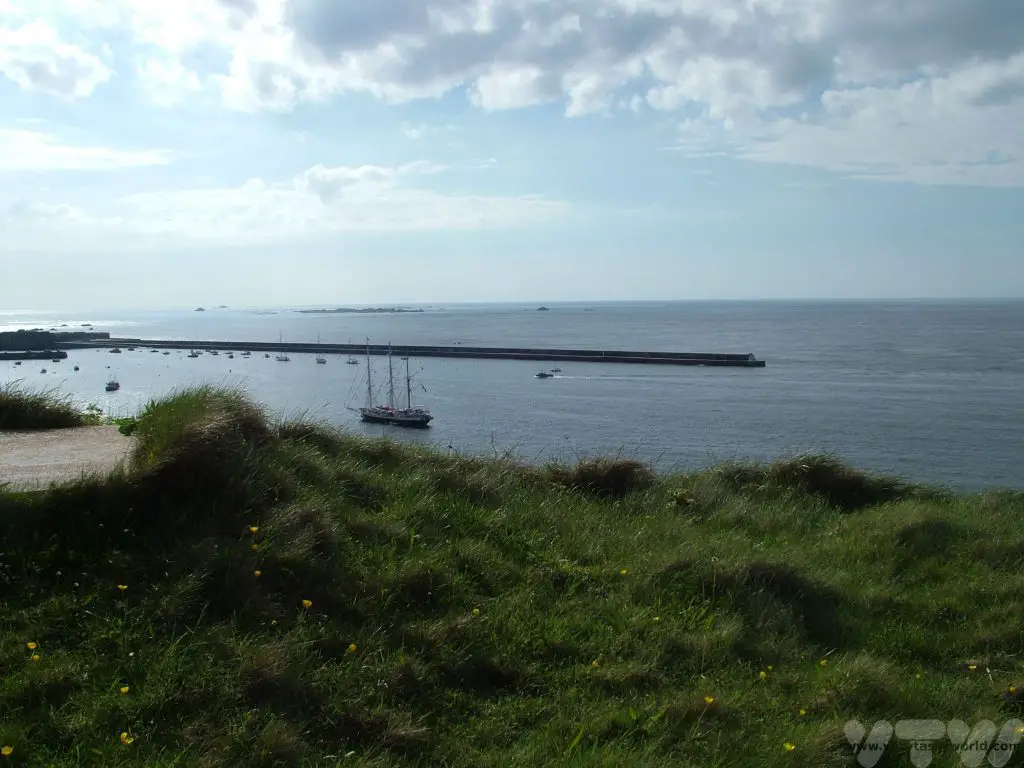
Days 6-7 Tórshavn
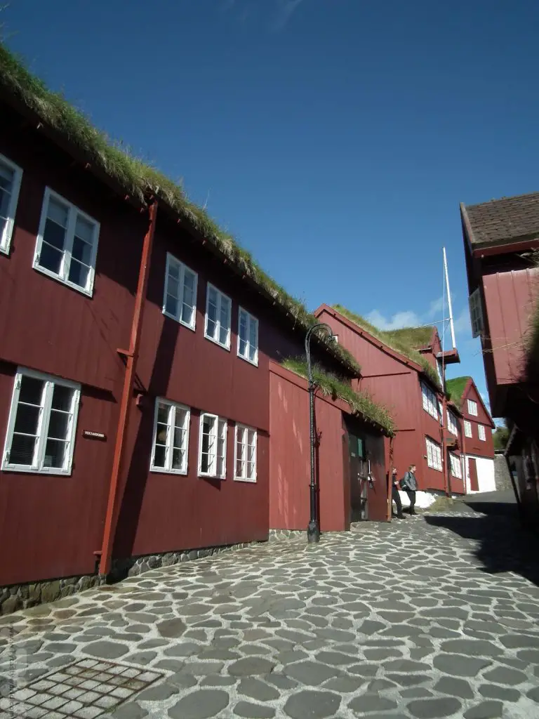
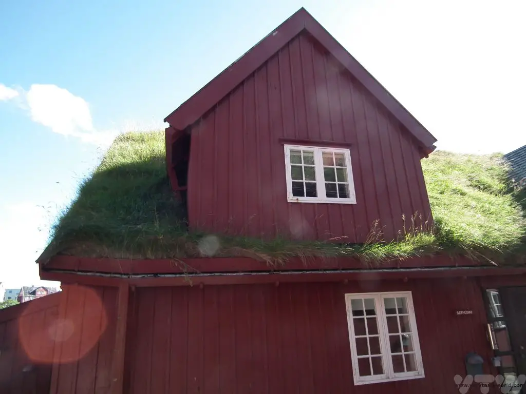
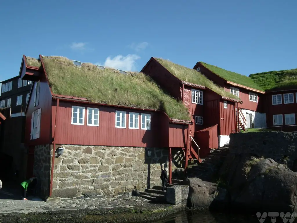
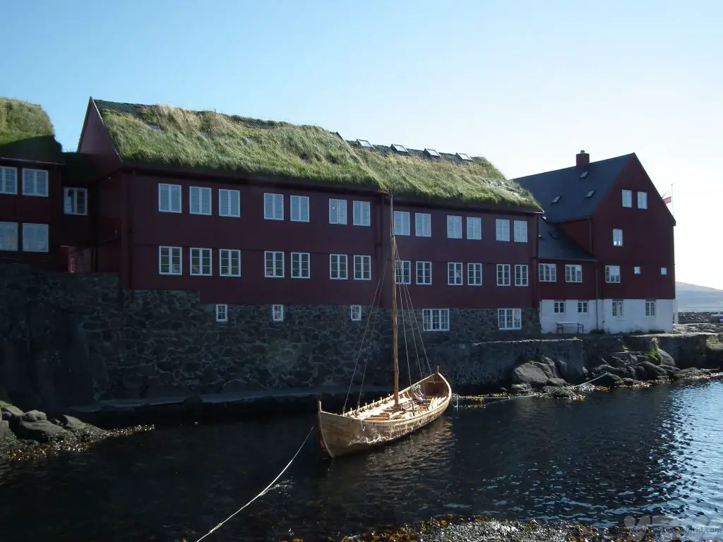
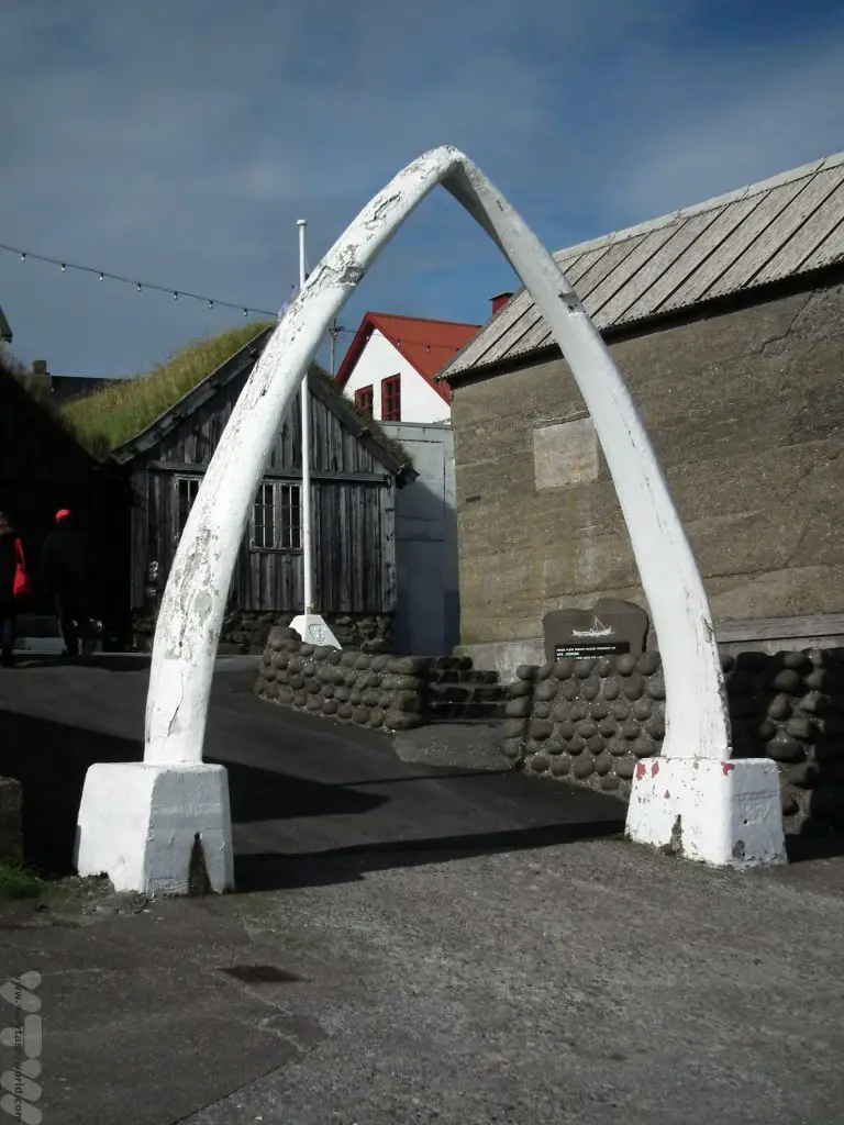
And then we drove back to Streymoy to explore Tórshavn which is, apparently, the smallest, cosiest capital in the world. Certainly according to the locals. It’s a great city to visit, with lots of history, interesting architecture, cool art galleries, fascinating museums and some really good restaurants.
Because it’s compact it’s very easy to park the car at your hotel and walk to all the sights in the city. It’s worth spending a couple of days here as there plenty of things to do. The local tourist information centre has lots of options for excursions.
Tinganes is the site of one of the world’s oldest parliaments, its name means ‘parliament jetty,’ and it was where the Viking parliament first started meeting in around 900 CE.
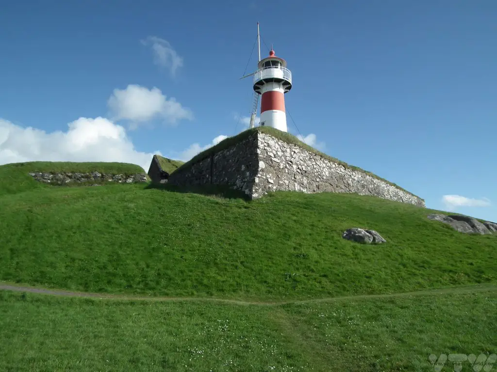
Fort Skansin was built in 1580 by Magnus Heinason on a hill close to the city in order to protect against pirate raids of the town.
A day trip aboard the Schooner Norðlýsið made for a very enjoyable excursion.
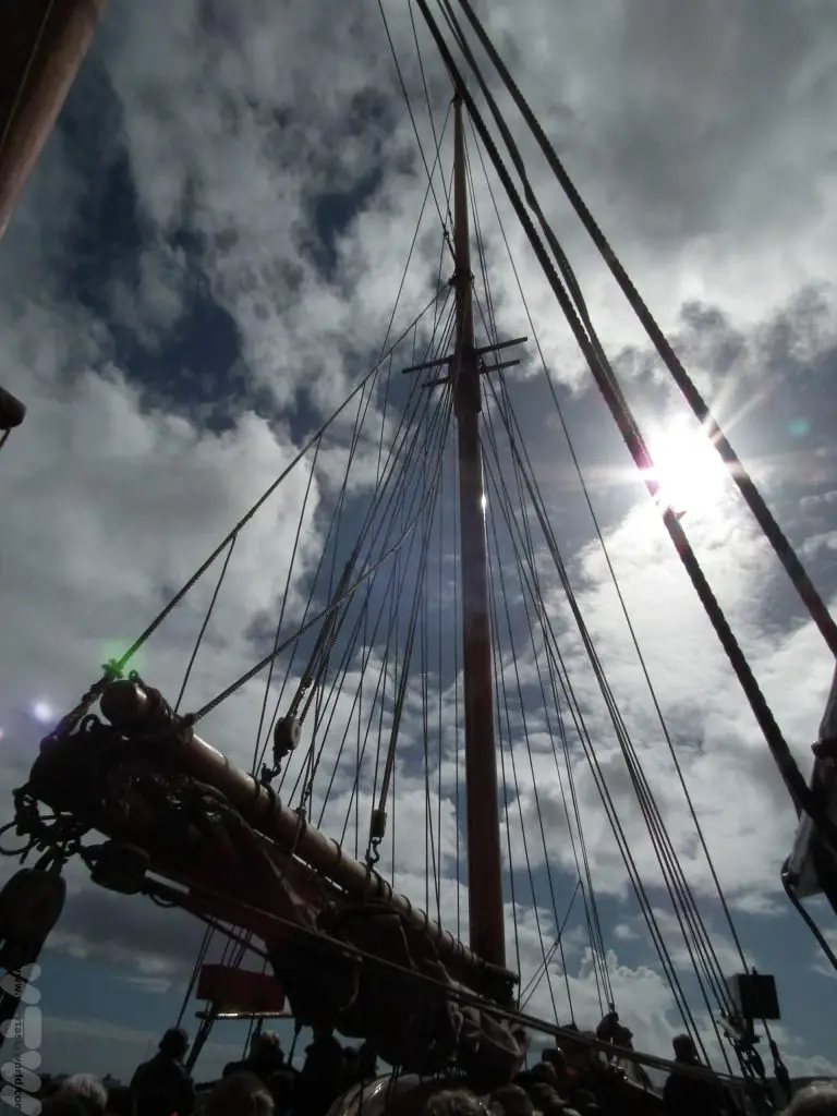
There’s a choice of a visit to either Hestur or Nólsoy and sometimes you can experience a concert in a cave.
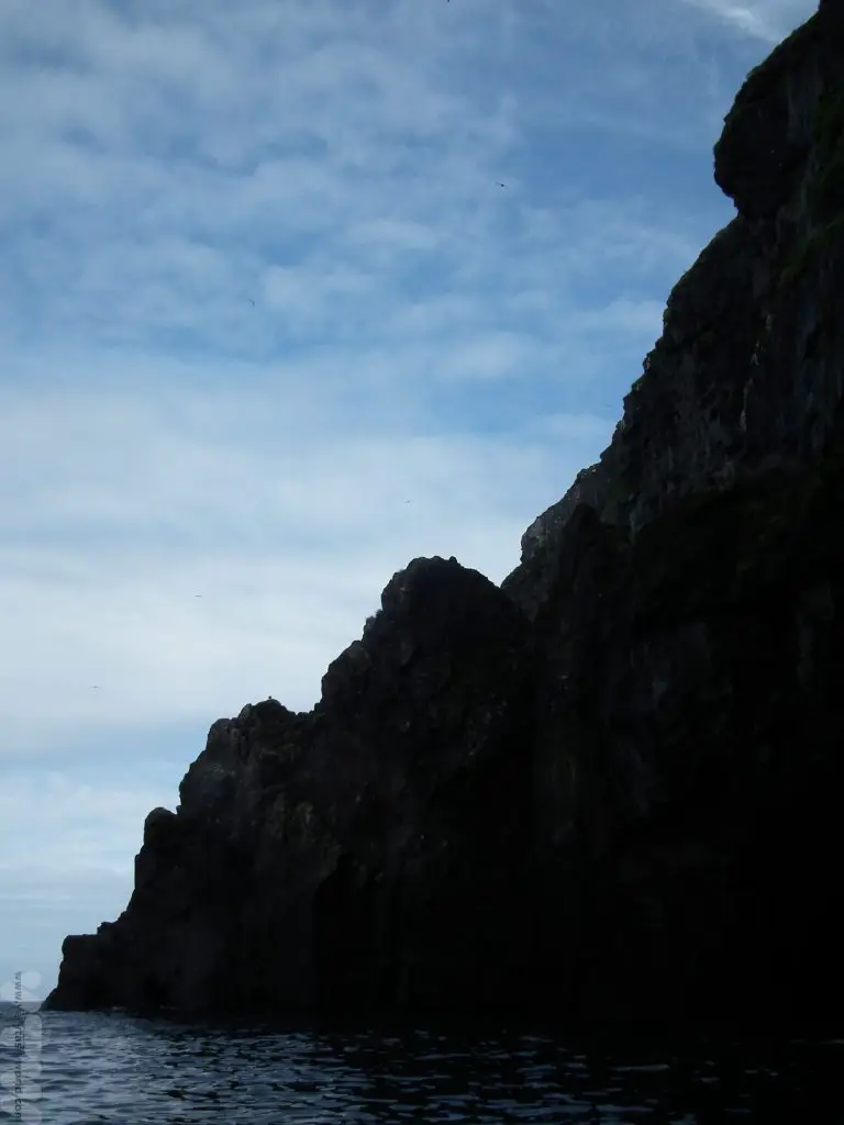
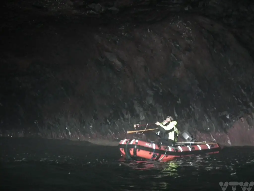
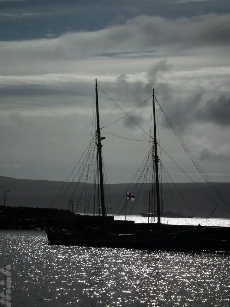
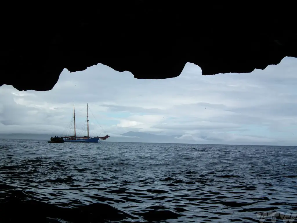
Our trip took us to Nólsoy; we visited some of the caves in a dinghy. There wasn’t a concert that day so a man in another dinghy blew a few tunes on a traditional horn so that we could get an idea of the impressive acoustics.
The boat made a brief landing on the island itself.
The following day it was time to return to the airport for the flight home. It takes around 45 minute to an hour to reach there from Tórshavn.
Related Posts You May Enjoy

Staying With Nomads In The Gobi Desert in Mongolia
A Life In The Day
It was 7am and sunlight was just beginning to filter through the plastic apex at the top of the ger in the Gobi Desert in Mongolia. Outside, the temperature was -15⁰ C. Inside it wasn’t much warmer, the temperature having dropped dramatically since the stove had gone out at around midnight. We were lying in beds, each on the opposite side of the ger from the other, inside sleeping bags and covered with blankets and duvets, just our noses poking out from the abundance of bedding. We hadn’t had a shower for three days. The outside toilet would involve a 50m walk in sub-zero temperatures from the ger to a hole in the ground. Mitch was lying in bed thinking, “What have I done?” Colin was lying in bed thinking, “What has Mitch done?”
This was a trip that was going to be a challenge.
There are some 165,000 nomadic families living and working in Mongolia and they still employ largely traditional farming methods, albeit using modern technology. Sheep, goats, horses, cows and yaks are the most common livestock kept and they are sent out to pasture every day. The nomads may need to relocate their herds three or four times a year and move to pastures new which means that they pack up their housing and all their possessions.
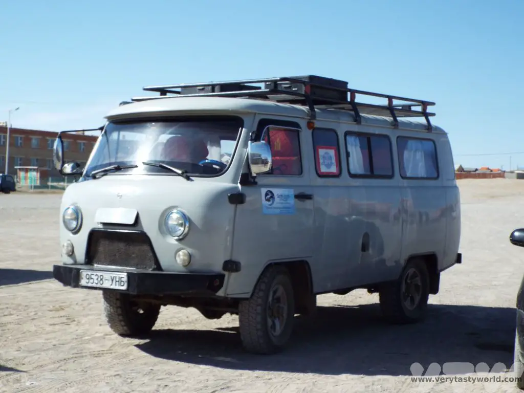
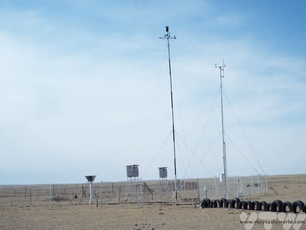
We had travelled from Ulaan Baatar across the vast Mongolian countryside in a Furgon van along roads where tiny Brandt voles would scuttle across from one side to the other and vultures circled in the sky scanning for prey. There were no road signs. Our driver just knew when to leave the road and head across the sparse desert landscape to our destination.
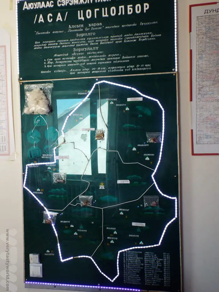
The previous day we had visited the town of Erdenedalai in the Gobi Desert to meet the singing weatherman. The weatherman monitors the location of all the nomadic families in the area and they communicate by radio to warn each other of potentially adverse weather conditions. The map shows the contact details for all the families in the area. The weatherman also has a range of guitars and gave us an impromptu concert.
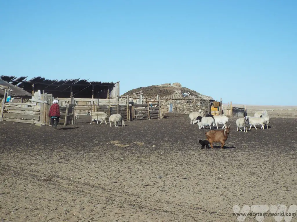
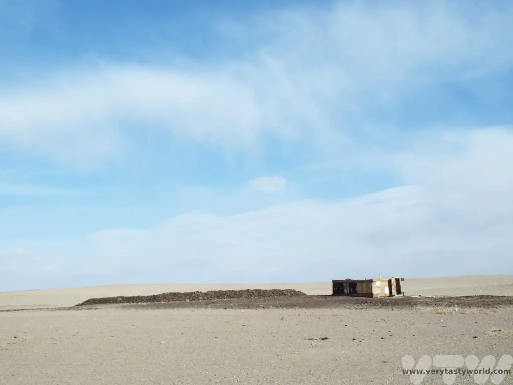
We were visiting Nergui and family who live in the Erdenedalai area, in the middle Gobi Desert in Mongolia. They kept cows, sheep and goats. The wooden pens for the animals are a permanent feature and the family move between different grazing locations several times a year. The gers are constructed alongside the animal pens. They can be taken down and put up in just a few hours – a really clever design.
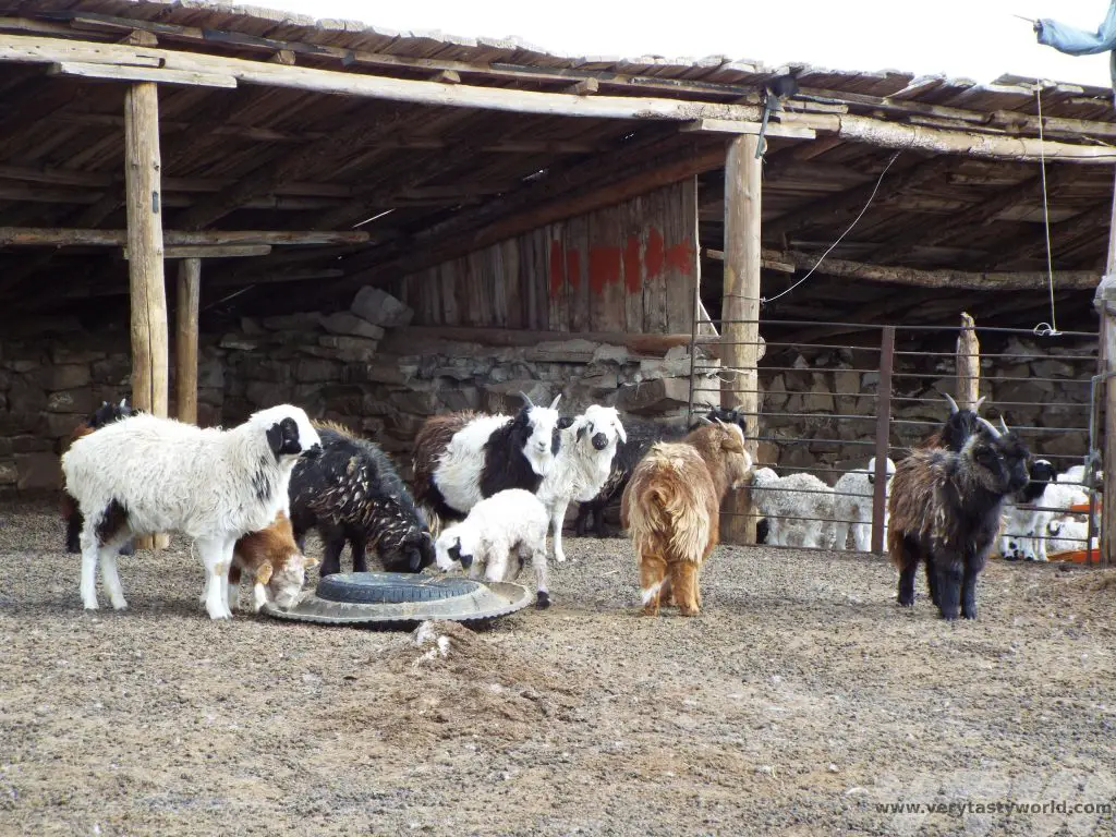
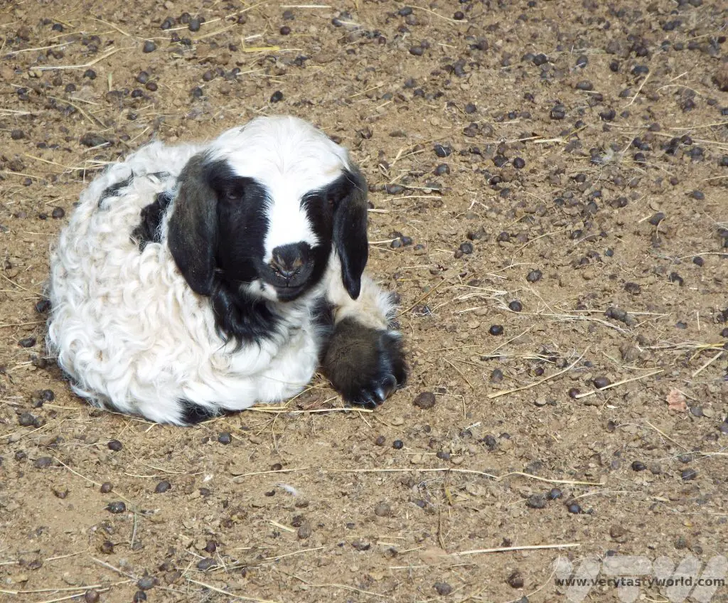
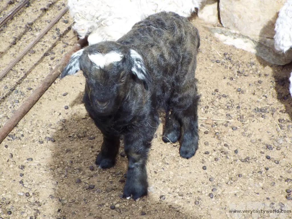
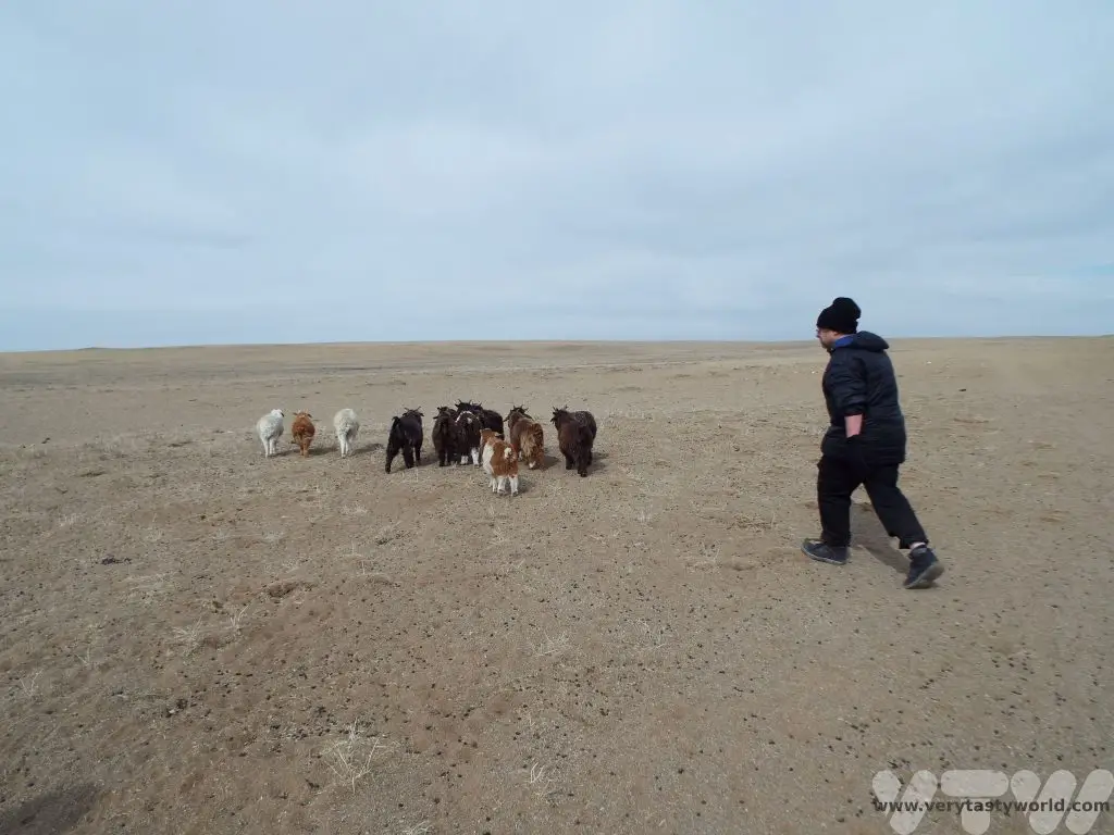
Our hosts had kindly given up one of their gers so that we could stay in their home. Just after 7am, they came in to start the fire. After a quick breakfast we offered to help with the family’s chores. First of all, the sheep and goats needed to go out to pasture. We were visiting in early springtime and many lambs and kids had been born over the previous few weeks. The youngsters were too young to go out so our job was to separate them out and put them into a pen – the nursery – for the day. (Don’t worry, they are reunited with their mums at the end of the day.) Lambs and kids are unbelievably lively little things and particularly good at evading visitors so catching them used a lot of energy! The temperature had risen to a balmy zero so we were toasty warm after all that chasing.

Once the lambs had been separated the older members of the herd were sent out to pasture. They were left to roam together and would be brought back via quad bike at the end of the day.
Then it was time to clean out the pens. We needed to rake through the wool and hairs amidst quite a significant amount of poo and gather it up.
Then we sent the teenagers out to pasture.
Next job was to water the cows. We drove to the nearest well which was several kilometres away. In the Gobi Desert there are precious few roads and we were constantly amazed at how the local people knew how to navigate across vast areas of desert and still find their way to the destination. The cows also have this in-built navigational ability as they were already waiting for us.
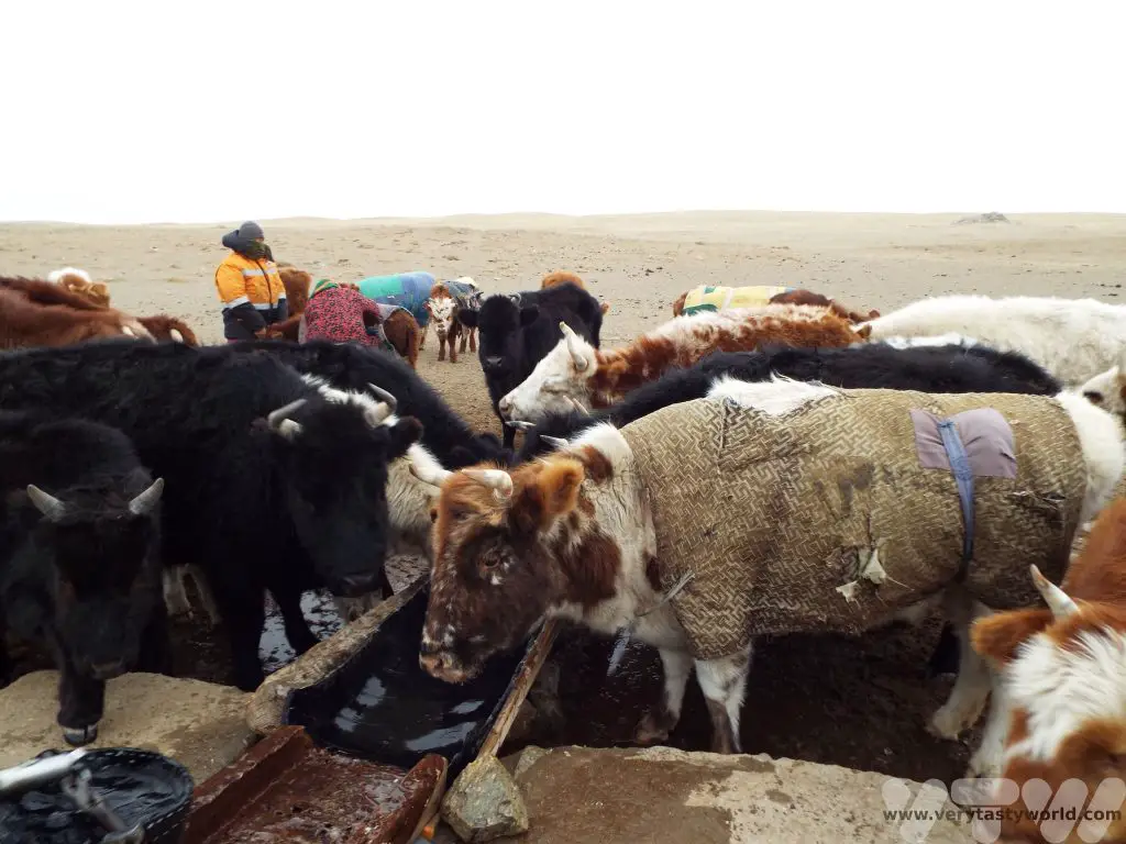
The sides of the well were frozen but the water was fine. It was a manual process to draw the water using a bucket.
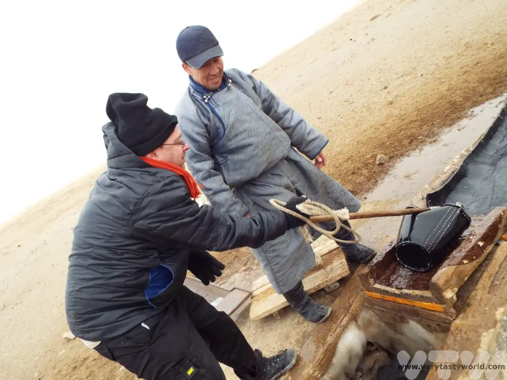
The water is pure and can be consumed without filtration. As the ger didn’t have running water we collected some for ourselves as well.
On our return to the ger camp, we needed to collect dung for the stove. The family have a dung storage area, located away from the main ger camp where the animal poo is collected and dried out. The family have a lot of animals which produce a lot of dung.
Cooking Dinner In The Gobi Desert In Mongolia
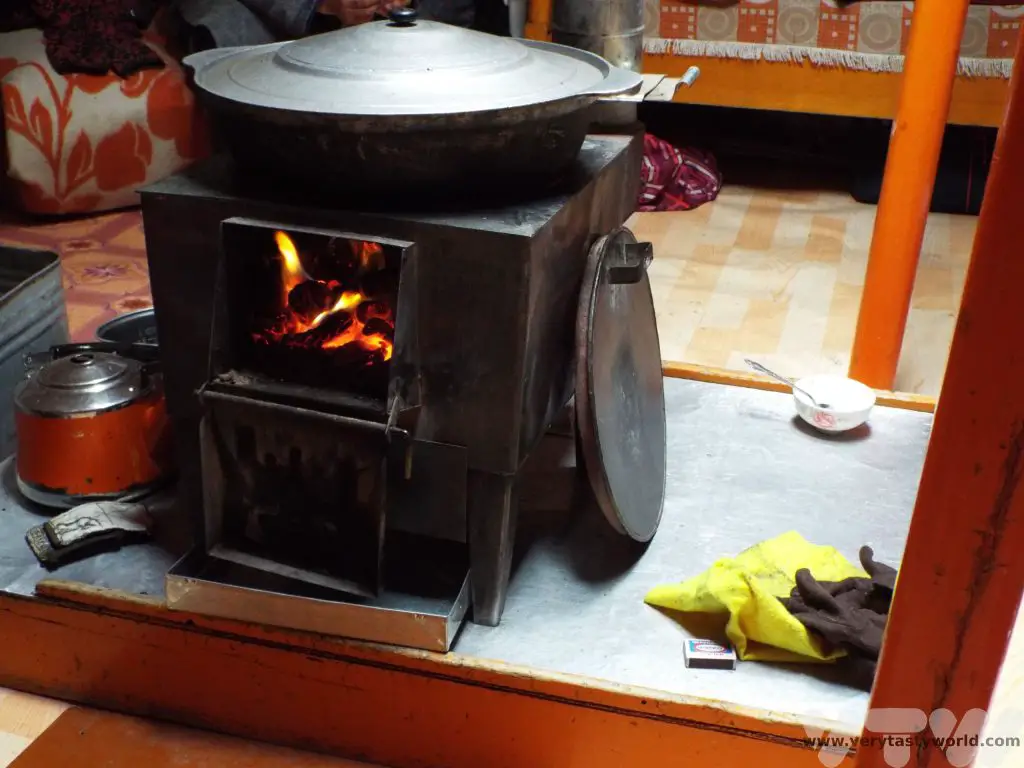
Then it was time to make dinner so we headed back to the ger. The stove is really adaptable and each are pretty much identical in terms of size and construction. Family kitchens will have various additional parts – a deep stewing pot or hob – which are interchangeable and offer a variety of cooking methods.
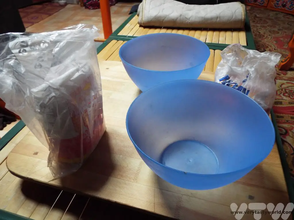
Tsuivan is a rustic dish, simple to make but it is delicious and filling. It comprises Mongolian noodles, vegetables and meat. First of all we set about making the noodles.
We made a dough using plain flour and water, kneading it until it had a soft, pliable texture and then let it rest for a few minutes.
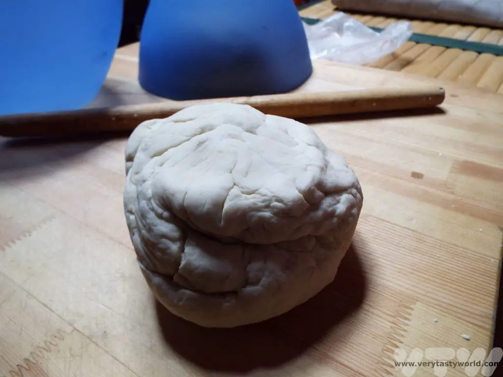
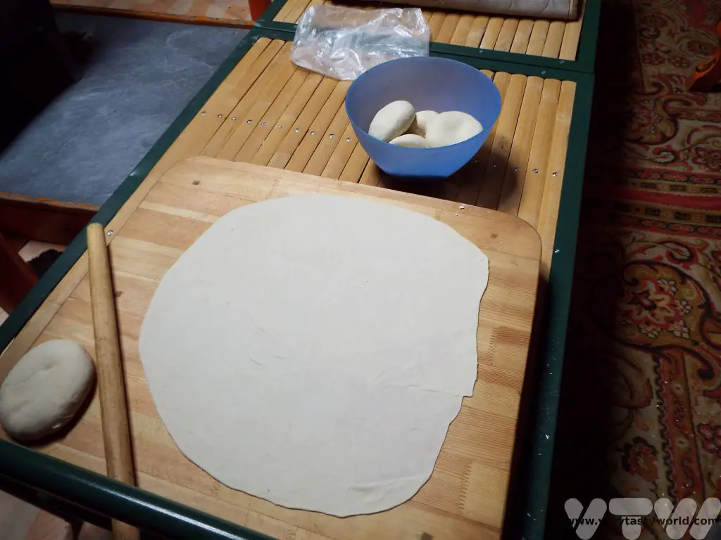
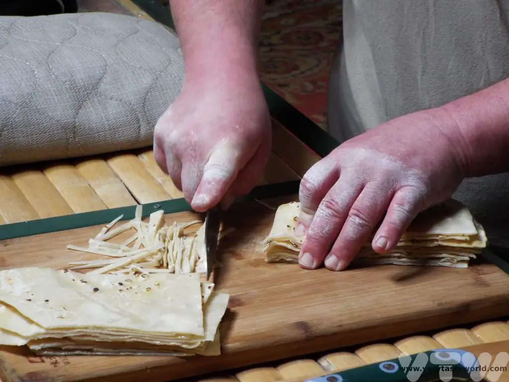
We then took a golf ball sized ball of dough and rolled it out very thinly, repeating the process until all the dough had been rolled into thin discs. The shape didn’t matter but we did try to make them as thin as possible using a rolling pin.
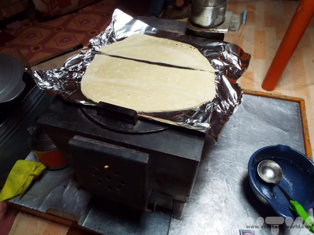
The noodles-in-waiting then need to be cooked briefly. They grill on the hob of the stove until lightly toasted – just for a few minutes, then they are turned over and the other side grilled.
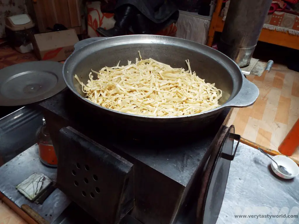
In the meantime we prepared some mutton and vegetables – potatoes, carrots and onions – by chopping into chunks. The stove was so versatile that the same heat source can be used as a pot or a griddle. The hob of the stove was then switched for the cooking pot – which fits over the fire perfectly – and the meat browned and vegetables added to fry in the meat juices.
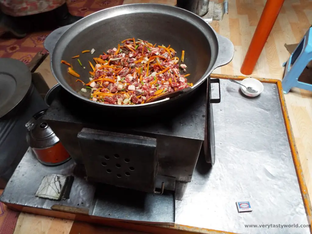
Then water is added to allow the food to stew. The seasoning was simply salt, you don’t get a variety of herbs and spices in Mongolia. Whereas we are used to eating lamb in the UK, mutton is more common across Mongolia. It has a lot more flavour than lamb and, although the meat isn’t as tender, it really benefits from being cooked for a long time over the heat. The taste of the mutton was so good that it meant we didn’t really need additional seasoning.
While the mutton and veg were stewing we stacked the toasted dough and cut it into thin noodles.
These were then laid across the meat and veg and steamed in the heat until they were soft.
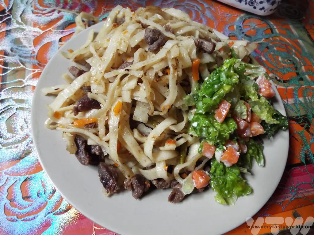
Time to serve up. It’s a delicious meal. We all ate together.
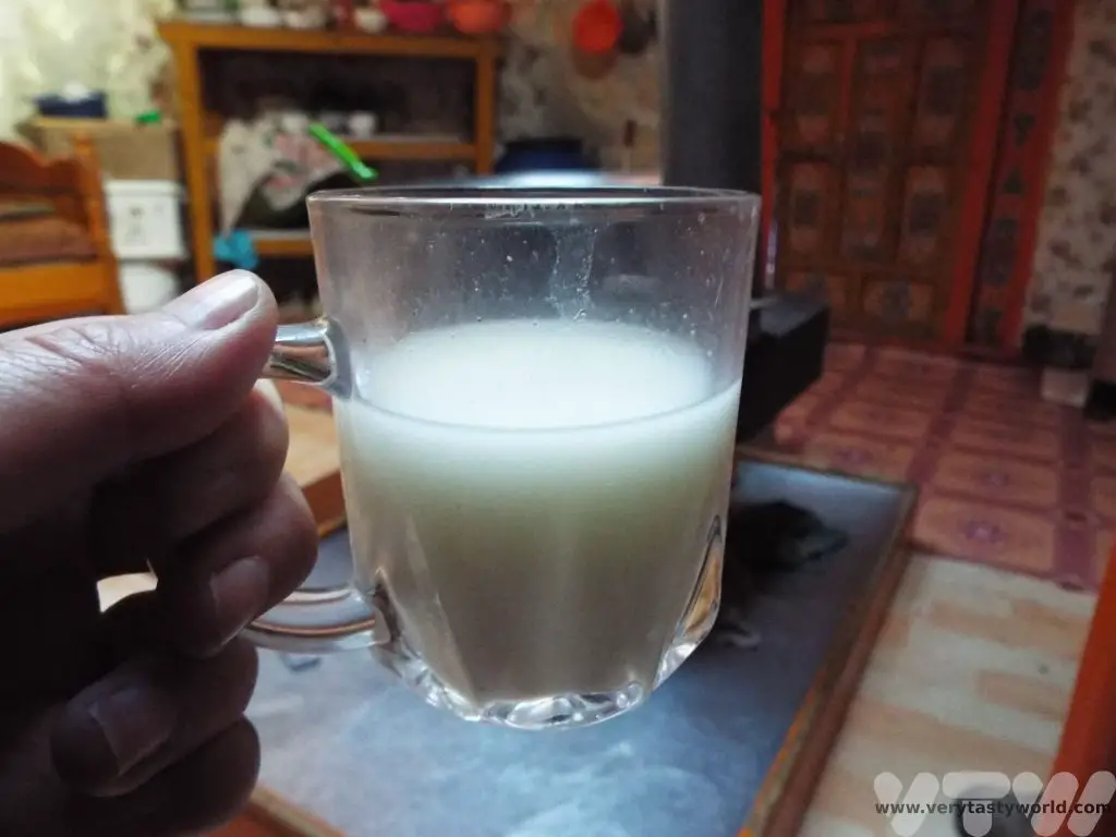
After our hearty dinner we sat down with the family and played silly card games. The family also offered some of the last of their airag, an alcoholic fermented mare’s milk drink. We had been keen to try it, although we knew we were visiting outside the mare milking season, so considered ourselves to be very lucky that the family were willing to share the remnants of last year’s brew with us.
Any fear of the unexpected that we had felt that morning had vanished. Yes, it had been challenging to experience a lifestyle so very different to ours but it was a fantastic challenge. We were very privileged to have joined this welcoming family and to have shared a day in their lives. They very kindly told us that we had genuinely helped out and had done a good job cleaning the pens.
And so to bed. But before we hit the sack we were joined by this little one.
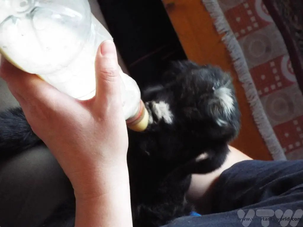
She was just 10 days old and our hosts decided that the overnight temperature was going to be too low for her to survive outside. So we fed her and let her prance around the ger. She bleated in the most delightful way throughout the night.
Related Posts You May Enjoy